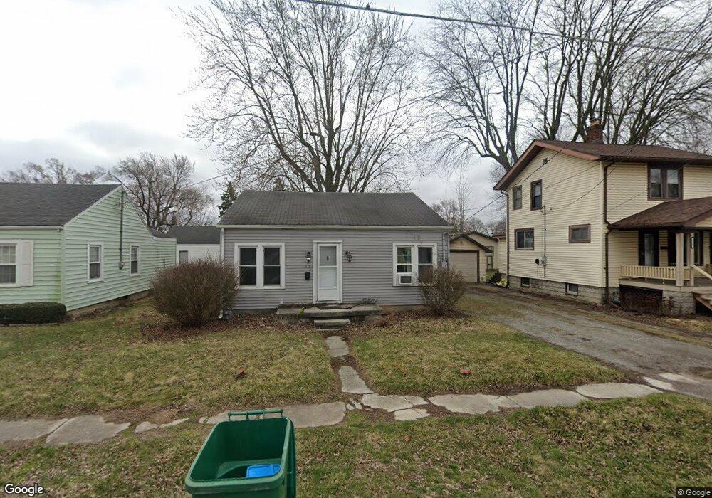
919 Adams St Findlay, OH 45840
Estimated Value: $80,000 - $98,636
2
Beds
1
Bath
908
Sq Ft
$100/Sq Ft
Est. Value
About This Home
This home is located at 919 Adams St, Findlay, OH 45840 and is currently estimated at $90,659, approximately $99 per square foot. 919 Adams St is a home located in Hancock County with nearby schools including Lincoln Elementary School, Donnell Middle School, and Findlay High School.
Ownership History
Date
Name
Owned For
Owner Type
Purchase Details
Closed on
Oct 10, 2017
Sold by
Seitz Daniel J
Bought by
Housing Rentals Llc
Current Estimated Value
Purchase Details
Closed on
Apr 16, 2013
Sold by
Deutsche Bank National Trust Co
Bought by
Seitz Daniel J
Purchase Details
Closed on
Apr 4, 2013
Sold by
Ibarra Rosario M
Bought by
Deutsche Bank National Trust Company
Purchase Details
Closed on
Apr 30, 1993
Bought by
Rupright David C
Purchase Details
Closed on
Jun 7, 1984
Bought by
Rupright David C
Purchase Details
Closed on
Nov 18, 1983
Bought by
Rupright Raymond L
Create a Home Valuation Report for This Property
The Home Valuation Report is an in-depth analysis detailing your home's value as well as a comparison with similar homes in the area
Home Values in the Area
Average Home Value in this Area
Purchase History
| Date | Buyer | Sale Price | Title Company |
|---|---|---|---|
| Housing Rentals Llc | $40,000 | Flag City Title | |
| Seitz Daniel J | $24,000 | Omega Title Agency Llc | |
| Deutsche Bank National Trust Company | $26,000 | None Available | |
| Rupright David C | -- | -- | |
| Rupright David C | -- | -- | |
| Rupright Raymond L | -- | -- |
Source: Public Records
Tax History Compared to Growth
Tax History
| Year | Tax Paid | Tax Assessment Tax Assessment Total Assessment is a certain percentage of the fair market value that is determined by local assessors to be the total taxable value of land and additions on the property. | Land | Improvement |
|---|---|---|---|---|
| 2024 | $870 | $23,880 | $5,180 | $18,700 |
| 2023 | $872 | $23,880 | $5,180 | $18,700 |
| 2022 | $869 | $23,880 | $5,180 | $18,700 |
| 2021 | $856 | $20,490 | $5,170 | $15,320 |
| 2020 | $856 | $20,490 | $5,170 | $15,320 |
| 2019 | $839 | $20,490 | $5,170 | $15,320 |
| 2018 | $752 | $16,860 | $4,240 | $12,620 |
| 2017 | $376 | $16,860 | $4,240 | $12,620 |
| 2016 | $1,117 | $16,860 | $4,240 | $12,620 |
| 2015 | $733 | $16,290 | $4,240 | $12,050 |
| 2014 | $733 | $16,290 | $4,240 | $12,050 |
| 2012 | $719 | $16,290 | $4,240 | $12,050 |
Source: Public Records
Map
Nearby Homes
- 407 Washington St
- 514 Liberty St
- 419 W Lincoln St
- 720 S West St
- 416 1/2 Lima Ave
- 412 Lima Ave
- 225 Lima Ave
- 535 Palm Dr
- 425 Nevada Ln
- 0 Canadian Way Unit 20253551
- 0 Canadian Way Unit 6135400
- 512 N Cory St
- 224 Defiance Ave
- 1115 Liberty St
- 0 Waterford Way Lot 78 Unit 6089639
- 1005 Broad Ave
- 706 N Cory St
- 213 Cherry St
- 829 Maple Ave
- 2014 W Sandusky St