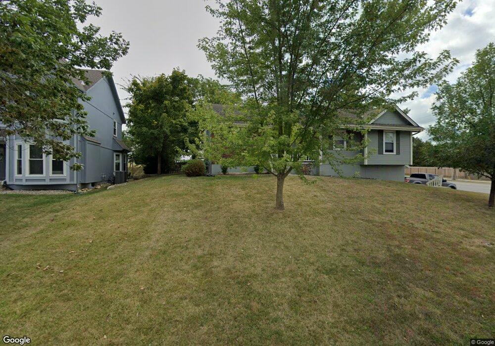
919 SW Georgetown St Lees Summit, MO 64082
Estimated Value: $310,000 - $374,000
3
Beds
2
Baths
1,444
Sq Ft
$238/Sq Ft
Est. Value
About This Home
This home is located at 919 SW Georgetown St, Lees Summit, MO 64082 and is currently estimated at $343,762, approximately $238 per square foot. 919 SW Georgetown St is a home located in Jackson County with nearby schools including Trailridge Elementary School, Summit Lakes Middle School, and Lee's Summit West High School.
Ownership History
Date
Name
Owned For
Owner Type
Purchase Details
Closed on
Apr 26, 2021
Sold by
Akers Holding Llc
Bought by
Akers Emily and Lentz Joshua
Current Estimated Value
Home Financials for this Owner
Home Financials are based on the most recent Mortgage that was taken out on this home.
Original Mortgage
$212,500
Outstanding Balance
$191,862
Interest Rate
3%
Mortgage Type
New Conventional
Estimated Equity
$151,900
Purchase Details
Closed on
Jul 31, 2020
Sold by
Nelson Donald C and Nelson Mary L
Bought by
Akers Holding Llc
Purchase Details
Closed on
Aug 10, 1995
Sold by
Volland John D and Volland Christy E
Bought by
Nelson Donald C and Nelson Mary L
Create a Home Valuation Report for This Property
The Home Valuation Report is an in-depth analysis detailing your home's value as well as a comparison with similar homes in the area
Home Values in the Area
Average Home Value in this Area
Purchase History
| Date | Buyer | Sale Price | Title Company |
|---|---|---|---|
| Akers Emily | -- | Meridian Title Company | |
| Akers Holding Llc | -- | First United Title Agcy Llc | |
| Nelson Donald C | -- | -- |
Source: Public Records
Mortgage History
| Date | Status | Borrower | Loan Amount |
|---|---|---|---|
| Open | Akers Emily | $212,500 |
Source: Public Records
Tax History
| Year | Tax Paid | Tax Assessment Tax Assessment Total Assessment is a certain percentage of the fair market value that is determined by local assessors to be the total taxable value of land and additions on the property. | Land | Improvement |
|---|---|---|---|---|
| 2025 | $3,366 | $48,746 | $14,130 | $34,616 |
| 2024 | $3,342 | $46,617 | $10,703 | $35,914 |
| 2023 | $3,342 | $46,616 | $7,594 | $39,022 |
| 2022 | $2,976 | $36,860 | $5,466 | $31,394 |
| 2021 | $3,037 | $36,860 | $5,466 | $31,394 |
| 2020 | $2,916 | $35,043 | $5,466 | $29,577 |
| 2019 | $2,836 | $35,043 | $5,466 | $29,577 |
| 2018 | $1,041,319 | $30,500 | $4,758 | $25,742 |
| 2016 | $2,620 | $29,735 | $4,332 | $25,403 |
Source: Public Records
Map
Nearby Homes
- 4400 SW Rivulet Dr
- 4407 SW Briarbrook Dr
- 1022 SW Cheshire Dr
- 1021 SW Cheshire Dr
- 908 SW Olympia Ct
- 4520 SW Berkshire Dr
- 4528 SW Berkshire Dr
- 4641 SW Soldier Dr
- 4647 SW Olympia Place
- 4624 SW Robinson Dr
- 4510 SW Fenwick Rd
- 4628 SW Robinson Dr
- 4600 SW Admiral Byrd Dr
- 4120 SW Flintrock Dr
- 4404 SW Flintrock Dr
- 1100 SW Blackpool Dr
- 917 SW Soldier Ct
- 1937 SW Merryman Dr
- 1208 SW Neelie Ln
- 732 SW Raintree Dr
- 919 SW Georgetown Dr
- 917 SW Georgetown St
- 917 SW Georgetown Dr
- 918 SW Georgetown St
- 916 SW Georgetown St
- 918 SW Georgetown Dr
- 915 SW Georgetown St
- 915 SW Georgetown Dr
- 914 SW Georgetown St
- 913 SW Georgetown Dr
- 913 SW Georgetown St
- 912 SW Georgetown St
- 912 SW Georgetown Dr
- 1929 SW Merryman Dr
- 1928 SW Merryman Dr
- 1932 SW Merryman Dr
- 1921 SW Merryman Dr
- 1936 SW Merryman Dr
- 1917 SW Merryman Dr
- 1905 SW Merryman Dr