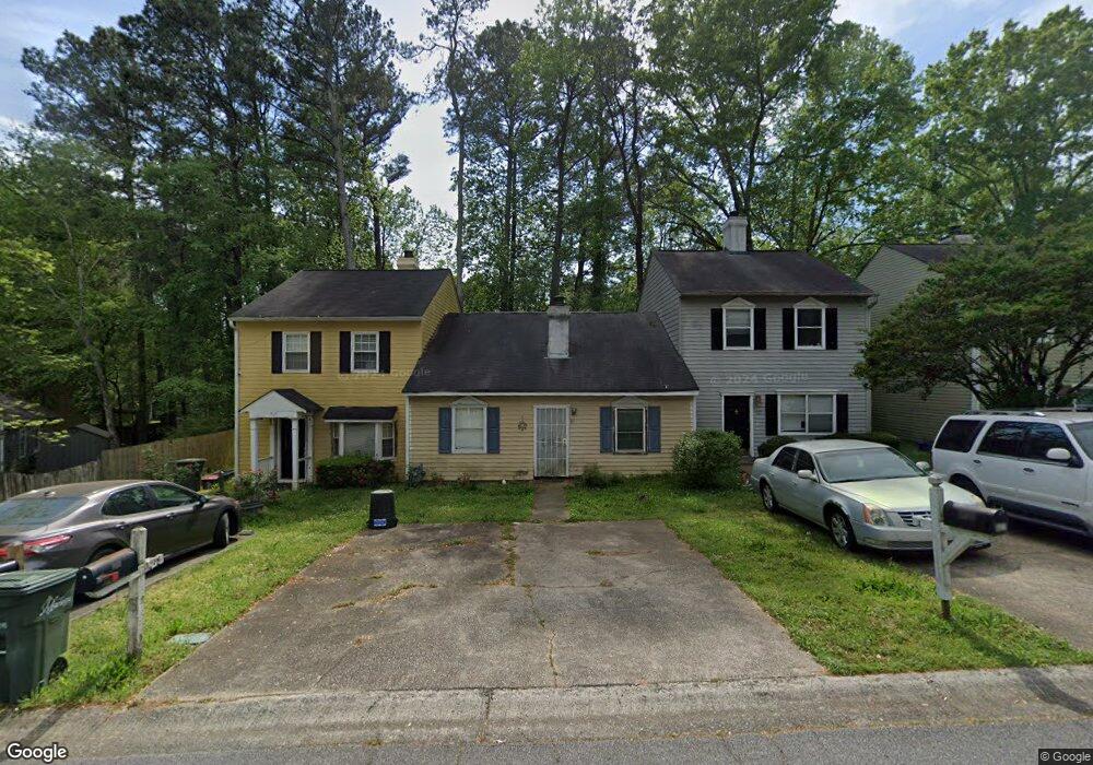
919 Westland Dr SW Marietta, GA 30064
Southwestern Marietta NeighborhoodEstimated Value: $202,000 - $244,000
2
Beds
2
Baths
1,064
Sq Ft
$212/Sq Ft
Est. Value
About This Home
This home is located at 919 Westland Dr SW, Marietta, GA 30064 and is currently estimated at $226,092, approximately $212 per square foot. 919 Westland Dr SW is a home located in Cobb County with nearby schools including A.L. Burruss Elementary School, Marietta Sixth Grade Academy, and Marietta Middle School.
Ownership History
Date
Name
Owned For
Owner Type
Purchase Details
Closed on
Feb 28, 2002
Sold by
Rich Laurie L
Bought by
Simmons Alonzo
Current Estimated Value
Home Financials for this Owner
Home Financials are based on the most recent Mortgage that was taken out on this home.
Original Mortgage
$80,000
Outstanding Balance
$32,822
Interest Rate
6.95%
Mortgage Type
New Conventional
Estimated Equity
$193,270
Purchase Details
Closed on
Aug 11, 1995
Sold by
Hud
Bought by
Griffith Laurie
Purchase Details
Closed on
Dec 6, 1994
Sold by
Suntrust Mtg Inc
Bought by
Secretary Of Hud
Create a Home Valuation Report for This Property
The Home Valuation Report is an in-depth analysis detailing your home's value as well as a comparison with similar homes in the area
Home Values in the Area
Average Home Value in this Area
Purchase History
| Date | Buyer | Sale Price | Title Company |
|---|---|---|---|
| Simmons Alonzo | $90,000 | -- | |
| Griffith Laurie | -- | -- | |
| Secretary Of Hud | -- | -- | |
| Suntrust Mtg Inc | $57,700 | -- |
Source: Public Records
Mortgage History
| Date | Status | Borrower | Loan Amount |
|---|---|---|---|
| Open | Simmons Alonzo | $80,000 | |
| Closed | Griffith Laurie | $0 |
Source: Public Records
Tax History Compared to Growth
Tax History
| Year | Tax Paid | Tax Assessment Tax Assessment Total Assessment is a certain percentage of the fair market value that is determined by local assessors to be the total taxable value of land and additions on the property. | Land | Improvement |
|---|---|---|---|---|
| 2025 | $193 | $94,552 | $34,000 | $60,552 |
| 2024 | $193 | $94,552 | $34,000 | $60,552 |
| 2023 | $40 | $59,560 | $20,000 | $39,560 |
| 2022 | $193 | $59,560 | $20,000 | $39,560 |
| 2021 | $199 | $46,828 | $20,000 | $26,828 |
| 2020 | $197 | $34,828 | $8,000 | $26,828 |
| 2019 | $197 | $34,828 | $8,000 | $26,828 |
| 2018 | $176 | $30,340 | $8,000 | $22,340 |
| 2017 | $128 | $28,340 | $6,000 | $22,340 |
| 2016 | $78 | $20,944 | $4,000 | $16,944 |
| 2015 | $86 | $20,944 | $4,000 | $16,944 |
| 2014 | $89 | $20,944 | $0 | $0 |
Source: Public Records
Map
Nearby Homes
- 818 Manning Way SW Unit 1
- 260 Manning Rd SW Unit 110
- 805 Manning Way SW
- 594 Manning Rd SW
- 560 Manning Rd SW
- 1141 Whitlock Ave NW
- 798 Sentinel Ridge SW
- 834 Cannon Run SW
- 873 Cavalry Dr SW
- 839 Manning Villas Ct SW
- 838 Cannon Run SW
- 1077 New Haven Dr SW Unit 12A
- 1161 Rockmann Terrace SW
- 1121 Cannongate Crossing SW
- 332 Rockmann Ln SW
- 917 Wemberley Ln
- 917 Westland Dr SW
- 921 Westland Dr SW
- 923 Westland Dr SW
- 925 Westland Dr SW
- 925 Westland Dr SW Unit 925
- 200 Westland Cir SW
- 202 Westland Cir SW
- 927 Westland Dr SW
- 918 Westland Dr SW
- 204 Westland Cir SW
- 318 Westland Way SW Unit 318
- 318 Westland Way SW
- 318 Westland Way SW
- 318 Westland Way SW
- 316 Westland Way SW
- 312 Westland Way SW Unit 1
- 916 Westland Dr SW
- 916 Westland Dr SW Unit 916
- 320 Westland Way SW
- 320 Westland Way SW Unit 320