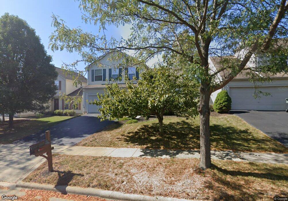
9199 Colonial Commons Dr Columbus, OH 43240
Polaris North NeighborhoodEstimated Value: $419,583 - $452,000
3
Beds
3
Baths
1,849
Sq Ft
$235/Sq Ft
Est. Value
About This Home
This home is located at 9199 Colonial Commons Dr, Columbus, OH 43240 and is currently estimated at $435,146, approximately $235 per square foot. 9199 Colonial Commons Dr is a home located in Delaware County with nearby schools including Freedom Trail Elementary School, Olentangy Orange Middle School, and Orange High School.
Ownership History
Date
Name
Owned For
Owner Type
Purchase Details
Closed on
Mar 14, 2003
Sold by
M/I Schottenstein Homes Inc
Bought by
Fox Thomas D and Swanson Gillian L
Current Estimated Value
Home Financials for this Owner
Home Financials are based on the most recent Mortgage that was taken out on this home.
Original Mortgage
$167,250
Interest Rate
5.95%
Mortgage Type
Purchase Money Mortgage
Create a Home Valuation Report for This Property
The Home Valuation Report is an in-depth analysis detailing your home's value as well as a comparison with similar homes in the area
Home Values in the Area
Average Home Value in this Area
Purchase History
| Date | Buyer | Sale Price | Title Company |
|---|---|---|---|
| Fox Thomas D | $209,100 | Transohio Residential Title |
Source: Public Records
Mortgage History
| Date | Status | Borrower | Loan Amount |
|---|---|---|---|
| Closed | Fox Thomas D | $167,250 |
Source: Public Records
Tax History Compared to Growth
Tax History
| Year | Tax Paid | Tax Assessment Tax Assessment Total Assessment is a certain percentage of the fair market value that is determined by local assessors to be the total taxable value of land and additions on the property. | Land | Improvement |
|---|---|---|---|---|
| 2024 | $5,516 | $113,410 | $25,380 | $88,030 |
| 2023 | $5,540 | $113,410 | $25,380 | $88,030 |
| 2022 | $5,297 | $86,350 | $17,330 | $69,020 |
| 2021 | $5,327 | $86,350 | $17,330 | $69,020 |
| 2020 | $5,357 | $86,350 | $17,330 | $69,020 |
| 2019 | $4,310 | $73,260 | $15,750 | $57,510 |
| 2018 | $4,330 | $73,260 | $15,750 | $57,510 |
| 2017 | $4,278 | $67,620 | $14,000 | $53,620 |
| 2016 | $4,240 | $67,620 | $14,000 | $53,620 |
| 2015 | $3,804 | $67,620 | $14,000 | $53,620 |
| 2014 | $3,861 | $67,620 | $14,000 | $53,620 |
| 2013 | $3,857 | $66,050 | $14,000 | $52,050 |
Source: Public Records
Map
Nearby Homes
- 9291 Prestwick Green Dr
- 3138 E Powell Rd
- 2715 Tucker Trail
- 9182 Gramford St Unit 9182
- 9168 Tahoma St
- 1746 E Powell Rd
- 9165 Stream Pebble Dr
- 3477 Birkland Cir
- 3694 Waverly Place Dr
- 7631 Pleasant Colony Ct
- 975 Adara Dr Unit 6975
- 3599 Birkland Cir
- 974 Shaula Dr Unit 3974
- 3679 Birkland Cir
- 3737 Birkland Cir
- 7697 Bale Kenyon Rd
- 2165 Ben Brush Place
- 2363 Pleasant Colony Dr
- 1923 Myrtle St
- 2160 Pleasant Colony Dr
- 9193 Colonial Commons Dr
- 9205 Colonial Commons Dr
- 9211 Colonial Commons Dr
- 9192 Cambrian Commons Dr
- 9204 Cambrian Commons Dr
- 1594 England Dr
- 1588 England Dr
- 1582 England Dr
- 9210 Cambrian Commons Dr
- 9200 Colonial Commons Dr
- 9206 Colonial Commons Dr
- 9194 Colonial Commons Dr
- 1576 England Dr
- 9212 Colonial Commons Dr
- 9182 Colonial Commons Dr
- 1596 Grove Hill Dr
- 1590 Grove Hill Dr
- 1602 Grove Hill Dr
- 1584 Grove Hill Dr
- 9197 Cambrian Commons Dr