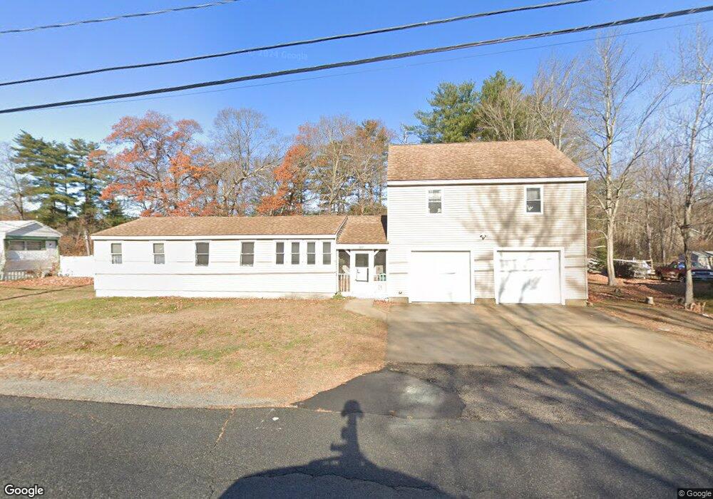
91B Farm Ln Seabrook, NH 03874
Estimated Value: $387,228 - $548,000
3
Beds
2
Baths
1,786
Sq Ft
$270/Sq Ft
Est. Value
About This Home
This home is located at 91B Farm Ln, Seabrook, NH 03874 and is currently estimated at $482,557, approximately $270 per square foot. 91B Farm Ln is a home located in Rockingham County with nearby schools including Seabrook Elementary School, Seabrook Middle School, and Winnacunnet High School.
Create a Home Valuation Report for This Property
The Home Valuation Report is an in-depth analysis detailing your home's value as well as a comparison with similar homes in the area
Home Values in the Area
Average Home Value in this Area
Tax History Compared to Growth
Tax History
| Year | Tax Paid | Tax Assessment Tax Assessment Total Assessment is a certain percentage of the fair market value that is determined by local assessors to be the total taxable value of land and additions on the property. | Land | Improvement |
|---|---|---|---|---|
| 2024 | $2,616 | $223,200 | $0 | $223,200 |
| 2023 | $2,695 | $178,600 | $0 | $178,600 |
| 2022 | $2,366 | $178,600 | $0 | $178,600 |
| 2021 | $2,452 | $178,600 | $0 | $178,600 |
| 2020 | $2,142 | $134,100 | $0 | $134,100 |
| 2019 | $2,112 | $134,100 | $0 | $134,100 |
| 2018 | $2,179 | $134,100 | $0 | $134,100 |
| 2017 | $2,179 | $134,100 | $0 | $134,100 |
| 2016 | $1,983 | $134,100 | $0 | $134,100 |
| 2015 | $1,816 | $122,800 | $0 | $122,800 |
| 2014 | $1,875 | $122,800 | $0 | $122,800 |
| 2013 | $1,875 | $122,800 | $0 | $122,800 |
Source: Public Records
Map
Nearby Homes
- 8 Kimberly Dr
- 14 Coleman Ct
- 22 Farm Ln
- 20 Railroad Ave
- 38 Rocks Rd Unit 2
- 38 Rocks Rd Unit 1
- 176 Lower Collins St
- 57 Washington St
- 35 Norman Rd
- 1 Old Salt Dr
- 27 Cross Beach Rd
- 28 Brooks Rd
- 81 Elm Ct
- 18 River St
- 241 & 245 Lafayette Rd
- 312 S Main St
- 308 Route 286 Unit 77
- 308 Route 286 Unit Lot 58
- 2 Collins St
- 51 Depot Rd