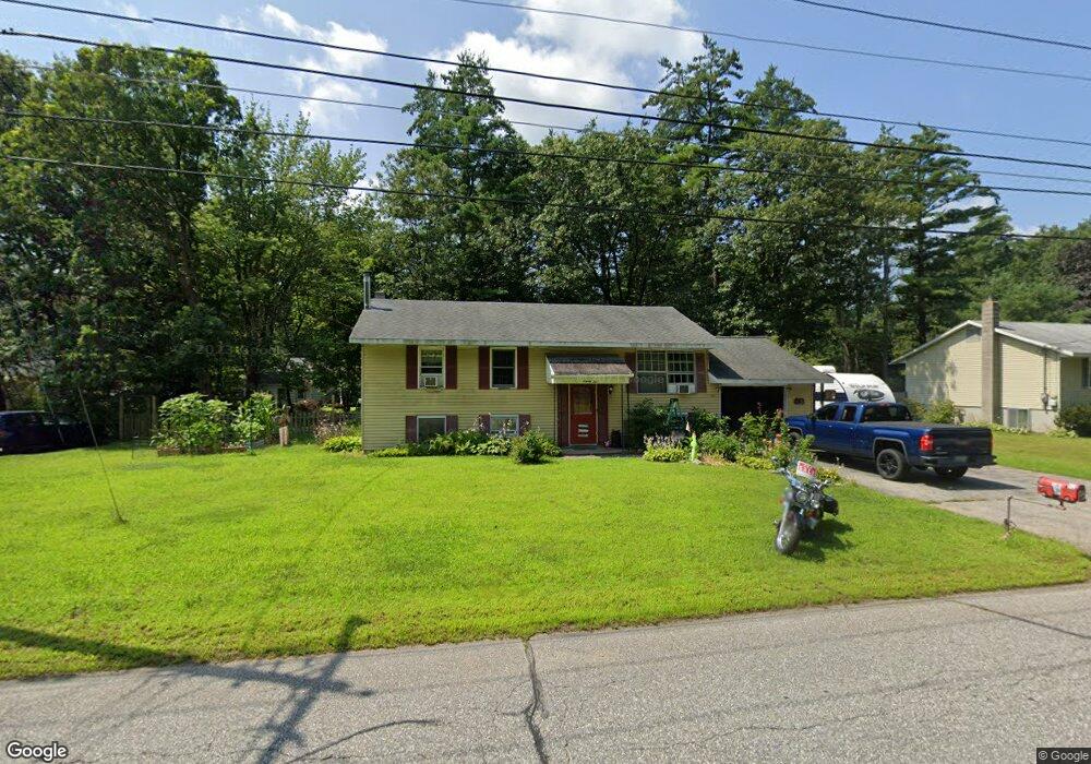
92 Abbott Rd Concord, NH 03303
West Concord NeighborhoodEstimated Value: $376,516 - $458,000
3
Beds
2
Baths
1,575
Sq Ft
$268/Sq Ft
Est. Value
About This Home
This home is located at 92 Abbott Rd, Concord, NH 03303 and is currently estimated at $421,379, approximately $267 per square foot. 92 Abbott Rd is a home located in Merrimack County with nearby schools including Beaver Meadow School, Rundlett Middle School, and Concord High School.
Ownership History
Date
Name
Owned For
Owner Type
Purchase Details
Closed on
Nov 12, 2021
Sold by
Rodgers James K
Bought by
James K Rodgers Ret and Rodgers
Current Estimated Value
Home Financials for this Owner
Home Financials are based on the most recent Mortgage that was taken out on this home.
Original Mortgage
$100,000
Interest Rate
7.03%
Mortgage Type
Stand Alone Refi Refinance Of Original Loan
Purchase Details
Closed on
Sep 19, 2011
Sold by
Loan Michael W and Loan Sharon L
Bought by
Crane Benjamin W and Crane Abigail
Home Financials for this Owner
Home Financials are based on the most recent Mortgage that was taken out on this home.
Original Mortgage
$160,817
Interest Rate
4.38%
Mortgage Type
Purchase Money Mortgage
Create a Home Valuation Report for This Property
The Home Valuation Report is an in-depth analysis detailing your home's value as well as a comparison with similar homes in the area
Home Values in the Area
Average Home Value in this Area
Purchase History
| Date | Buyer | Sale Price | Title Company |
|---|---|---|---|
| James K Rodgers Ret | -- | None Available | |
| James K Rodgers Ret | -- | None Available | |
| Crane Benjamin W | $165,000 | -- | |
| Crane Benjamin W | $165,000 | -- |
Source: Public Records
Mortgage History
| Date | Status | Borrower | Loan Amount |
|---|---|---|---|
| Previous Owner | James K Rodgers Ret | $100,000 | |
| Previous Owner | Crane Benjamin W | $160,817 |
Source: Public Records
Tax History
| Year | Tax Paid | Tax Assessment Tax Assessment Total Assessment is a certain percentage of the fair market value that is determined by local assessors to be the total taxable value of land and additions on the property. | Land | Improvement |
|---|---|---|---|---|
| 2025 | $7,219 | $248,000 | $94,100 | $153,900 |
| 2024 | $6,867 | $248,000 | $94,100 | $153,900 |
| 2023 | $6,661 | $248,000 | $94,100 | $153,900 |
| 2022 | $6,421 | $248,000 | $94,100 | $153,900 |
| 2021 | $6,267 | $249,500 | $94,100 | $155,400 |
| 2020 | $5,810 | $217,100 | $75,400 | $141,700 |
| 2019 | $5,187 | $186,700 | $68,600 | $118,100 |
| 2018 | $5,412 | $192,000 | $68,600 | $123,400 |
| 2017 | $5,083 | $180,000 | $65,200 | $114,800 |
| 2016 | $4,745 | $171,500 | $65,200 | $106,300 |
| 2015 | $4,497 | $164,500 | $63,200 | $101,300 |
| 2014 | $4,410 | $164,500 | $63,200 | $101,300 |
| 2013 | $4,208 | $164,500 | $63,200 | $101,300 |
| 2012 | $4,041 | $165,800 | $63,200 | $102,600 |
Source: Public Records
Map
Nearby Homes
- 70 Abbott Rd
- 4 Bellflower Cir
- 37 Woodbine Ave
- 59 Hobart St
- 120 Fisherville Rd Unit 176
- 120 Fisherville Rd Unit 52
- 127 Sewalls Falls Rd
- 123 Sewalls Falls Rd
- 125 Sewalls Falls Rd
- 117 Sewalls Falls Rd
- 4 Tanager Cir Unit 8
- 4 Tanager Cir Unit 7
- 4 Tanager Cir Unit 5
- 4 Tanager Cir Unit 3
- 4 Tanager Cir Unit 2
- 145 Abbott Rd
- 13 Suffolk Rd Unit 5
- 13 Suffolk Rd Unit 4
- 13 Suffolk Rd Unit 8
- 0 Sewalls Falls & Abbott Rd Unit Multiple
Your Personal Tour Guide
Ask me questions while you tour the home.