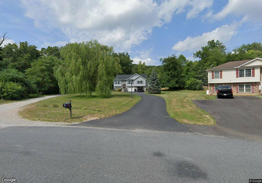
92 Municipal Rd Unit 9 Hanover, PA 17331
Estimated Value: $339,000 - $412,678
3
Beds
2
Baths
1,780
Sq Ft
$214/Sq Ft
Est. Value
About This Home
This home is located at 92 Municipal Rd Unit 9, Hanover, PA 17331 and is currently estimated at $380,170, approximately $213 per square foot. 92 Municipal Rd Unit 9 is a home located in Adams County with nearby schools including New Oxford Senior High School and Oxford Christian Academy.
Ownership History
Date
Name
Owned For
Owner Type
Purchase Details
Closed on
Feb 8, 2012
Sold by
Fannie Mae
Bought by
Dougherty Shawn Michael and Dougherty Kelsy A
Current Estimated Value
Home Financials for this Owner
Home Financials are based on the most recent Mortgage that was taken out on this home.
Original Mortgage
$178,251
Outstanding Balance
$122,120
Interest Rate
3.89%
Mortgage Type
VA
Estimated Equity
$258,050
Create a Home Valuation Report for This Property
The Home Valuation Report is an in-depth analysis detailing your home's value as well as a comparison with similar homes in the area
Home Values in the Area
Average Home Value in this Area
Purchase History
| Date | Buyer | Sale Price | Title Company |
|---|---|---|---|
| Dougherty Shawn Michael | $174,500 | None Available |
Source: Public Records
Mortgage History
| Date | Status | Borrower | Loan Amount |
|---|---|---|---|
| Open | Dougherty Shawn Michael | $178,251 |
Source: Public Records
Tax History Compared to Growth
Tax History
| Year | Tax Paid | Tax Assessment Tax Assessment Total Assessment is a certain percentage of the fair market value that is determined by local assessors to be the total taxable value of land and additions on the property. | Land | Improvement |
|---|---|---|---|---|
| 2025 | $6,038 | $270,300 | $95,200 | $175,100 |
| 2024 | $5,363 | $261,500 | $95,200 | $166,300 |
| 2023 | $5,084 | $261,500 | $95,200 | $166,300 |
| 2022 | $4,913 | $261,500 | $95,200 | $166,300 |
| 2021 | $4,775 | $261,500 | $95,200 | $166,300 |
| 2020 | $4,652 | $261,500 | $95,200 | $166,300 |
| 2019 | $4,546 | $261,500 | $95,200 | $166,300 |
| 2018 | $4,434 | $261,100 | $95,200 | $165,900 |
| 2017 | $4,231 | $261,100 | $95,200 | $165,900 |
| 2016 | -- | $261,100 | $95,200 | $165,900 |
| 2015 | -- | $261,100 | $95,200 | $165,900 |
| 2014 | -- | $261,100 | $95,200 | $165,900 |
Source: Public Records
Map
Nearby Homes
- 168 Ledger Dr Unit 74
- 156 Ledger Dr Unit 75
- 138 Ledger Dr Unit 76
- 23 Broadwing Dr
- Elder Plan at Summerfield - Single Family Homes
- Hazel Plan at Summerfield - Single Family Homes
- Cedar Plan at Summerfield - Single Family Homes
- Birch Plan at Summerfield - Single Family Homes
- Tupelo Plan at Summerfield - Single Family Homes
- 45 Broadwing Dr
- 58 Summerfield Dr
- 123 Broadwing Dr
- 104 Raptor Dr
- 30 Raptor Dr
- 57 Blue Heron Dr
- 85 Raptor Dr
- 236 Ledger Dr Unit 71
- 280 Ledger Dr Unit 140
- 254 Ledger Dr Unit 142
- 268 Ledger Dr Unit 141
- 92 Municipal Rd Unit 8
- 96 Municipal Rd Unit 10
- 80 Municipal Rd Unit 8
- 60 & 70 Municipal Rd
- 60 Municipal Rd
- 60 Municipal Rd Unit 6
- 90 Municipal Rd
- 90 Municipal Rd
- 50 Municipal Rd Unit 5
- 150 Municipal Rd
- 40 Municipal Rd Unit 4
- 30 Municipal Rd Unit 3
- 160 Municipal Rd
- 20 Municipal Rd Unit 2
- 172 Municipal Rd Unit 1
- 2185 Carlisle Pike
- 180 Municipal Rd
- 70 Huff Rd
- 300 Green Springs Rd Unit 1
- 10 Municipal Rd Unit 1