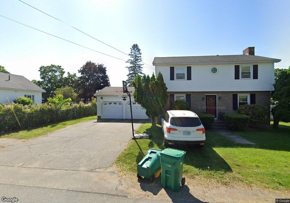
92 Pine St Rochester, NH 03867
Estimated Value: $420,000 - $501,000
4
Beds
3
Baths
2,235
Sq Ft
$206/Sq Ft
Est. Value
About This Home
This home is located at 92 Pine St, Rochester, NH 03867 and is currently estimated at $459,847, approximately $205 per square foot. 92 Pine St is a home located in Strafford County with nearby schools including William Allen School, Rochester Middle School, and Spaulding High School.
Ownership History
Date
Name
Owned For
Owner Type
Purchase Details
Closed on
Jan 4, 2017
Sold by
92 Pine Street Llc
Bought by
Jones Derek A and Parker-Jones Heather
Current Estimated Value
Home Financials for this Owner
Home Financials are based on the most recent Mortgage that was taken out on this home.
Original Mortgage
$172,000
Outstanding Balance
$139,620
Interest Rate
4.03%
Mortgage Type
Purchase Money Mortgage
Estimated Equity
$320,227
Create a Home Valuation Report for This Property
The Home Valuation Report is an in-depth analysis detailing your home's value as well as a comparison with similar homes in the area
Home Values in the Area
Average Home Value in this Area
Purchase History
| Date | Buyer | Sale Price | Title Company |
|---|---|---|---|
| Jones Derek A | $175,000 | -- |
Source: Public Records
Mortgage History
| Date | Status | Borrower | Loan Amount |
|---|---|---|---|
| Open | Jones Derek A | $172,000 |
Source: Public Records
Tax History
| Year | Tax Paid | Tax Assessment Tax Assessment Total Assessment is a certain percentage of the fair market value that is determined by local assessors to be the total taxable value of land and additions on the property. | Land | Improvement |
|---|---|---|---|---|
| 2025 | $6,749 | $441,100 | $96,800 | $344,300 |
| 2024 | $6,550 | $441,100 | $96,800 | $344,300 |
| 2023 | $6,198 | $240,800 | $47,000 | $193,800 |
| 2022 | $6,087 | $240,800 | $47,000 | $193,800 |
| 2021 | $5,936 | $240,800 | $47,000 | $193,800 |
| 2020 | $5,929 | $240,900 | $47,000 | $193,900 |
| 2019 | $5,998 | $240,900 | $47,000 | $193,900 |
| 2018 | $5,430 | $197,300 | $33,000 | $164,300 |
| 2017 | $5,195 | $197,300 | $33,000 | $164,300 |
| 2016 | $4,838 | $171,200 | $33,000 | $138,200 |
| 2015 | $4,814 | $171,000 | $33,000 | $138,000 |
| 2014 | $4,697 | $171,000 | $33,000 | $138,000 |
| 2013 | $4,687 | $177,800 | $45,400 | $132,400 |
| 2012 | $4,566 | $177,800 | $45,400 | $132,400 |
Source: Public Records
Map
Nearby Homes
- 75 Chestnut St
- 105 Maple St
- 49 Washington St
- 99 Washington St
- 46-48 Lafayette St
- 168 Brock St
- 43-45 Charles St
- 5 Kirsten Ave
- 18 Wakefield St
- 87 Charles St Unit 2
- 2 Barker Ct
- 17-19 Upham St
- 45 Hanson St
- 164 Brock St
- 15 Linden St
- 33 Linden St
- 10 Sarah Ct
- 1 Brook St
- 16 Springfield Estates
- 54 Harding St
Your Personal Tour Guide
Ask me questions while you tour the home.