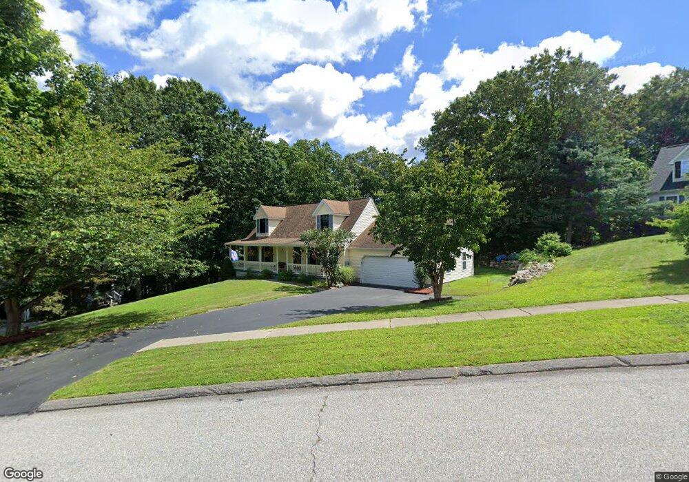
92 Richard Brown Dr Uncasville, CT 06382
Estimated Value: $333,000 - $406,000
4
Beds
3
Baths
1,411
Sq Ft
$271/Sq Ft
Est. Value
About This Home
This home is located at 92 Richard Brown Dr, Uncasville, CT 06382 and is currently estimated at $382,600, approximately $271 per square foot. 92 Richard Brown Dr is a home located in New London County with nearby schools including Leonard J. Tyl Middle School, Montville High School, and Mayflower Montessori School.
Ownership History
Date
Name
Owned For
Owner Type
Purchase Details
Closed on
Oct 2, 1998
Sold by
Rtt Dev Inc
Bought by
Boss Robert D and Boss Holly A
Current Estimated Value
Create a Home Valuation Report for This Property
The Home Valuation Report is an in-depth analysis detailing your home's value as well as a comparison with similar homes in the area
Home Values in the Area
Average Home Value in this Area
Purchase History
| Date | Buyer | Sale Price | Title Company |
|---|---|---|---|
| Boss Robert D | $155,000 | -- | |
| Rtt Dev Inc | $31,000 | -- | |
| Boss Robert D | $155,000 | -- |
Source: Public Records
Mortgage History
| Date | Status | Borrower | Loan Amount |
|---|---|---|---|
| Open | Boss Robert D | $281,059 | |
| Closed | Boss Robert D | $278,489 | |
| Closed | Boss Robert D | $100,000 |
Source: Public Records
Tax History Compared to Growth
Tax History
| Year | Tax Paid | Tax Assessment Tax Assessment Total Assessment is a certain percentage of the fair market value that is determined by local assessors to be the total taxable value of land and additions on the property. | Land | Improvement |
|---|---|---|---|---|
| 2025 | $5,663 | $196,140 | $35,070 | $161,070 |
| 2024 | $5,447 | $196,140 | $35,070 | $161,070 |
| 2023 | $5,447 | $196,140 | $35,070 | $161,070 |
| 2022 | $5,239 | $196,140 | $35,070 | $161,070 |
| 2021 | $5,106 | $160,830 | $34,760 | $126,070 |
| 2020 | $5,208 | $160,830 | $34,760 | $126,070 |
| 2019 | $5,229 | $160,830 | $34,760 | $126,070 |
| 2018 | $5,103 | $160,830 | $34,760 | $126,070 |
| 2017 | $5,098 | $160,830 | $34,760 | $126,070 |
| 2016 | $5,191 | $169,580 | $43,450 | $126,130 |
| 2015 | $5,191 | $169,580 | $43,450 | $126,130 |
| 2014 | $4,981 | $169,580 | $43,450 | $126,130 |
Source: Public Records
Map
Nearby Homes
- 124 Holly Hill Dr
- 32 Cedar Ln
- 19 Desjardins Dr
- 60 Fort Shantok Rd
- 61 Fort Shantok Rd
- 2057 Norwich New London Turnpike
- 87 Fort Shantok Rd
- 1622 Old Pond Ln Unit 1622
- 586 W Thames St Unit 610
- 527 W Thames St Unit 9
- 527 W Thames St Unit 27
- 102 Lucas Park Rd
- 4 Traders Ct
- 9 Thamesview Rd
- 114 Park Ave
- 4 Maplewood Ct
- 118 Sheraton Ln
- 26 Dydo Dr
- 6 Perry Ave
- 27 Sycamore Rd
- 94 Richard Brown Dr
- 88 Richard Brown Dr
- 135 Holly Hill Dr
- 136 Holly Hill Dr
- 86 Richard Brown Dr
- 8 Libby Dr
- 96 Richard Brown Dr
- 4 Libby Dr
- 91 Richard Brown Dr
- 132 Holly Hill Dr
- 97 Richard Brown Dr
- 87 Richard Brown Dr
- 83 Richard Brown Dr
- 27 Crestview Dr
- 35 Crestview Dr
- 98 Richard Brown Dr
- 128 Holly Hill Dr
- 11 Libby Dr
- 7 Libby Dr
- 3 Libby Dr