
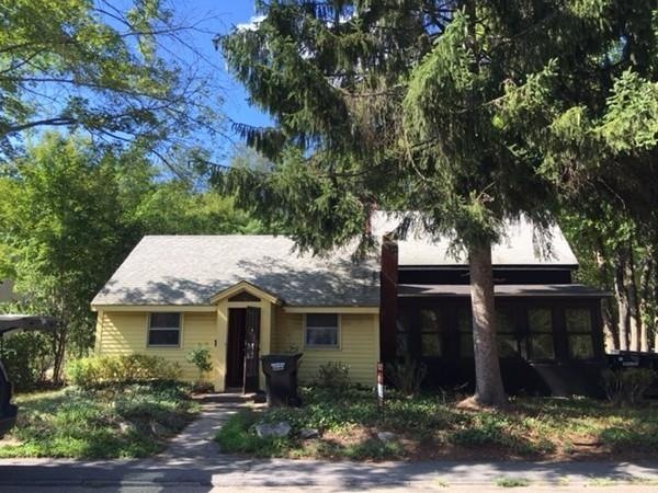
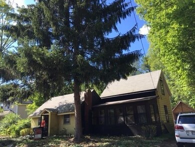
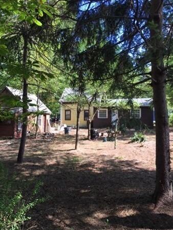
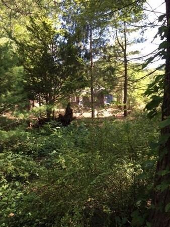


92 S Worcester St Norton, MA 02766
0.64
Acre
$195,312
Price per Acre
27,878
Sq Ft Lot
Highlights
- Golf Course Community
- Shops
- Level Lot
- Wooded Lot
- Property is near schools
About This Lot
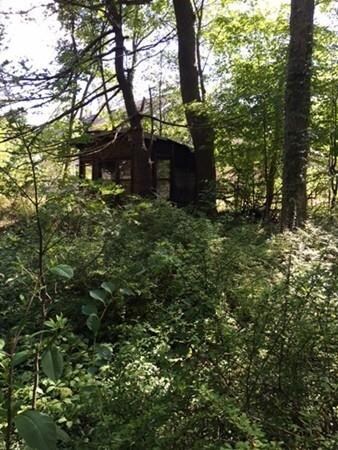
As of August 2018The lot is level and wooded. There is an 1455 sq. ft. older home on the property. Great country road. We can walk the land, but no showings on the home until 8/21/16. Super value! Please do not walk on property without the list agent. Thank you!
Last Buyer's Agent
Cheryle Cantin
Conway - Mansfield License #455013538
Property Details
Property Type
- Land
Year Built
- 2017
Lot Details
- 0.64 Acre Lot
- Level Lot
- Wooded Lot
- Property is zoned R40
Location
- Property is near schools
Utilities
- Electricity To Lot Line
- Natural Gas Not Available
- Private Sewer
Listing and Financial Details
- Tax Lot 154
- Assessor Parcel Number M:26 P:154,2925275
Community Details
Amenities
- Shops
Recreation
- Golf Course Community
Ownership History
Date
Name
Owned For
Owner Type
Purchase Details
Listed on
Jun 20, 2018
Closed on
Aug 2, 2018
Sold by
Dimilla Christopher E
Bought by
Martin Matthew and Harper Mallory
Seller's Agent
Paula Lopes
RE/MAX Real Estate Center
Buyer's Agent
Virginia Fidalgo
GRANITE GROUP REALTORS®
List Price
$409,999
Sold Price
$412,500
Premium/Discount to List
$2,501
0.61%
Total Days on Market
2
Current Estimated Value
Home Financials for this Owner
Home Financials are based on the most recent Mortgage that was taken out on this home.
Estimated Appreciation
$219,911
Avg. Annual Appreciation
6.48%
Original Mortgage
$391,875
Outstanding Balance
$343,835
Interest Rate
4.5%
Mortgage Type
New Conventional
Estimated Equity
$288,576
Purchase Details
Listed on
Dec 23, 2016
Closed on
Jun 30, 2017
Sold by
Barnside Corp
Bought by
Dimilla Christopher E
Seller's Agent
Cheryle Cantin
Conway - Mansfield
Buyer's Agent
Non Member
Non Member Office
List Price
$359,900
Sold Price
$359,900
Home Financials for this Owner
Home Financials are based on the most recent Mortgage that was taken out on this home.
Avg. Annual Appreciation
13.33%
Original Mortgage
$353,380
Interest Rate
3.87%
Mortgage Type
FHA
Purchase Details
Listed on
Aug 14, 2016
Closed on
Dec 22, 2016
Sold by
Joppich Marta
Bought by
Barnside Corp
Seller's Agent
Sheryle DeGirolamo
Kensington Real Estate Brokerage
Buyer's Agent
Cheryle Cantin
Conway - Mansfield
List Price
$125,000
Sold Price
$125,000
Home Financials for this Owner
Home Financials are based on the most recent Mortgage that was taken out on this home.
Avg. Annual Appreciation
664.21%
Original Mortgage
$212,500
Interest Rate
3.57%
Mortgage Type
New Conventional
Map
Create a Home Valuation Report for This Property
The Home Valuation Report is an in-depth analysis detailing your home's value as well as a comparison with similar homes in the area
Similar Properties in Norton, MA
Home Values in the Area
Average Home Value in this Area
Purchase History
| Date | Type | Sale Price | Title Company |
|---|---|---|---|
| Not Resolvable | $412,500 | -- | |
| Not Resolvable | $359,900 | -- | |
| Not Resolvable | $125,000 | -- |
Source: Public Records
Mortgage History
| Date | Status | Loan Amount | Loan Type |
|---|---|---|---|
| Open | $391,875 | New Conventional | |
| Previous Owner | $353,380 | FHA | |
| Previous Owner | $212,500 | New Conventional |
Source: Public Records
Property History
| Date | Event | Price | Change | Sq Ft Price |
|---|---|---|---|---|
| 08/02/2018 08/02/18 | Sold | $412,500 | +0.6% | $226 / Sq Ft |
| 06/25/2018 06/25/18 | Pending | -- | -- | -- |
| 06/20/2018 06/20/18 | For Sale | $409,999 | +13.9% | $225 / Sq Ft |
| 06/30/2017 06/30/17 | Sold | $359,900 | 0.0% | $287 / Sq Ft |
| 02/06/2017 02/06/17 | Pending | -- | -- | -- |
| 01/27/2017 01/27/17 | For Sale | $359,900 | +187.9% | $287 / Sq Ft |
| 01/25/2017 01/25/17 | Pending | -- | -- | -- |
| 12/23/2016 12/23/16 | Sold | $125,000 | -65.3% | $86 / Sq Ft |
| 12/23/2016 12/23/16 | For Sale | $359,900 | +187.9% | $287 / Sq Ft |
| 11/23/2016 11/23/16 | Pending | -- | -- | -- |
| 08/14/2016 08/14/16 | For Sale | $125,000 | -- | $86 / Sq Ft |
Source: MLS Property Information Network (MLS PIN)
Tax History
| Year | Tax Paid | Tax Assessment Tax Assessment Total Assessment is a certain percentage of the fair market value that is determined by local assessors to be the total taxable value of land and additions on the property. | Land | Improvement |
|---|---|---|---|---|
| 2025 | $68 | $521,700 | $184,400 | $337,300 |
| 2024 | $6,480 | $500,400 | $175,600 | $324,800 |
| 2023 | $6,175 | $475,400 | $165,600 | $309,800 |
| 2022 | $6,009 | $421,400 | $150,600 | $270,800 |
| 2021 | $5,703 | $382,000 | $143,400 | $238,600 |
| 2020 | $5,528 | $373,500 | $139,200 | $234,300 |
| 2019 | $5,264 | $353,300 | $133,900 | $219,400 |
| 2018 | $3,022 | $360,000 | $133,900 | $226,100 |
| 2017 | $3,618 | $235,400 | $133,900 | $101,500 |
| 2016 | $3,542 | $226,900 | $133,900 | $93,000 |
| 2015 | $3,418 | $222,100 | $131,300 | $90,800 |
| 2014 | $3,065 | $199,400 | $112,500 | $86,900 |
Source: Public Records
Source: MLS Property Information Network (MLS PIN)
MLS Number: 72053089
APN: NORT-000026-000000-000154
Disclaimer: Certain information contained herein is derived from information provided by parties other than Homes.com. All information provided is deemed reliable, but is not guaranteed to be accurate and should be independently verified.
![]() The property listing data and information, or the Images, set forth herein were provided to MLS Property Information Network, Inc. from third party sources, including sellers, lessors and public records, and were compiled by MLS Property Information Network, Inc. The property listing data and information, and the Images, are for the personal, non-commercial use of consumers having a good faith interest in purchasing or leasing listed properties of the type displayed to them and may not be used for any purpose other than to identify prospective properties which such consumers may have a good faith interest in purchasing or leasing. MLS Property Information Network, Inc. and its subscribers disclaim any and all representations and warranties as to the accuracy of the property listing data and information, or as to the accuracy of any of the Images, set forth herein.
The property listing data and information, or the Images, set forth herein were provided to MLS Property Information Network, Inc. from third party sources, including sellers, lessors and public records, and were compiled by MLS Property Information Network, Inc. The property listing data and information, and the Images, are for the personal, non-commercial use of consumers having a good faith interest in purchasing or leasing listed properties of the type displayed to them and may not be used for any purpose other than to identify prospective properties which such consumers may have a good faith interest in purchasing or leasing. MLS Property Information Network, Inc. and its subscribers disclaim any and all representations and warranties as to the accuracy of the property listing data and information, or as to the accuracy of any of the Images, set forth herein.
Nearby Homes
- 108 S Worcester St
- 25-27 Sturdy St
- 12 Spring Ln
- 271 W Main St
- 182 John Scott Blvd
- 180 John Scott Blvd
- 205 S Worcester St
- 207 S Worcester St
- 47-49 Harvey St
- 110 Harvey St
- 48 Dean St
- 22 Freeman St
- 28 Barrows St
- 16 Village Way Unit D
- 5 Eileen Rd
- 10 Codding Rd
- 12 Village Way Unit F
- 103 Slater St
- 17 Village Way Unit D
- 100 John Scott Blvd