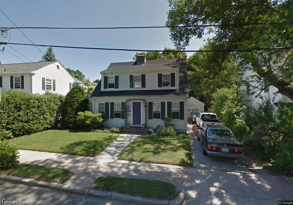
92 Sheffield Ave Pawtucket, RI 02860
Oak Hill NeighborhoodEstimated Value: $460,788 - $616,000
3
Beds
2
Baths
1,560
Sq Ft
$355/Sq Ft
Est. Value
About This Home
This home is located at 92 Sheffield Ave, Pawtucket, RI 02860 and is currently estimated at $553,697, approximately $354 per square foot. 92 Sheffield Ave is a home located in Providence County with nearby schools including International Charter School, Blackstone Academy Charter School, and Ocean Tides School.
Ownership History
Date
Name
Owned For
Owner Type
Purchase Details
Closed on
Jun 4, 2013
Sold by
Solomon Gail R
Bought by
Solomon Gail R and Palatucci Michael M
Current Estimated Value
Purchase Details
Closed on
Jul 30, 1992
Sold by
Shepard Michael Est
Bought by
Solomon Gail R
Home Financials for this Owner
Home Financials are based on the most recent Mortgage that was taken out on this home.
Original Mortgage
$85,000
Interest Rate
8.46%
Create a Home Valuation Report for This Property
The Home Valuation Report is an in-depth analysis detailing your home's value as well as a comparison with similar homes in the area
Home Values in the Area
Average Home Value in this Area
Purchase History
| Date | Buyer | Sale Price | Title Company |
|---|---|---|---|
| Solomon Gail R | -- | -- | |
| Solomon Gail R | $115,000 | -- |
Source: Public Records
Mortgage History
| Date | Status | Borrower | Loan Amount |
|---|---|---|---|
| Previous Owner | Solomon Gail R | $235,000 | |
| Previous Owner | Solomon Gail R | $75,000 | |
| Previous Owner | Solomon Gail R | $80,000 | |
| Previous Owner | Solomon Gail R | $85,000 |
Source: Public Records
Tax History Compared to Growth
Tax History
| Year | Tax Paid | Tax Assessment Tax Assessment Total Assessment is a certain percentage of the fair market value that is determined by local assessors to be the total taxable value of land and additions on the property. | Land | Improvement |
|---|---|---|---|---|
| 2025 | $4,338 | $329,900 | $152,400 | $177,500 |
| 2024 | $4,071 | $329,900 | $152,400 | $177,500 |
| 2023 | $4,523 | $267,000 | $112,800 | $154,200 |
| 2022 | $4,427 | $267,000 | $112,800 | $154,200 |
| 2021 | $4,427 | $267,000 | $112,800 | $154,200 |
| 2020 | $5,452 | $261,000 | $143,600 | $117,400 |
| 2019 | $5,452 | $261,000 | $143,600 | $117,400 |
| 2018 | $5,254 | $261,000 | $143,600 | $117,400 |
| 2017 | $4,814 | $211,900 | $116,600 | $95,300 |
| 2016 | $4,638 | $211,900 | $116,600 | $95,300 |
| 2015 | $4,638 | $211,900 | $116,600 | $95,300 |
| 2014 | $3,897 | $169,000 | $104,600 | $64,400 |
Source: Public Records
Map
Nearby Homes
- 603 East Ave
- 26 Bowles Ct
- 640 East Ave
- 142 Ridge St
- 64 Smith St
- 410 Pawtucket Ave
- 70 Dunnell Ave
- 122 Lowden St
- 207 Pawtucket Ave
- 199 Pawtucket Ave
- 167 George St
- 50 Jefferson Ave
- 126 Dunnell Ave
- 54 Jefferson Ave
- 228 School St Unit 8
- 68 Maryland Ave
- 44 Pawtucket Ave
- 92 Jefferson Ave
- 136 Hillside Ave
- 141 Hillside Ave
- 88 Sheffield Ave
- 100 Sheffield Ave
- 44 Fowler Ave
- 205 Cleveland St
- 211 Cleveland St
- 70 Fowler Ave
- 104 Sheffield Ave
- 97 Sheffield Ave
- 215 Cleveland St
- 110 Sheffield Ave
- 78 Fowler Ave
- 105 Sheffield Ave
- 73 Sheffield Ave
- 223 Cleveland St
- 114 Sheffield Ave
- 107 Sheffield Ave
- 227 Cleveland St
- 200 Cleveland St
- 208 Cleveland St
- 86 Fowler Ave