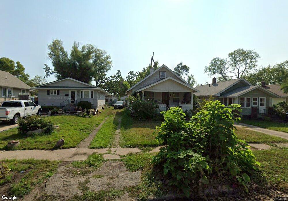
920 Daniels St NE Cedar Rapids, IA 52402
Mound View NeighborhoodEstimated Value: $110,000 - $118,000
2
Beds
1
Bath
884
Sq Ft
$128/Sq Ft
Est. Value
About This Home
This home is located at 920 Daniels St NE, Cedar Rapids, IA 52402 and is currently estimated at $113,294, approximately $128 per square foot. 920 Daniels St NE is a home located in Linn County with nearby schools including Garfield Elementary School, Franklin Middle School, and George Washington High School.
Ownership History
Date
Name
Owned For
Owner Type
Purchase Details
Closed on
Oct 27, 2005
Sold by
Pranskunas Emma M and Pranskunas Dorothy M
Bought by
Brown Kathryn R
Current Estimated Value
Home Financials for this Owner
Home Financials are based on the most recent Mortgage that was taken out on this home.
Original Mortgage
$70,300
Outstanding Balance
$37,952
Interest Rate
5.8%
Mortgage Type
Fannie Mae Freddie Mac
Estimated Equity
$75,342
Create a Home Valuation Report for This Property
The Home Valuation Report is an in-depth analysis detailing your home's value as well as a comparison with similar homes in the area
Home Values in the Area
Average Home Value in this Area
Purchase History
| Date | Buyer | Sale Price | Title Company |
|---|---|---|---|
| Brown Kathryn R | $73,500 | -- |
Source: Public Records
Mortgage History
| Date | Status | Borrower | Loan Amount |
|---|---|---|---|
| Open | Brown Kathryn R | $70,300 |
Source: Public Records
Tax History Compared to Growth
Tax History
| Year | Tax Paid | Tax Assessment Tax Assessment Total Assessment is a certain percentage of the fair market value that is determined by local assessors to be the total taxable value of land and additions on the property. | Land | Improvement |
|---|---|---|---|---|
| 2025 | $1,386 | $95,600 | $21,400 | $74,200 |
| 2024 | $1,452 | $88,800 | $19,300 | $69,500 |
| 2023 | $1,452 | $88,800 | $19,300 | $69,500 |
| 2022 | $1,326 | $77,700 | $19,300 | $58,400 |
| 2021 | $1,408 | $73,000 | $19,300 | $53,700 |
| 2020 | $1,408 | $72,400 | $17,100 | $55,300 |
| 2019 | $1,338 | $70,600 | $17,100 | $53,500 |
| 2018 | $1,296 | $70,600 | $17,100 | $53,500 |
| 2017 | $1,577 | $62,300 | $17,100 | $45,200 |
| 2016 | $1,577 | $74,200 | $17,100 | $57,100 |
| 2015 | $1,687 | $79,269 | $19,260 | $60,009 |
| 2014 | $1,502 | $89,176 | $19,620 | $69,556 |
| 2013 | $1,672 | $89,176 | $19,620 | $69,556 |
Source: Public Records
Map
Nearby Homes
- 1311 I Ave NE
- 832 Daniels St NE
- 826 Daniels St NE
- 910 Maplewood Dr NE
- 1046 12th St NE
- 1060 17th St NE
- 1204 Elmhurst Dr NE
- 420 16th St NE
- 2011 Sierra Cir NE
- 2000 Sierra Cir NE
- 2015 Sierra Cir NE
- 2006 Sierra Cir NE
- 2019 Sierra Cir NE
- 2012 Sierra Cir NE
- 2023 Sierra Cir NE
- 2018 Sierra Cir NE
- 2103 Sierra Cir NE
- 517 18th St NE
- 1551 C Ave NE
- 2109 Sierra Cir NE
- 924 Daniels St NE
- 916 Daniels St NE
- 928 Daniels St NE
- 914 Daniels St NE
- 908 Daniels St NE
- 932 Daniels St NE
- 904 Daniels St NE
- 1352 H Ave NE
- 1352 H Ave NE Unit 1352 h
- 923 Oakland Rd NE
- 921 Oakland Rd NE
- 925 Oakland Rd NE
- 940 Daniels St NE
- 1354 H Ave NE
- 915 Oakland Rd NE
- 1350 H Ave NE
- 935 Oakland Rd NE
- 919 Daniels St NE
- 925 Daniels St NE
- 917 Daniels St NE