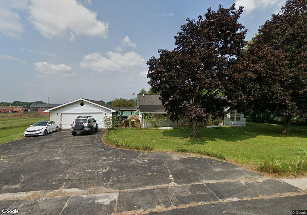
920 E Grant Hwy Marengo, IL 60152
Estimated Value: $198,000 - $304,845
2
Beds
1
Bath
--
Sq Ft
0.59
Acres
About This Home
This home is located at 920 E Grant Hwy, Marengo, IL 60152 and is currently estimated at $268,711. 920 E Grant Hwy is a home located in McHenry County with nearby schools including Locust Elementary School, Marengo Community Middle School, and Marengo Community High School.
Ownership History
Date
Name
Owned For
Owner Type
Purchase Details
Closed on
Oct 15, 2021
Sold by
Krol Kenneth L
Bought by
Gelly Jesus E
Current Estimated Value
Home Financials for this Owner
Home Financials are based on the most recent Mortgage that was taken out on this home.
Original Mortgage
$152,625
Outstanding Balance
$139,180
Interest Rate
2.8%
Mortgage Type
New Conventional
Estimated Equity
$129,531
Purchase Details
Closed on
May 27, 2003
Sold by
Pollnow Kim I
Bought by
Krol Kenneth L
Home Financials for this Owner
Home Financials are based on the most recent Mortgage that was taken out on this home.
Original Mortgage
$152,000
Interest Rate
5.88%
Mortgage Type
Purchase Money Mortgage
Purchase Details
Closed on
May 19, 1999
Sold by
Hubbs Mildred I and Mallory Ralph B
Bought by
Hubbs Mildred E and Mallory Ralph B
Create a Home Valuation Report for This Property
The Home Valuation Report is an in-depth analysis detailing your home's value as well as a comparison with similar homes in the area
Home Values in the Area
Average Home Value in this Area
Purchase History
| Date | Buyer | Sale Price | Title Company |
|---|---|---|---|
| Gelly Jesus E | $150,000 | Nlt Title Llc | |
| Krol Kenneth L | $160,000 | Mt | |
| Hubbs Mildred E | -- | -- |
Source: Public Records
Mortgage History
| Date | Status | Borrower | Loan Amount |
|---|---|---|---|
| Open | Gelly Jesus E | $152,625 | |
| Previous Owner | Krol Kenneth L | $152,000 |
Source: Public Records
Tax History Compared to Growth
Tax History
| Year | Tax Paid | Tax Assessment Tax Assessment Total Assessment is a certain percentage of the fair market value that is determined by local assessors to be the total taxable value of land and additions on the property. | Land | Improvement |
|---|---|---|---|---|
| 2024 | -- | $79,532 | $29,593 | $49,939 |
| 2023 | $5,687 | $70,109 | $26,087 | $44,022 |
| 2022 | $5,687 | $63,401 | $23,591 | $39,810 |
| 2021 | $4,770 | $57,768 | $21,495 | $36,273 |
| 2020 | $4,677 | $54,975 | $20,456 | $34,519 |
| 2019 | $4,932 | $52,089 | $19,382 | $32,707 |
| 2018 | $4,560 | $48,791 | $18,155 | $30,636 |
| 2017 | $4,398 | $46,217 | $17,197 | $29,020 |
| 2016 | $4,234 | $43,181 | $16,067 | $27,114 |
| 2013 | -- | $42,248 | $15,720 | $26,528 |
Source: Public Records
Map
Nearby Homes
- 214 S Prospect St
- 900 Mary Ct
- 0 Maple St
- 6211 Maple St Unit 501
- 5 Lindow Ave
- 8 Lindow Ave
- 6 Lindow Ave
- 730 Cloverleaf Dr
- 720 Cloverleaf Dr
- 725 Cloverleaf Dr
- 422 Damen St
- 935 Courtney Ln
- 832 Oak Manor Dr
- 1200 Maplewood Dr
- 1210 Maplewood Dr
- The Charlotte Plan at Deerpass Estates
- The Remington Plan at Deerpass Estates
- The Williamsburg Plan at Deerpass Estates
- 622 Telegraph St
- 212 E Van Buren St
- 932 E Grant Hwy
- 934 E Grant Hwy
- 927 E Grant Hwy
- 839 E Grant Hwy
- 1002 E Grant Hwy
- 821 E Grant Hwy Unit C-D
- 821 E Grant Hwy Unit D
- 821 E Grant Hwy Unit F
- 821 E Grant Hwy Unit C
- 821 E Grant Hwy Unit B
- 821 E Grant Hwy Unit E
- 791 E Grant Hwy
- 260 Shady Lane Dr
- 270 Shady Lane Dr
- 280 Shady Lane Dr
- 315 Riley Dr
- 820 Diane Ct
- 310 Riley Dr
- 325 Riley Dr
- 320 Riley Dr