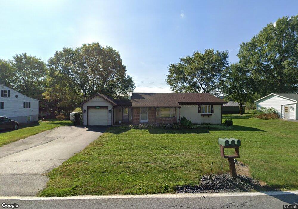
920 Ivy Dr Lancaster, PA 17601
Oyster Point NeighborhoodEstimated Value: $230,000 - $353,000
2
Beds
2
Baths
1,008
Sq Ft
$293/Sq Ft
Est. Value
About This Home
This home is located at 920 Ivy Dr, Lancaster, PA 17601 and is currently estimated at $295,599, approximately $293 per square foot. 920 Ivy Dr is a home located in Lancaster County with nearby schools including Landisville Primary Center, Landisville Middle School, and Hempfield High School.
Ownership History
Date
Name
Owned For
Owner Type
Purchase Details
Closed on
May 20, 2021
Sold by
Tomlinson Beverly Gaye and Estate Of Russell L Barley
Bought by
Forry David Glen
Current Estimated Value
Home Financials for this Owner
Home Financials are based on the most recent Mortgage that was taken out on this home.
Original Mortgage
$100,000
Outstanding Balance
$75,709
Interest Rate
3.1%
Mortgage Type
New Conventional
Estimated Equity
$219,890
Create a Home Valuation Report for This Property
The Home Valuation Report is an in-depth analysis detailing your home's value as well as a comparison with similar homes in the area
Home Values in the Area
Average Home Value in this Area
Purchase History
| Date | Buyer | Sale Price | Title Company |
|---|---|---|---|
| Forry David Glen | $175,000 | None Available |
Source: Public Records
Mortgage History
| Date | Status | Borrower | Loan Amount |
|---|---|---|---|
| Open | Forry David Glen | $100,000 |
Source: Public Records
Tax History
| Year | Tax Paid | Tax Assessment Tax Assessment Total Assessment is a certain percentage of the fair market value that is determined by local assessors to be the total taxable value of land and additions on the property. | Land | Improvement |
|---|---|---|---|---|
| 2025 | $3,890 | $172,500 | $51,800 | $120,700 |
| 2024 | $3,890 | $172,500 | $51,800 | $120,700 |
| 2023 | $3,816 | $172,500 | $51,800 | $120,700 |
| 2022 | $3,715 | $172,500 | $51,800 | $120,700 |
| 2021 | $3,641 | $172,500 | $51,800 | $120,700 |
| 2020 | $3,641 | $172,500 | $51,800 | $120,700 |
| 2019 | $3,582 | $172,500 | $51,800 | $120,700 |
| 2018 | $752 | $172,500 | $51,800 | $120,700 |
| 2017 | $3,417 | $132,900 | $50,300 | $82,600 |
| 2016 | $3,349 | $132,900 | $50,300 | $82,600 |
| 2015 | $674 | $132,900 | $50,300 | $82,600 |
| 2014 | $2,462 | $132,900 | $50,300 | $82,600 |
Source: Public Records
Map
Nearby Homes
- 3481 Coronet Ave
- 923 Jade Ave
- 906 Snapper Dam Rd
- 3301 Marietta Ave
- 3880 Nolt Rd
- 3710 Little Mac Dr
- 319 Druid Hill Rd
- 421 Hempfield Hill Rd
- 415 LOT # 1 Hempfield Hill Rd
- 419 LOT # 7 Hempfield Hill Rd
- 3059 Buckthorn Dr
- 415 Hempfield Hill Rd
- 427 Hempfield Hill Rd
- 118 Erica Ln
- 3242 Elmae Dr
- 122 Erica Ln
- 202 Lindsey Dr
- 1049 Signal Hill Ln
- 250 Huntington Dr
- 825 Robin Rd
Your Personal Tour Guide
Ask me questions while you tour the home.