Estimated Value: $318,000 - $350,000
4
Beds
2
Baths
2,237
Sq Ft
$150/Sq Ft
Est. Value
About This Home
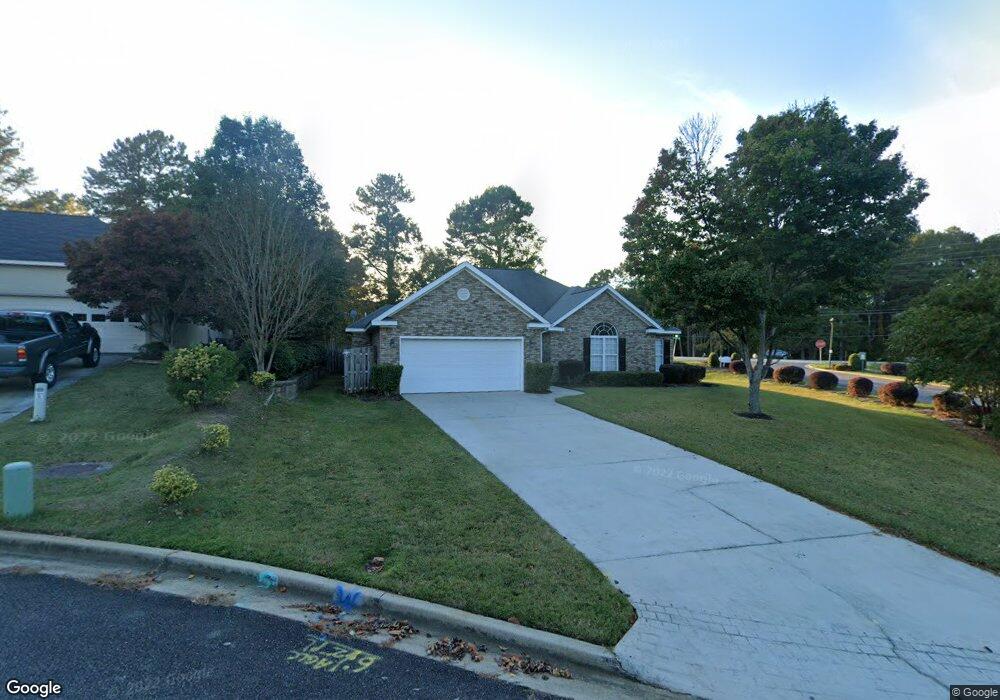
This home is located at 920 Prairie Cir, Evans, GA 30809 and is currently estimated at $335,267, approximately $149 per square foot. 920 Prairie Cir is a home located in Columbia County with nearby schools including River Ridge Elementary School, Riverside Middle School, and Lakeside High School.
Ownership History
Date
Name
Owned For
Owner Type
Purchase Details
Closed on
Nov 17, 2003
Sold by
Marshall Place Development Inc
Bought by
Pierwood Investment Corp
Current Estimated Value
Home Financials for this Owner
Home Financials are based on the most recent Mortgage that was taken out on this home.
Original Mortgage
$97,800
Interest Rate
6.04%
Mortgage Type
Purchase Money Mortgage
Create a Home Valuation Report for This Property
The Home Valuation Report is an in-depth analysis detailing your home's value as well as a comparison with similar homes in the area
Home Values in the Area
Average Home Value in this Area
Purchase History
| Date | Buyer | Sale Price | Title Company |
|---|---|---|---|
| Pierwood Investment Corp | $21,900 | -- |
Source: Public Records
Mortgage History
| Date | Status | Borrower | Loan Amount |
|---|---|---|---|
| Closed | Pierwood Investment Corp | $97,800 |
Source: Public Records
Tax History Compared to Growth
Tax History
| Year | Tax Paid | Tax Assessment Tax Assessment Total Assessment is a certain percentage of the fair market value that is determined by local assessors to be the total taxable value of land and additions on the property. | Land | Improvement |
|---|---|---|---|---|
| 2025 | $2,886 | $118,560 | $25,804 | $92,756 |
| 2024 | $3,249 | $127,688 | $25,804 | $101,884 |
| 2023 | $3,249 | $105,333 | $20,604 | $84,729 |
| 2022 | $2,603 | $97,939 | $19,304 | $78,635 |
| 2021 | $2,563 | $92,114 | $18,704 | $73,410 |
| 2020 | $2,549 | $89,707 | $18,204 | $71,503 |
| 2019 | $2,357 | $82,775 | $16,404 | $66,371 |
| 2018 | $2,303 | $80,570 | $15,404 | $65,166 |
| 2017 | $2,310 | $80,546 | $15,904 | $64,642 |
| 2016 | $2,117 | $76,355 | $15,180 | $61,175 |
| 2015 | $1,934 | $69,453 | $14,180 | $55,273 |
| 2014 | $1,982 | $70,321 | $14,180 | $56,141 |
Source: Public Records
Map
Nearby Homes
- 303 N Sandhills Ln
- 839 Prairie Ln
- 819 Cape Cod Ct
- 812 Cape Cod Ct
- 322 Sandhills Ln
- 787 Springbrook Cir
- 4277 Deerwood Ln
- 829 Woodberry Dr
- 936 Deercrest Cir
- 1013 Emerald Place
- 4489 Woodberry Ct
- 612 Emerald Crossing
- 656 Deerwood Way
- 854 Sparkleberry Rd
- 802 Sparkleberry Rd
- 800 Sparkleberry Rd
- 628 Emerald Crossing
- 1062 Emerald Place
- 4305 Southern Pines Dr
- 3113 Sunset Maple Trail
- 865 Prairie Ln
- 922 Prairie Cir
- 909 Prairie Ln
- 899 Prairie Ln
- 924 Prairie Cir
- 921 Prairie Cir
- 908 Prairie Ln
- 923 Prairie Cir
- 863 Prairie Ln
- 864 Prairie Ln
- 701 Adcock Ct
- 861 Prairie Ln
- 4307 Pierwood Way
- 859 Prairie Ln
- 703 Adcock Ct
- 705 Adcock Ct
- 702 Adcock Ct
- 707 Adcock Ct
- 857 Prairie Ln
- 858 Prairie Ln