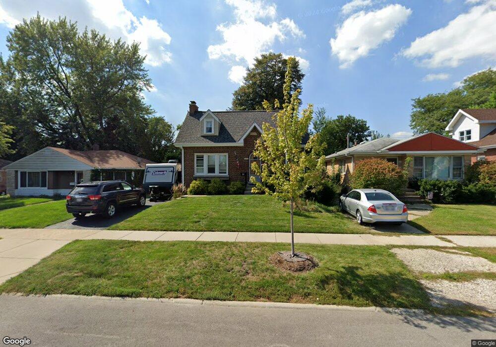
920 S 6th Ave Des Plaines, IL 60016
Estimated Value: $364,000 - $422,000
4
Beds
2
Baths
1,213
Sq Ft
$316/Sq Ft
Est. Value
About This Home
This home is located at 920 S 6th Ave, Des Plaines, IL 60016 and is currently estimated at $383,102, approximately $315 per square foot. 920 S 6th Ave is a home located in Cook County with nearby schools including Forest Elementary School, Algonquin Middle School, and Maine West High School.
Ownership History
Date
Name
Owned For
Owner Type
Purchase Details
Closed on
Sep 22, 2009
Sold by
Kudlicki Daniel
Bought by
Wall Grande Anthony J and Wall Grande Judith
Current Estimated Value
Home Financials for this Owner
Home Financials are based on the most recent Mortgage that was taken out on this home.
Original Mortgage
$250,381
Outstanding Balance
$163,415
Interest Rate
5.15%
Mortgage Type
FHA
Estimated Equity
$219,687
Purchase Details
Closed on
May 27, 2004
Sold by
Kudlicki Chester A
Bought by
Kudlicki Chester and Chester Kudlicki Living Trust
Create a Home Valuation Report for This Property
The Home Valuation Report is an in-depth analysis detailing your home's value as well as a comparison with similar homes in the area
Home Values in the Area
Average Home Value in this Area
Purchase History
| Date | Buyer | Sale Price | Title Company |
|---|---|---|---|
| Wall Grande Anthony J | $255,000 | Attorneys Title Guaranty Fun | |
| Kudlicki Chester | -- | -- |
Source: Public Records
Mortgage History
| Date | Status | Borrower | Loan Amount |
|---|---|---|---|
| Open | Wall Grande Anthony J | $250,381 |
Source: Public Records
Tax History Compared to Growth
Tax History
| Year | Tax Paid | Tax Assessment Tax Assessment Total Assessment is a certain percentage of the fair market value that is determined by local assessors to be the total taxable value of land and additions on the property. | Land | Improvement |
|---|---|---|---|---|
| 2024 | $6,574 | $28,250 | $3,990 | $24,260 |
| 2023 | $6,389 | $28,250 | $3,990 | $24,260 |
| 2022 | $6,389 | $28,250 | $3,990 | $24,260 |
| 2021 | $4,212 | $17,032 | $3,325 | $13,707 |
| 2020 | $5,434 | $21,085 | $3,325 | $17,760 |
| 2019 | $5,453 | $23,692 | $3,325 | $20,367 |
| 2018 | $5,843 | $22,973 | $2,926 | $20,047 |
| 2017 | $5,757 | $22,973 | $2,926 | $20,047 |
| 2016 | $5,690 | $22,973 | $2,926 | $20,047 |
| 2015 | $4,612 | $17,880 | $2,527 | $15,353 |
| 2014 | $4,531 | $17,880 | $2,527 | $15,353 |
| 2013 | $4,401 | $17,880 | $2,527 | $15,353 |
Source: Public Records
Map
Nearby Homes
- 906 Alfini Dr
- 714 E Thacker St
- 520 E Thacker St
- 911 E Villa Dr
- 858 E Grant Dr
- 1056 E Villa Dr
- 434 E Thacker St
- 881 E Thacker St
- 1157 W Grant Dr
- 886 E Thacker St
- 508 Crestwood Dr
- 1205 S Wolf Rd
- 514 S 4th Ave
- 879 North Ave
- 474 E Washington St
- 1394 Carol Ln
- 648 1st Ave
- 505 Forest Ave
- 890 North Ave
- 1057 Hollywood Ave