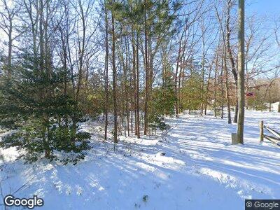
9201 Graves Rd Unit 9 South Chesterfield, VA 23803
South Chesterfield County NeighborhoodEstimated Value: $445,833 - $461,000
3
Beds
3
Baths
1,763
Sq Ft
$257/Sq Ft
Est. Value
About This Home
This home is located at 9201 Graves Rd Unit 9, South Chesterfield, VA 23803 and is currently estimated at $452,708, approximately $256 per square foot. 9201 Graves Rd Unit 9 is a home located in Chesterfield County with nearby schools including Matoaca Elementary School, Matoaca Middle School, and Matoaca High School.
Ownership History
Date
Name
Owned For
Owner Type
Purchase Details
Closed on
Sep 3, 2016
Sold by
Robertson M Keith M and Robertson Donna J
Bought by
Jessup Andrew S and Jessup Brittany C
Current Estimated Value
Home Financials for this Owner
Home Financials are based on the most recent Mortgage that was taken out on this home.
Original Mortgage
$240,562
Outstanding Balance
$196,617
Interest Rate
3.75%
Mortgage Type
FHA
Estimated Equity
$258,964
Purchase Details
Closed on
Nov 30, 2011
Sold by
Premier Partners Inc
Bought by
Robertson Morris K
Home Financials for this Owner
Home Financials are based on the most recent Mortgage that was taken out on this home.
Original Mortgage
$134,000
Interest Rate
4.09%
Mortgage Type
New Conventional
Create a Home Valuation Report for This Property
The Home Valuation Report is an in-depth analysis detailing your home's value as well as a comparison with similar homes in the area
Home Values in the Area
Average Home Value in this Area
Purchase History
| Date | Buyer | Sale Price | Title Company |
|---|---|---|---|
| Jessup Andrew S | $245,000 | Attorney | |
| Robertson Morris K | $184,000 | -- |
Source: Public Records
Mortgage History
| Date | Status | Borrower | Loan Amount |
|---|---|---|---|
| Open | Jessup Andrew S | $240,562 | |
| Previous Owner | Robertson Morris K | $134,000 | |
| Previous Owner | Premier Partners Inc | $228,000 |
Source: Public Records
Tax History Compared to Growth
Tax History
| Year | Tax Paid | Tax Assessment Tax Assessment Total Assessment is a certain percentage of the fair market value that is determined by local assessors to be the total taxable value of land and additions on the property. | Land | Improvement |
|---|---|---|---|---|
| 2024 | $3,350 | $357,900 | $87,500 | $270,400 |
| 2023 | $3,150 | $346,100 | $85,500 | $260,600 |
| 2022 | $2,907 | $316,000 | $75,900 | $240,100 |
| 2021 | $2,694 | $276,600 | $72,900 | $203,700 |
| 2020 | $2,556 | $269,100 | $72,900 | $196,200 |
| 2019 | $2,450 | $257,900 | $70,900 | $187,000 |
| 2018 | $2,388 | $251,400 | $65,800 | $185,600 |
| 2017 | $2,320 | $241,700 | $64,800 | $176,900 |
| 2016 | $2,279 | $237,400 | $64,800 | $172,600 |
| 2015 | $2,274 | $234,300 | $64,800 | $169,500 |
| 2014 | $2,228 | $229,500 | $64,800 | $164,700 |
Source: Public Records
Map
Nearby Homes
- 9518 Kathleen Dr
- 17513 Kathleen Ct
- 9021 Hickory Rd
- 9019 Hickory Rd
- 17416 Chemin Rd
- 9818 Peacefield Ct
- 16121 Rowlett Rd
- 19416 Eanes Rd
- 10424 Chesdin Park Turn
- 9100 River Rd
- 9307 Trumpeter Run Ct
- 9030 River Rd
- 10212 Hickory Rd
- 9214 River Rd
- 10512 River Rd
- 8721 River Rd
- 20001 Chesdin Harbor Dr
- 15125 Wellesley Dr
- 20405 Vernetta Ln
- 10950 Buttevant Dr
- 9201 Graves Rd
- 9201 Graves Rd Unit 9
- 9227 Graves Rd
- 9141 Graves Rd
- 9200 Graves Rd
- 9301 Graves Rd
- 9140 Graves Rd
- 9130 Graves Rd
- 9121 Graves Rd
- 17560 Katie Ln
- 9309 Graves Rd
- 17550 Katie Ln
- 9317 Graves Rd
- 17540 Katie Ln
- 9024 Anvil Forge Ln
- 9030 Anvil Forge Ln
- 9036 Anvil Forge Ln
- 9335 Graves Rd
- 9325 Graves Rd
- 17530 Katie Ln
