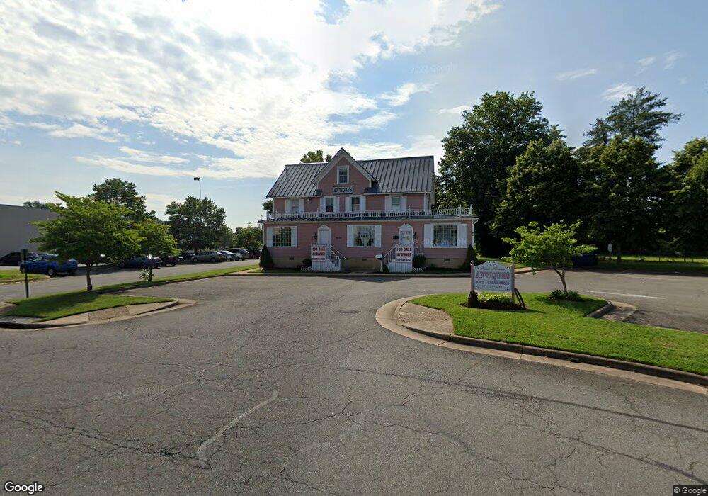
9201 Prescott Ave Manassas, VA 20110
Old Town Manassas NeighborhoodEstimated Value: $1,449,546
Studio
--
Bath
4,200
Sq Ft
$345/Sq Ft
Est. Value
About This Home
This home is located at 9201 Prescott Ave, Manassas, VA 20110 and is currently estimated at $1,449,546, approximately $345 per square foot. 9201 Prescott Ave is a home located in Manassas City with nearby schools including Jennie Dean Elementary School, Mayfield Intermediate School, and Grace E. Metz Middle School.
Ownership History
Date
Name
Owned For
Owner Type
Purchase Details
Closed on
Oct 7, 2002
Sold by
Lowe Lee R
Bought by
Island Isles Llc
Current Estimated Value
Home Financials for this Owner
Home Financials are based on the most recent Mortgage that was taken out on this home.
Original Mortgage
$575,000
Outstanding Balance
$237,910
Interest Rate
6.24%
Mortgage Type
Commercial
Estimated Equity
$1,211,632
Purchase Details
Closed on
Aug 30, 1996
Sold by
Lowe Ida L
Bought by
Manassas Llc
Create a Home Valuation Report for This Property
The Home Valuation Report is an in-depth analysis detailing your home's value as well as a comparison with similar homes in the area
Home Values in the Area
Average Home Value in this Area
Purchase History
| Date | Buyer | Sale Price | Title Company |
|---|---|---|---|
| Island Isles Llc | $575,000 | -- | |
| Manassas Llc | $176,800 | -- |
Source: Public Records
Mortgage History
| Date | Status | Borrower | Loan Amount |
|---|---|---|---|
| Open | Island Isles Llc | $575,000 |
Source: Public Records
Tax History
| Year | Tax Paid | Tax Assessment Tax Assessment Total Assessment is a certain percentage of the fair market value that is determined by local assessors to be the total taxable value of land and additions on the property. | Land | Improvement |
|---|---|---|---|---|
| 2025 | $11,093 | $880,400 | $501,500 | $378,900 |
| 2024 | $11,093 | $880,400 | $501,500 | $378,900 |
| 2023 | $11,093 | $880,400 | $501,500 | $378,900 |
| 2022 | $10,847 | $808,300 | $501,500 | $306,800 |
| 2021 | $11,551 | $808,300 | $501,500 | $306,800 |
| 2020 | $11,801 | $808,300 | $501,500 | $306,800 |
| 2019 | $11,963 | $808,300 | $501,500 | $306,800 |
| 2018 | $11,876 | $813,400 | $501,500 | $311,900 |
| 2017 | -- | $797,200 | $501,500 | $295,700 |
| 2016 | -- | $797,200 | $0 | $0 |
Source: Public Records
Map
Nearby Homes
- 8941 Quarry Rd
- 8956 Center St
- 8770 Deblanc Place
- 9105 Ewell St
- 9576 Jayhawk Terrace Unit 301
- 8383 Buttress Ln Unit 302
- 8376 Buttress Ln Unit 203
- 8374 Buttress Ln Unit 202
- 8591 Signal Hill Rd
- 9508 Lehr Ct
- 9553 Battery Heights Blvd Unit 303
- 9200 Azure Ct Unit 201
- 9211 Azure Ct Unit 202
- 9680 Swallowtail Ln
- 8510 Clearridge Ln
- 9204 Douglas St
- 9016 Grant Ave
- 9400 Beauregard Ave
- 0 Dogwood Dr Unit SHEA 24-R2
- 8737 Bretton Woods Dr
- 9203 Prescott Ave
- 9151 Centreville Rd
- 9169 Key Commons Ct Unit 3-2
- 9207 Prescott Ave
- 9211 Prescott Ave
- 9199 Prescott Ave
- 9121 Centreville Rd
- 8897 Cherry St
- 9213 Prescott Ave
- 8879 Cherry St
- 8883 Cherry St
- 9208 Prescott Ave
- 9206 Prescott Ave
- 9210 Prescott Ave
- 8887 Cherry St
- 9204 Prescott Ave
- 9220 Prescott Ave
- 8891 Cherry St
- 9202 Prescott Ave
- 9224 Prescott Ave
Your Personal Tour Guide
Ask me questions while you tour the home.