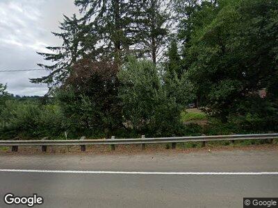
92011 Highway 202 Astoria, OR 97103
River Point NeighborhoodEstimated Value: $540,000 - $652,000
3
Beds
2
Baths
2,244
Sq Ft
$255/Sq Ft
Est. Value
About This Home
This home is located at 92011 Highway 202, Astoria, OR 97103 and is currently estimated at $572,967, approximately $255 per square foot. 92011 Highway 202 is a home located in Clatsop County with nearby schools including Astor Elementary School, Lewis & Clark Elementary School, and Astoria Middle School.
Ownership History
Date
Name
Owned For
Owner Type
Purchase Details
Closed on
Mar 10, 2022
Sold by
Cave Living Trust
Bought by
Cave Larry E and Cave Sherri L
Current Estimated Value
Purchase Details
Closed on
Oct 15, 2021
Sold by
Cave Adam B
Bought by
Cave Adam B and Cave Khayla
Home Financials for this Owner
Home Financials are based on the most recent Mortgage that was taken out on this home.
Original Mortgage
$337,750
Interest Rate
2.8%
Mortgage Type
New Conventional
Purchase Details
Closed on
Aug 14, 2015
Sold by
Rowe Joseph D and Rowe Crystal
Bought by
Cave Adam B
Home Financials for this Owner
Home Financials are based on the most recent Mortgage that was taken out on this home.
Original Mortgage
$206,632
Interest Rate
4.05%
Mortgage Type
New Conventional
Create a Home Valuation Report for This Property
The Home Valuation Report is an in-depth analysis detailing your home's value as well as a comparison with similar homes in the area
Home Values in the Area
Average Home Value in this Area
Purchase History
| Date | Buyer | Sale Price | Title Company |
|---|---|---|---|
| Cave Larry E | $97,000 | None Listed On Document | |
| Cave Adam B | -- | Ticor Title Ins Co | |
| Cave Adam B | $197,500 | Ticor Title Ins Co |
Source: Public Records
Mortgage History
| Date | Status | Borrower | Loan Amount |
|---|---|---|---|
| Previous Owner | Cave Adam B | $337,750 | |
| Previous Owner | Cave Adam B | $293,447 | |
| Previous Owner | Cave Adam B | $35,000 | |
| Previous Owner | Cave Adam B | $206,632 | |
| Previous Owner | Rowe Crystal | $50,860 | |
| Previous Owner | Rowe Crystal J | $45,000 |
Source: Public Records
Tax History Compared to Growth
Tax History
| Year | Tax Paid | Tax Assessment Tax Assessment Total Assessment is a certain percentage of the fair market value that is determined by local assessors to be the total taxable value of land and additions on the property. | Land | Improvement |
|---|---|---|---|---|
| 2024 | $3,807 | $273,945 | -- | -- |
| 2023 | $3,672 | $265,967 | $0 | $0 |
| 2022 | $3,571 | $258,221 | $0 | $0 |
| 2021 | $3,476 | $250,701 | $0 | $0 |
| 2020 | $3,378 | $243,400 | $0 | $0 |
| 2019 | $3,276 | $236,311 | $0 | $0 |
| 2018 | $2,947 | $229,429 | $0 | $0 |
| 2017 | $2,805 | $222,747 | $0 | $0 |
| 2016 | $2,729 | $216,260 | $60,619 | $155,641 |
| 2015 | $2,612 | $209,962 | $58,854 | $151,108 |
| 2014 | $2,566 | $203,847 | $0 | $0 |
| 2013 | -- | $197,910 | $0 | $0 |
Source: Public Records
Map
Nearby Homes
- 36368 Bartoldus Loop
- 36226 River Point Dr
- 0 Walluski Loop
- 92277 Youngs River Rd
- 35927 Abbie Ln
- 0 Adj To 2314 Se 1st
- 2041 SE 1st St
- 91196 Youngs River Rd
- 0 Wireless Rd
- 35567 Dow Ln
- 35680 Bella Ridge Loop
- 35692 Bella Ridge Loop
- 92621 Wireless Rd Unit 2
- 92621 Wireless Rd Unit PARC1
- 0 Abbott (19551) Rd Unit 823437
- 0 Abbott (19562) Rd Unit 823436
- Lot 36 Bella Ridge Loop
- 36 Bella Ridge Rd
- 16 Bella Ridge Loop
- 1880 SE 3rd St
- 92011 Highway 202
- 92011 Hwy 202
- 92009 Oregon 202
- 92009 Highway 202
- 92009 Hwy 202
- 91997 Oregon 202
- 91995 Highway 202
- 91995 Oregon 202
- 91924 Highway 202
- 36619 Timber Ridge Ln
- 36618 Timber Ridge Ln
- 91909 Highway 202
- 91922 Highway 202
- 91906 Highway 202
- 91906 Hwy 202
- 91906 Oregon 202
- 36620 Timber Ridge Ln
- 36429 River Point Dr
- 91901 Highway 202
- 91898 Highway 202
