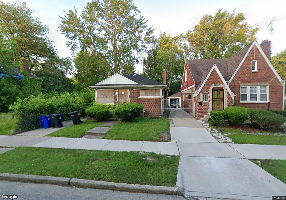
9203 Devonshire Rd Detroit, MI 48224
Outer Drive-Hayes NeighborhoodEstimated Value: $11,000 - $88,000
--
Bed
1
Bath
737
Sq Ft
$79/Sq Ft
Est. Value
About This Home
This home is located at 9203 Devonshire Rd, Detroit, MI 48224 and is currently estimated at $58,128, approximately $78 per square foot. 9203 Devonshire Rd is a home located in Wayne County with nearby schools including Wayne Elementary School, Edward 'Duke' Ellington Conservatory of Music and Art, and Charles L. Spain Elementary-Middle School.
Ownership History
Date
Name
Owned For
Owner Type
Purchase Details
Closed on
Sep 3, 2024
Sold by
Detroit Land Bank Authority
Bought by
Wilson Christopher
Current Estimated Value
Purchase Details
Closed on
Nov 15, 2018
Sold by
Manning Lashean
Bought by
Detrok Land Bank Authority
Purchase Details
Closed on
Jan 6, 2015
Sold by
Treasurer Of The Charter County Of Wayne
Bought by
Detroit Land Bank Authority
Create a Home Valuation Report for This Property
The Home Valuation Report is an in-depth analysis detailing your home's value as well as a comparison with similar homes in the area
Home Values in the Area
Average Home Value in this Area
Purchase History
| Date | Buyer | Sale Price | Title Company |
|---|---|---|---|
| Wilson Christopher | $10,000 | None Listed On Document | |
| Detrok Land Bank Authority | -- | None Available | |
| Manning Lashean | $1,100 | Title Source Inc | |
| Detroit Land Bank Authority | -- | None Available |
Source: Public Records
Tax History Compared to Growth
Tax History
| Year | Tax Paid | Tax Assessment Tax Assessment Total Assessment is a certain percentage of the fair market value that is determined by local assessors to be the total taxable value of land and additions on the property. | Land | Improvement |
|---|---|---|---|---|
| 2025 | $1,409 | $17,200 | $0 | $0 |
| 2024 | $1,409 | $14,100 | $0 | $0 |
| 2023 | $861 | $10,735 | $0 | $0 |
| 2022 | $912 | $10,800 | $0 | $0 |
| 2021 | $889 | $8,900 | $0 | $0 |
| 2020 | $889 | $8,500 | $0 | $0 |
| 2019 | $877 | $7,200 | $0 | $0 |
| 2018 | $0 | $0 | $0 | $0 |
| 2017 | $1,230 | $0 | $0 | $0 |
| 2016 | $240 | $12,300 | $0 | $0 |
| 2015 | $1,230 | $12,300 | $0 | $0 |
| 2013 | $1,591 | $17,017 | $0 | $0 |
| 2010 | -- | $24,950 | $1,106 | $23,844 |
Source: Public Records
Map
Nearby Homes
- 9265 Bedford St
- 9316 Mckinney St
- 9300 Mckinney St
- 15925 Evanston St
- 9200 King Richard St
- 9210 King Richard St
- 9344 Courville St
- 9910 Somerset Ave
- 15837 Evanston St
- 10029 Balfour Rd
- 9205 Mckinney St
- 5934 Haverhill St
- 10172 Somerset Ave
- 5957 Three Mile Dr
- 9610 Whittier St
- 9510 Whittier St
- 9875 Nottingham Rd
- 5984 Courville St
- 10278 Nottingham Rd
- 5944 Courville St
- 9197 Devonshire Rd
- 9189 Devonshire Rd
- 9183 Devonshire Rd
- 9225 Devonshire Rd
- 9175 Devonshire Rd
- 9170 Haverhill St
- 9231 Devonshire Rd
- 9164 Haverhill St
- 9178 Haverhill St
- 9169 Devonshire Rd
- 9184 Haverhill St
- 9158 Haverhill St
- 9190 Haverhill St
- 9150 Haverhill St
- 9239 Devonshire Rd
- 9208 Devonshire Rd
- 9200 Devonshire Rd
- 9216 Devonshire Rd
- 9161 Devonshire Rd
- 9180 Devonshire Rd