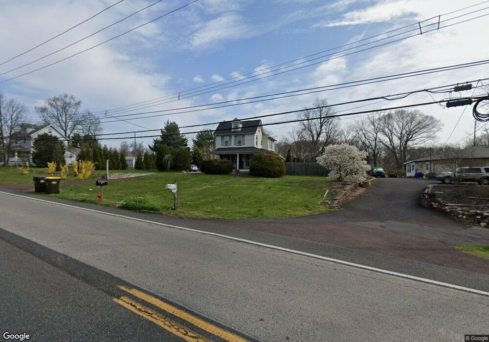
921 Allentown Rd Lansdale, PA 19446
Upper Gwynedd Township NeighborhoodEstimated Value: $532,000 - $632,000
4
Beds
3
Baths
2,296
Sq Ft
$252/Sq Ft
Est. Value
About This Home
This home is located at 921 Allentown Rd, Lansdale, PA 19446 and is currently estimated at $577,998, approximately $251 per square foot. 921 Allentown Rd is a home located in Montgomery County with nearby schools including Inglewood Elementary School, Penndale Middle School, and North Penn Senior High School.
Ownership History
Date
Name
Owned For
Owner Type
Purchase Details
Closed on
Jan 12, 2009
Sold by
Gray Jeffrey M and Gray Jennifer L
Bought by
Gray Jeffrey M
Current Estimated Value
Home Financials for this Owner
Home Financials are based on the most recent Mortgage that was taken out on this home.
Original Mortgage
$265,771
Outstanding Balance
$170,928
Interest Rate
5.51%
Estimated Equity
$407,070
Purchase Details
Closed on
Sep 21, 2004
Sold by
Willits James C and Willits Susanne B
Bought by
Gray Jeffrey M and Gray Jennifer L
Create a Home Valuation Report for This Property
The Home Valuation Report is an in-depth analysis detailing your home's value as well as a comparison with similar homes in the area
Home Values in the Area
Average Home Value in this Area
Purchase History
| Date | Buyer | Sale Price | Title Company |
|---|---|---|---|
| Gray Jeffrey M | -- | None Available | |
| Gray Jeffrey M | $270,000 | -- |
Source: Public Records
Mortgage History
| Date | Status | Borrower | Loan Amount |
|---|---|---|---|
| Open | Gray Jeffrey M | $265,771 | |
| Closed | Gray Jeffrey M | $0 |
Source: Public Records
Tax History Compared to Growth
Tax History
| Year | Tax Paid | Tax Assessment Tax Assessment Total Assessment is a certain percentage of the fair market value that is determined by local assessors to be the total taxable value of land and additions on the property. | Land | Improvement |
|---|---|---|---|---|
| 2025 | $5,779 | $157,530 | -- | -- |
| 2024 | $5,779 | $157,530 | -- | -- |
| 2023 | $5,508 | $157,530 | $0 | $0 |
| 2022 | $5,313 | $157,530 | $0 | $0 |
| 2021 | $5,173 | $157,530 | $0 | $0 |
| 2020 | $4,854 | $151,750 | $53,360 | $98,390 |
| 2019 | $4,765 | $151,750 | $53,360 | $98,390 |
| 2018 | $4,765 | $151,750 | $53,360 | $98,390 |
| 2017 | $4,564 | $151,750 | $53,360 | $98,390 |
| 2016 | $4,506 | $151,750 | $53,360 | $98,390 |
| 2015 | $4,301 | $151,750 | $53,360 | $98,390 |
| 2014 | $4,301 | $151,750 | $53,360 | $98,390 |
Source: Public Records
Map
Nearby Homes
- 750 Annes Ct
- 1107 Jarvis Ln
- 630 Perkiomen Ave
- 1231 Meadowview Cir
- 818 Green St
- 545 Winding Rd
- 515 Winding Rd
- 1109 Walnut Ln Unit 59
- 1131 Walnut Ln
- 418 Jefferson St
- 920 Columbia Ave
- 340 Central Dr
- 723 Columbia Ave
- 521 Columbia Ave
- 134 State St
- 846 Fulton Ave
- 712 Derstine Ave
- 132 Green St
- 118 Green St
- 21 S Valley Forge Rd Unit 213
- 925 Allentown Rd
- 919 Allentown Rd
- 937 Allentown Rd
- 941 Allentown Rd
- 900 Breezewood Ln
- 742 S Towamencin Ave
- 901 Breezewood Ln
- 938 Allentown Rd
- 945 Allentown Rd
- 740 S Towamencin Ave
- 942 Allentown Rd
- 947 Allentown Rd
- 904 Breezewood Ln
- 907 Breezewood Ln
- 711 Stoler Ave
- 736 S Towamencin Ave
- 951 Allentown Rd
- 908 Breezewood Ln
- 911 Breezewood Ln
- 732 S Towamencin Ave