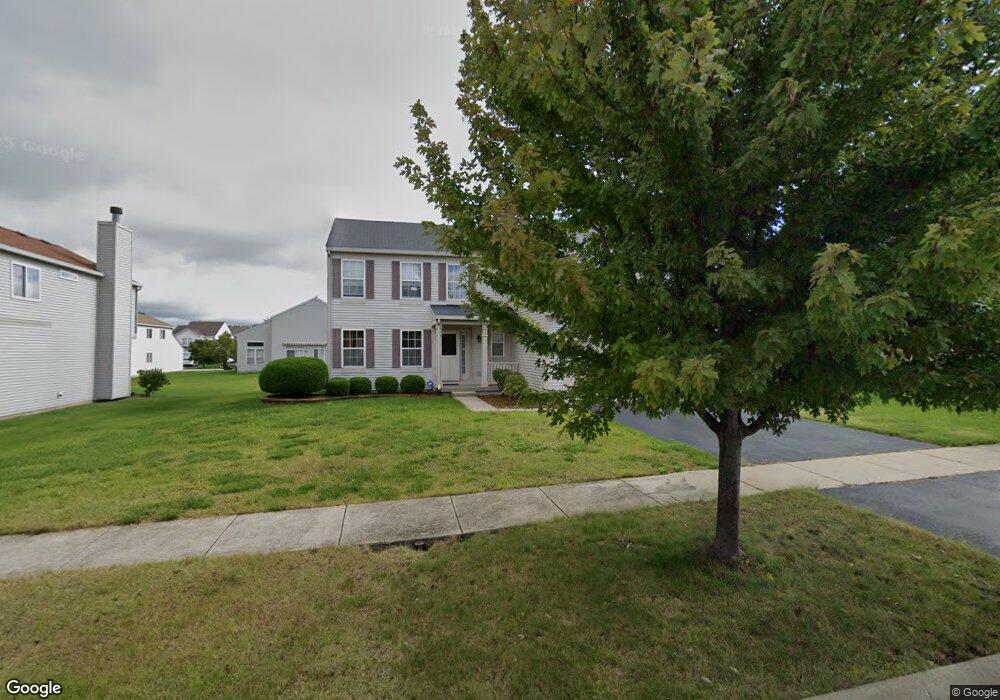
921 Eagle Point Dr Matteson, IL 60443
West Matteson NeighborhoodEstimated Value: $361,532 - $417,000
4
Beds
3
Baths
2,474
Sq Ft
$152/Sq Ft
Est. Value
About This Home
This home is located at 921 Eagle Point Dr, Matteson, IL 60443 and is currently estimated at $376,883, approximately $152 per square foot. 921 Eagle Point Dr is a home located in Cook County with nearby schools including Colin Powell Middle School and Southland College Prep.
Ownership History
Date
Name
Owned For
Owner Type
Purchase Details
Closed on
Mar 24, 2005
Sold by
Montalbano Builders Inc
Bought by
Knox Ronetta
Current Estimated Value
Home Financials for this Owner
Home Financials are based on the most recent Mortgage that was taken out on this home.
Original Mortgage
$206,800
Outstanding Balance
$102,944
Interest Rate
5.64%
Mortgage Type
Unknown
Estimated Equity
$273,939
Create a Home Valuation Report for This Property
The Home Valuation Report is an in-depth analysis detailing your home's value as well as a comparison with similar homes in the area
Home Values in the Area
Average Home Value in this Area
Purchase History
| Date | Buyer | Sale Price | Title Company |
|---|---|---|---|
| Knox Ronetta | $230,000 | Cti |
Source: Public Records
Mortgage History
| Date | Status | Borrower | Loan Amount |
|---|---|---|---|
| Open | Knox Ronetta | $206,800 |
Source: Public Records
Tax History
| Year | Tax Paid | Tax Assessment Tax Assessment Total Assessment is a certain percentage of the fair market value that is determined by local assessors to be the total taxable value of land and additions on the property. | Land | Improvement |
|---|---|---|---|---|
| 2025 | $11,476 | $31,000 | $4,859 | $26,141 |
| 2024 | $11,476 | $31,000 | $4,859 | $26,141 |
| 2023 | $7,674 | $31,000 | $4,859 | $26,141 |
| 2022 | $7,674 | $17,755 | $4,197 | $13,558 |
| 2021 | $7,795 | $17,754 | $4,196 | $13,558 |
| 2020 | $7,651 | $17,754 | $4,196 | $13,558 |
| 2019 | $8,423 | $18,845 | $3,754 | $15,091 |
| 2018 | $9,509 | $21,096 | $3,754 | $17,342 |
| 2017 | $9,277 | $21,096 | $3,754 | $17,342 |
| 2016 | $9,455 | $20,767 | $3,313 | $17,454 |
| 2015 | $9,220 | $20,767 | $3,313 | $17,454 |
| 2014 | $8,996 | $20,767 | $3,313 | $17,454 |
| 2013 | $8,521 | $21,151 | $3,313 | $17,838 |
Source: Public Records
Map
Nearby Homes
- 6216 Pond View Dr
- 21131 Vivienne Dr
- 21143 Gray Hawk Dr Unit 2554
- 21156 Christina Dr
- 21218 Shannon Ave
- 21206 Sophia Dr
- 6158 White Birch Ln
- 6503 Blue Sky Ln Unit 2502
- 6125 Sunflower Dr
- 6500 Pasture Side Trail
- 0 Ridgeland Ave
- 1010 Regent Dr
- 970 Regent Dr
- 997 Regent Dr
- 6037 Spring Ln
- 6021 Spring Ln
- 6306 Beaver Dam Rd
- 6704 Bridle Path Dr
- 912 Princeton Ave
- 829 Princeton Ave
- 917 Eagle Point Dr
- 1001 Eagle Point Dr
- 918 Great Plains Ave
- 913 Eagle Point Dr
- 1005 Eagle Point Dr
- 1002 Great Plains Ave
- 914 Great Plains Ave
- 918 Eagle Point Dr
- 914 Eagle Point Dr
- 1006 Great Plains Ave
- 910 Great Plains Ave
- 1009 Eagle Point Dr
- 909 Eagle Point Dr
- 1002 Eagle Point Dr
- 910 Eagle Point Dr
- 1006 Eagle Point Dr
- 1010 Great Plains Ave
- 925 Fieldside Dr Unit 1233
- 1001 Fieldside Dr Unit 1234
Your Personal Tour Guide
Ask me questions while you tour the home.