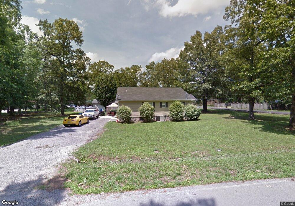
921 Lincoln St Manchester, TN 37355
Estimated Value: $256,000 - $306,000
--
Bed
--
Bath
1,456
Sq Ft
$193/Sq Ft
Est. Value
About This Home
This home is located at 921 Lincoln St, Manchester, TN 37355 and is currently estimated at $280,320, approximately $192 per square foot. 921 Lincoln St is a home with nearby schools including Westwood Middle School and Temple Baptist Christian School.
Ownership History
Date
Name
Owned For
Owner Type
Purchase Details
Closed on
May 1, 2014
Sold by
Highland Rim Habitat For H
Bought by
Bryant Tonya
Current Estimated Value
Home Financials for this Owner
Home Financials are based on the most recent Mortgage that was taken out on this home.
Original Mortgage
$17,000
Outstanding Balance
$12,934
Interest Rate
4.44%
Mortgage Type
New Conventional
Estimated Equity
$267,386
Purchase Details
Closed on
Mar 25, 2013
Sold by
Thomas Kipp
Bought by
Highland Rim Habitat For Human
Purchase Details
Closed on
Dec 30, 2005
Sold by
Lowe David
Bought by
Thomas Kipp
Purchase Details
Closed on
May 11, 1998
Sold by
Harton Family Partners
Bought by
Uselton Merry K
Create a Home Valuation Report for This Property
The Home Valuation Report is an in-depth analysis detailing your home's value as well as a comparison with similar homes in the area
Home Values in the Area
Average Home Value in this Area
Purchase History
| Date | Buyer | Sale Price | Title Company |
|---|---|---|---|
| Bryant Tonya | $92,000 | -- | |
| Highland Rim Habitat For Human | $10,000 | -- | |
| Thomas Kipp | $10,000 | -- | |
| Uselton Merry K | $62,000 | -- |
Source: Public Records
Mortgage History
| Date | Status | Borrower | Loan Amount |
|---|---|---|---|
| Open | Bryant Tonya | $17,000 | |
| Open | Bryant Tonya | $92,000 |
Source: Public Records
Tax History Compared to Growth
Tax History
| Year | Tax Paid | Tax Assessment Tax Assessment Total Assessment is a certain percentage of the fair market value that is determined by local assessors to be the total taxable value of land and additions on the property. | Land | Improvement |
|---|---|---|---|---|
| 2024 | $1,908 | $45,275 | $5,000 | $40,275 |
| 2023 | $1,908 | $45,275 | $0 | $0 |
| 2022 | $1,643 | $45,275 | $5,000 | $40,275 |
| 2021 | $1,509 | $32,950 | $2,500 | $30,450 |
| 2020 | $1,509 | $32,950 | $2,500 | $30,450 |
| 2019 | $1,509 | $32,950 | $2,500 | $30,450 |
| 2018 | $1,509 | $32,950 | $2,500 | $30,450 |
| 2017 | $1,515 | $28,875 | $2,500 | $26,375 |
| 2016 | $1,515 | $28,875 | $2,500 | $26,375 |
| 2015 | $1,515 | $28,875 | $2,500 | $26,375 |
| 2014 | $1,514 | $28,869 | $0 | $0 |
Source: Public Records
Map
Nearby Homes
- 905 Royal Trail
- 1203 Edgewood Dr
- 112 Reynard St
- 1306 Mcmahan St
- 1003 Kennedy Dr
- 142 Heritage Cir
- 422 Heritage Cir
- 355 W Doak Rd
- 1550 S Spring St
- 121 Regalwood Dr
- 0 Forrestwood Dr
- 195 Hamilton Ct
- 2674 New Tullahoma Hwy
- 23 Regalwood Dr
- 1841 Hills Chapel Rd
- Lot 51 Philips
- 1619 Hills Chapel Rd
- 1212 Woodcrest Dr
- 12 Fox Creek Ct
- 1221 Hillcrest Dr
- 1900 2nd Ave
- 254 Blanford Cir
- 314 Blanford Cir
- 138 Blanford Cir
- 2000 2nd Ave
- 2004 2nd Ave
- 2008 2nd Ave
- 1001 Lincoln St
- 914 Royal Trail
- 912 Royal Trail
- 1000 Lincoln St
- 1000 Royal Trail
- 910 Royal Trail
- 1002 Lincoln St
- 1005 Lincoln St
- 1002 Royal Trail
- 0 2nd Ave
- 912 Lincoln St
- 1001 Kennedy Dr
- 0 Kennedy Dr - App 0 52ac