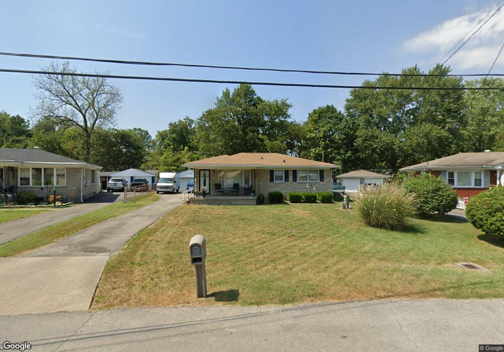
9219 Star Rest Cir Louisville, KY 40272
Valley Station NeighborhoodEstimated Value: $201,904 - $226,000
3
Beds
1
Bath
988
Sq Ft
$212/Sq Ft
Est. Value
About This Home
This home is located at 9219 Star Rest Cir, Louisville, KY 40272 and is currently estimated at $209,476, approximately $212 per square foot. 9219 Star Rest Cir is a home located in Jefferson County with nearby schools including Auburndale Elementary School, Coral Ridge Elementary School, and Minors Lane Elementary School.
Ownership History
Date
Name
Owned For
Owner Type
Purchase Details
Closed on
Apr 9, 2009
Sold by
Metcalf Jennifer L and Metcalf James M
Bought by
Paulson Michelle
Current Estimated Value
Home Financials for this Owner
Home Financials are based on the most recent Mortgage that was taken out on this home.
Original Mortgage
$107,025
Outstanding Balance
$68,056
Interest Rate
5.05%
Mortgage Type
FHA
Estimated Equity
$141,420
Purchase Details
Closed on
Jul 16, 2007
Sold by
Hud
Bought by
Metcalf Jennifer L and Metcalf James M
Home Financials for this Owner
Home Financials are based on the most recent Mortgage that was taken out on this home.
Original Mortgage
$74,526
Interest Rate
6.52%
Mortgage Type
Purchase Money Mortgage
Create a Home Valuation Report for This Property
The Home Valuation Report is an in-depth analysis detailing your home's value as well as a comparison with similar homes in the area
Home Values in the Area
Average Home Value in this Area
Purchase History
| Date | Buyer | Sale Price | Title Company |
|---|---|---|---|
| Paulson Michelle | $109,000 | Ky Pioneer | |
| Metcalf Jennifer L | $76,505 | Regional First |
Source: Public Records
Mortgage History
| Date | Status | Borrower | Loan Amount |
|---|---|---|---|
| Open | Paulson Michelle | $107,025 | |
| Previous Owner | Metcalf Jennifer L | $74,526 |
Source: Public Records
Tax History Compared to Growth
Tax History
| Year | Tax Paid | Tax Assessment Tax Assessment Total Assessment is a certain percentage of the fair market value that is determined by local assessors to be the total taxable value of land and additions on the property. | Land | Improvement |
|---|---|---|---|---|
| 2024 | $1,100 | $103,260 | $16,000 | $87,260 |
| 2023 | $1,134 | $103,260 | $16,000 | $87,260 |
| 2022 | $1,138 | $103,260 | $16,000 | $87,260 |
| 2021 | $1,220 | $103,260 | $16,000 | $87,260 |
| 2020 | $846 | $76,450 | $17,000 | $59,450 |
| 2019 | $829 | $76,450 | $17,000 | $59,450 |
| 2018 | $818 | $76,450 | $17,000 | $59,450 |
| 2017 | $802 | $76,450 | $17,000 | $59,450 |
| 2013 | $1,090 | $109,000 | $23,000 | $86,000 |
Source: Public Records
Map
Nearby Homes
- 1704 Star Rest Dr
- 8800 W Manslick Rd
- 8405 Arnoldtown Rd
- 2108 Churchdown Ln
- 2407 Kings Cross Ct
- 2710 Windsor Forest Dr
- 2506 Tavistock Ct
- 9209 Lakeridge Dr
- 9203 Lakeridge Dr
- 9206 Lakeridge Dr
- 7912 3rd Street Rd
- 9703 Scarborough Ave
- 9600 Britannia Ct
- 1217 Burnwick Ct
- 9613 Scarborough Ave
- 6401 Old New Cut Rd
- 8215 Afterglow Dr
- 9231 Hawthorne Pointe Dr Unit 9231
- 9243 Hawthorne Pointe Dr
- 9223 Hawthorne Pointe Dr Unit 9223
- 9221 Star Rest Cir
- 9217 Star Rest Cir
- 9223 Star Rest Cir
- 1618 Greyling Dr
- 9215 Star Rest Cir
- 1620 Greyling Dr
- 1616 Greyling Dr
- 1705 Star Rest Dr
- 9208 Star Rest Cir
- 1614 Greyling Dr
- 1622 Greyling Dr
- 1623 Star Rest Dr
- 1707 Star Rest Dr
- 9213 Star Rest Cir
- 1612 Greyling Dr
- 1624 Greyling Dr
- 1709 Star Rest Dr
- 1621 Star Rest Dr
- 1626 Greyling Dr
- 1610 Greyling Dr