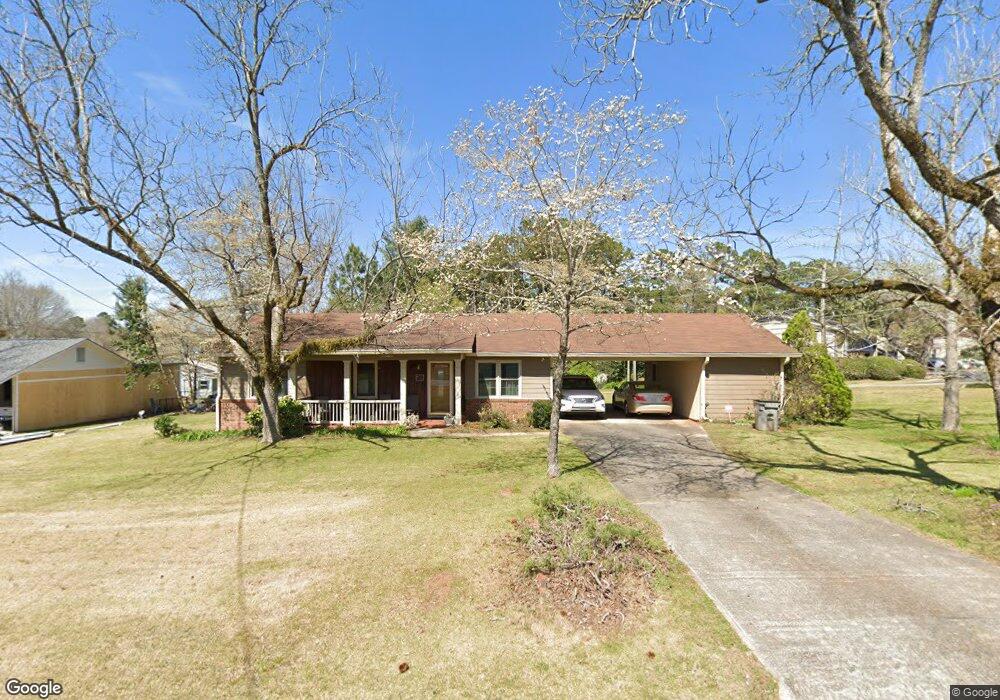
922 Malibu Dr Lagrange, GA 30240
Estimated Value: $162,000 - $212,000
3
Beds
1
Bath
1,332
Sq Ft
$145/Sq Ft
Est. Value
About This Home
This home is located at 922 Malibu Dr, Lagrange, GA 30240 and is currently estimated at $192,829, approximately $144 per square foot. 922 Malibu Dr is a home located in Troup County with nearby schools including Franklin Forest Elementary School, Hollis Hand Elementary School, and Ethel W. Kight Elementary School.
Ownership History
Date
Name
Owned For
Owner Type
Purchase Details
Closed on
Jan 26, 1978
Sold by
Turner Winston A and Turner Virginia L
Bought by
Stribling Harry H and Stribling Wanda G
Current Estimated Value
Purchase Details
Closed on
Oct 26, 1976
Sold by
Bellesfield Harold J
Bought by
Turner Winston A and Turner Virginia L
Purchase Details
Closed on
May 30, 1975
Sold by
J Brumbeloe B and J E
Bought by
Bellesfield Harold J
Purchase Details
Closed on
Jan 1, 1972
Sold by
Barskin Annie C
Bought by
J Brumbeloe B and J E
Purchase Details
Closed on
Oct 1, 1960
Sold by
Faver Martha Elizabeth
Bought by
Barskin Annie C
Create a Home Valuation Report for This Property
The Home Valuation Report is an in-depth analysis detailing your home's value as well as a comparison with similar homes in the area
Purchase History
We collect this data history from publicly available records. To have your information removed, we recommend requesting removal directly through your county’s website.
| Date | Buyer | Sale Price | Title Company |
|---|---|---|---|
| Stribling Harry H | $35,000 | -- | |
| Turner Winston A | $34,900 | -- | |
| Bellesfield Harold J | $31,400 | -- | |
| J Brumbeloe B | $25,000 | -- | |
| Barskin Annie C | -- | -- |
Source: Public Records
Tax History
| Year | Tax Paid | Tax Assessment Tax Assessment Total Assessment is a certain percentage of the fair market value that is determined by local assessors to be the total taxable value of land and additions on the property. | Land | Improvement |
|---|---|---|---|---|
| 2025 | $1,642 | $71,200 | $10,440 | $60,760 |
| 2024 | $1,486 | $62,320 | $10,440 | $51,880 |
| 2023 | $733 | $52,600 | $10,440 | $42,160 |
| 2022 | $1,185 | $50,200 | $10,440 | $39,760 |
| 2021 | $1,035 | $42,080 | $10,440 | $31,640 |
| 2020 | $1,035 | $42,080 | $10,440 | $31,640 |
| 2019 | $827 | $35,160 | $6,600 | $28,560 |
| 2018 | $827 | $35,160 | $6,600 | $28,560 |
| 2017 | $827 | $35,160 | $6,600 | $28,560 |
| 2016 | $810 | $34,618 | $6,600 | $28,018 |
| 2015 | $862 | $36,337 | $7,060 | $29,277 |
| 2014 | $844 | $35,746 | $7,060 | $28,686 |
| 2013 | -- | $37,112 | $7,060 | $30,052 |
Source: Public Records
Map
Nearby Homes
- 106 Ewing St
- 724 Camellia Dr
- 1333 Mooty Bridge Rd Unit 2
- 121 N Chilton Crescent
- 135 S Chilton Crescent
- 102 Beech Creek Dr
- 100 Deer Creek Dr
- 110 Russell St
- 733 Azalea Dr
- 806 New Franklin Rd
- 120 North St
- 900 North St
- 124 Melrose Dr
- 115 Daniel Ct
- 243 Beechwood Cir
- 222 Beechwood Cir
- 172 Merrybrook Dr
- 725 N Greenwood St
- 133 Alton Dr
- 134 S Page St
- 924 Malibu Dr
- 929 Malibu Dr
- 927 Malibu Dr
- 103 Meadow Terrace
- 926 Malibu Dr
- 1041 Mooty Bridge Rd
- 925 Malibu Dr
- 931 Malibu Dr
- 933 Malibu Dr
- 1244 Mooty Bridge Rd
- 928 Malibu Dr
- 928 Norwood Dr
- 1600 Meadow Terrace
- 1600 Meadow Terrace
- 939 Malibu Dr
- 923 Malibu Dr
- 1043 Mooty Bridge Rd
- 923 Norwood Dr
- 930 Norwood Dr
- 930 Malibu Dr
Your Personal Tour Guide
Ask me questions while you tour the home.