922 Pheasant Run Dr Westport, WA 98595
Estimated Value: $457,000 - $817,000
2
Beds
2
Baths
1,452
Sq Ft
$471/Sq Ft
Est. Value
About This Home
This home is located at 922 Pheasant Run Dr, Westport, WA 98595 and is currently estimated at $683,902, approximately $471 per square foot. 922 Pheasant Run Dr is a home located in Grays Harbor County with nearby schools including Ocosta Elementary School and Ocosta Junior/Senior High School.
Ownership History
Date
Name
Owned For
Owner Type
Purchase Details
Closed on
Oct 17, 2022
Sold by
Yu Wenqian and Yu Bo
Bought by
Yu Wenqian and Liu Bo
Current Estimated Value
Purchase Details
Closed on
Jul 6, 2022
Sold by
Porter Christopher R and Porter Kathleen
Bought by
Yu Wenqian and Liu Bo
Purchase Details
Closed on
Apr 19, 2011
Sold by
Hubacker Allan S and Hubacker Peggy S
Bought by
Porter Christopher R and Kobashi Porter Kathleen
Home Financials for this Owner
Home Financials are based on the most recent Mortgage that was taken out on this home.
Original Mortgage
$270,000
Interest Rate
4.83%
Mortgage Type
New Conventional
Purchase Details
Closed on
Mar 13, 2008
Sold by
Miller Yvonne B
Bought by
Hubacker Allan S and Hubacker Peggy S
Home Financials for this Owner
Home Financials are based on the most recent Mortgage that was taken out on this home.
Original Mortgage
$480,000
Interest Rate
5.88%
Mortgage Type
Credit Line Revolving
Create a Home Valuation Report for This Property
The Home Valuation Report is an in-depth analysis detailing your home's value as well as a comparison with similar homes in the area
Home Values in the Area
Average Home Value in this Area
Purchase History
| Date | Buyer | Sale Price | Title Company |
|---|---|---|---|
| Yu Wenqian | -- | -- | |
| Yu Wenqian | -- | Grays Harbor Title | |
| Porter Christopher R | $360,000 | Coast Title | |
| Hubacker Allan S | $600,000 | Coast Title |
Source: Public Records
Mortgage History
| Date | Status | Borrower | Loan Amount |
|---|---|---|---|
| Previous Owner | Porter Christopher R | $270,000 | |
| Previous Owner | Hubacker Allan S | $480,000 |
Source: Public Records
Tax History Compared to Growth
Tax History
| Year | Tax Paid | Tax Assessment Tax Assessment Total Assessment is a certain percentage of the fair market value that is determined by local assessors to be the total taxable value of land and additions on the property. | Land | Improvement |
|---|---|---|---|---|
| 2025 | $5,429 | $637,880 | $328,003 | $309,877 |
| 2023 | $5,253 | $587,351 | $291,525 | $295,826 |
| 2022 | $5,162 | $448,251 | $149,500 | $298,751 |
| 2021 | $4,906 | $448,251 | $149,500 | $298,751 |
| 2020 | $4,794 | $389,540 | $149,500 | $240,040 |
| 2019 | $4,398 | $364,603 | $130,000 | $234,603 |
| 2018 | $4,802 | $343,275 | $130,000 | $213,275 |
| 2017 | $3,544 | $334,744 | $130,000 | $204,744 |
| 2016 | $4,114 | $300,620 | $130,000 | $170,620 |
| 2014 | -- | $303,775 | $130,000 | $173,775 |
| 2013 | -- | $465,040 | $234,000 | $231,040 |
Source: Public Records
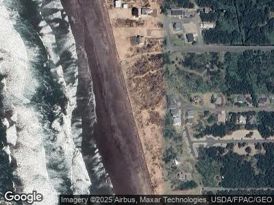
Map
Nearby Homes
- 926 Pheasant Run
- 921 Pheasant Run Dr
- 0 Sunset Beach Ct Unit NWM2333278
- 1210 Hancock Ave
- 0 XX Surf St
- 0 Dunecrest Dr Unit NWM2264403
- 0 S Gold St Unit NWM2367586
- 0 Surf St Unit NWM2338986
- 530 S Surf St
- 0 XX Starr St
- 710 S Hancock Ave Unit 422
- 710 S Hancock Ave Unit 309+
- 710 S Hancock Ave Unit 111
- 710 S Hancock Ave Unit 301
- 710 S Hancock Ave Unit 308
- 1600 W Ocean Ave Unit 421
- 1600 W Ocean Ave Unit 1218
- 1600 W Ocean Ave Unit 920
- 1600 W Ocean Ave Unit 1215
- 1600 W Ocean Ave Unit 423
- 922 Pheasant Run
- 922 Pheasant Run Dr
- 924 Pheasant Run Dr
- 923 Dune Crest Dr
- 930 Pheasant Run
- 925 Pheasant Run Dr
- 925 Dune Crest
- 8 Pheasant Run
- 927 Pheasant Run
- 0 Pheasant Run Unit 28068953
- 0 Pheasant Run Unit NWM33171115
- 0 Pheasant Run Unit NWM33167045
- 0 Pheasant Run Unit 1625565
- 2 Pheasant Run Dr
- 805 S Dune Crest Dr
- 926 Pheasant Run Dr
- 0 Sunset Beach Ct Unit NWM2167422
- 2655 N Harms St
- 912 Pheasant Run
- 601 Dune Crest Loop