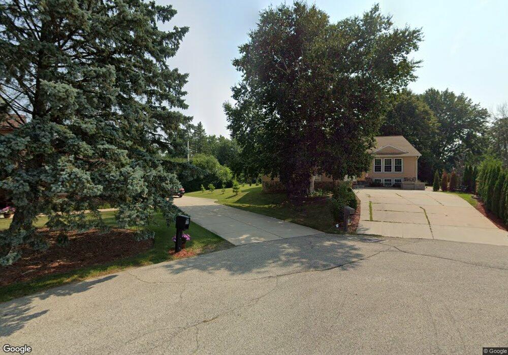
9220 N Port Ct Milwaukee, WI 53217
Estimated Value: $488,000 - $626,000
5
Beds
4
Baths
3,518
Sq Ft
$159/Sq Ft
Est. Value
About This Home
This home is located at 9220 N Port Ct, Milwaukee, WI 53217 and is currently estimated at $560,772, approximately $159 per square foot. 9220 N Port Ct is a home located in Milwaukee County with nearby schools including Stormonth Elementary School, Bayside Middle School, and Nicolet High School.
Ownership History
Date
Name
Owned For
Owner Type
Purchase Details
Closed on
Jul 28, 2017
Sold by
Margulius Simon
Bought by
Satanovsky Alexander M and Satanovsky Natali E
Current Estimated Value
Home Financials for this Owner
Home Financials are based on the most recent Mortgage that was taken out on this home.
Original Mortgage
$235,653
Outstanding Balance
$198,922
Interest Rate
4.4%
Mortgage Type
FHA
Estimated Equity
$361,850
Create a Home Valuation Report for This Property
The Home Valuation Report is an in-depth analysis detailing your home's value as well as a comparison with similar homes in the area
Home Values in the Area
Average Home Value in this Area
Purchase History
| Date | Buyer | Sale Price | Title Company |
|---|---|---|---|
| Satanovsky Alexander M | $240,000 | None Available |
Source: Public Records
Mortgage History
| Date | Status | Borrower | Loan Amount |
|---|---|---|---|
| Open | Satanovsky Alexander M | $235,653 |
Source: Public Records
Tax History Compared to Growth
Tax History
| Year | Tax Paid | Tax Assessment Tax Assessment Total Assessment is a certain percentage of the fair market value that is determined by local assessors to be the total taxable value of land and additions on the property. | Land | Improvement |
|---|---|---|---|---|
| 2024 | $7,971 | $368,000 | $123,400 | $244,600 |
| 2023 | $7,971 | $349,000 | $123,400 | $225,600 |
| 2022 | $8,146 | $316,100 | $123,400 | $192,700 |
| 2021 | $6,891 | $258,500 | $123,400 | $135,100 |
| 2020 | $6,873 | $253,500 | $123,400 | $130,100 |
| 2019 | $6,929 | $249,600 | $123,400 | $126,200 |
| 2018 | $6,569 | $240,000 | $123,400 | $116,600 |
| 2017 | $7,778 | $282,800 | $123,400 | $159,400 |
| 2016 | $10,178 | $374,100 | $123,400 | $250,700 |
| 2015 | $9,974 | $363,700 | $123,400 | $240,300 |
| 2014 | $10,001 | $363,700 | $123,400 | $240,300 |
Source: Public Records
Map
Nearby Homes
- 9280 N Port Washington Rd
- 9166 N Briarwood Ct Unit 4
- 641 W Fairy Chasm Rd
- 9149 N Briarwood Ct
- 1030 W Ravine Ln
- 9470 N Sleepy Hollow Ln
- 1168 W Manor Ln
- 201 W Ellsworth Ln
- 9100 N Santa Monica Blvd
- 1530 W Cedar Ln
- 945 W Heritage Ct Unit 104
- 1465 W County Line Rd
- 8825 N Spruce Rd
- 1201 W Brown Deer Rd
- 1012 W Cedar Ridge Ct
- 1723 N River Cir
- 1740 N River Cir
- 1501 W Brown Deer Rd
- The Heather Plan at The Grove in River Hills
- The Finnegan Plan at The Grove in River Hills
- 9240 N Port Ct
- 9224 N Port Ct
- 9250 N Port Ct
- 9210 N Port Ct
- 9266 N Port Washington Rd
- 702 W Fairy Chasm Rd
- 9229 N Ironwood Ln
- 9245 N Ironwood Ln
- 9240 N Ironwood Ln
- 9221 N Port Washington Rd
- 9200 N Ironwood Ln
- 9215 N Ironwood Ln
- 740 W Fairy Chasm Rd
- 9261 N Port Washington Rd
- 9241 N Port Washington Rd
- 727 W Laramie Ln
- 711 W Laramie Ln
- 9294 N Port Washington Rd
- 743 W Laramie Ln
- 700 W Laramie Ln