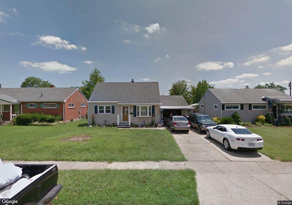
924 Armistead Dr Hamilton, OH 45013
Estimated Value: $188,077 - $222,000
2
Beds
2
Baths
1,120
Sq Ft
$187/Sq Ft
Est. Value
About This Home
This home is located at 924 Armistead Dr, Hamilton, OH 45013 and is currently estimated at $209,269, approximately $186 per square foot. 924 Armistead Dr is a home located in Butler County with nearby schools including Brookwood Elementary School, Wilson Middle School, and Hamilton High School Main Campus.
Ownership History
Date
Name
Owned For
Owner Type
Purchase Details
Closed on
Apr 30, 2018
Sold by
Midfirst Bank
Bought by
Grelor Properties Llc
Current Estimated Value
Home Financials for this Owner
Home Financials are based on the most recent Mortgage that was taken out on this home.
Interest Rate
4.58%
Purchase Details
Closed on
Feb 23, 2018
Sold by
Leece Edwin J
Bought by
Midfirst Bank
Purchase Details
Closed on
Jun 2, 1994
Sold by
Vanwinkle Timothy
Bought by
Branham Earl G and Branham Patricia
Home Financials for this Owner
Home Financials are based on the most recent Mortgage that was taken out on this home.
Original Mortgage
$75,700
Interest Rate
8.48%
Mortgage Type
VA
Purchase Details
Closed on
May 1, 1992
Create a Home Valuation Report for This Property
The Home Valuation Report is an in-depth analysis detailing your home's value as well as a comparison with similar homes in the area
Home Values in the Area
Average Home Value in this Area
Purchase History
| Date | Buyer | Sale Price | Title Company |
|---|---|---|---|
| Grelor Properties Llc | $69,200 | -- | |
| Midfirst Bank | $63,000 | None Available | |
| Branham Earl G | $73,500 | -- | |
| -- | $60,000 | -- |
Source: Public Records
Mortgage History
| Date | Status | Borrower | Loan Amount |
|---|---|---|---|
| Closed | Grelor Properties Llc | -- | |
| Previous Owner | Branham Earl G | $75,700 |
Source: Public Records
Tax History
| Year | Tax Paid | Tax Assessment Tax Assessment Total Assessment is a certain percentage of the fair market value that is determined by local assessors to be the total taxable value of land and additions on the property. | Land | Improvement |
|---|---|---|---|---|
| 2025 | $2,101 | $48,510 | $6,220 | $42,290 |
| 2024 | $2,101 | $48,510 | $6,220 | $42,290 |
| 2023 | $2,092 | $48,270 | $6,220 | $42,050 |
| 2022 | $1,803 | $35,210 | $6,220 | $28,990 |
| 2021 | $1,580 | $33,990 | $6,220 | $27,770 |
| 2020 | $1,646 | $33,990 | $6,220 | $27,770 |
| 2019 | $1,667 | $22,770 | $6,140 | $16,630 |
| 2018 | $1,089 | $22,770 | $6,140 | $16,630 |
| 2017 | $1,244 | $25,800 | $6,950 | $18,850 |
| 2016 | $1,193 | $23,570 | $6,950 | $16,620 |
| 2015 | $1,186 | $23,570 | $6,950 | $16,620 |
| 2014 | $1,165 | $23,570 | $6,950 | $16,620 |
| 2013 | $1,165 | $29,300 | $6,950 | $22,350 |
Source: Public Records
Map
Nearby Homes
- 30 Berkshire Ct
- 570 Fairhaven Dr
- 75 Berkshire Ct
- 925 Carlisle Ave
- 987 Carlisle Ave
- 824 Carlisle Ave
- 1102 Arbor Springs Dr
- 540 Carlisle Ave
- 64 Brookwood Ave
- 238 Twinbrook Dr
- 104 Chamberlin Dr
- 974 Westview Ave
- 1326 Franklin St
- 146 Winston Dr
- 46 Lexington Dr
- 55 Cove Ct
- 1116 Azel Ave
- 10 Cove Ct Unit 6
- 10 Cove Ct
- 205 Olympus Dr
- 934 Armistead Dr
- 914 Armistead Dr
- 944 Armistead Dr
- 904 Armistead Dr
- 925 Kingston Dr
- 935 Kingston Dr
- 915 Kingston Dr
- 945 Kingston Dr
- 905 Kingston Dr
- 925 Armistead Dr
- 954 Armistead Dr
- 900 Armistead Dr
- 935 Armistead Dr
- 955 Kingston Dr
- 901 Kingston Dr
- 945 Armistead Dr
- 964 Armistead Dr
- 894 Armistead Dr
- 25 Berkshire Ct
- 955 Armistead Dr
Your Personal Tour Guide
Ask me questions while you tour the home.