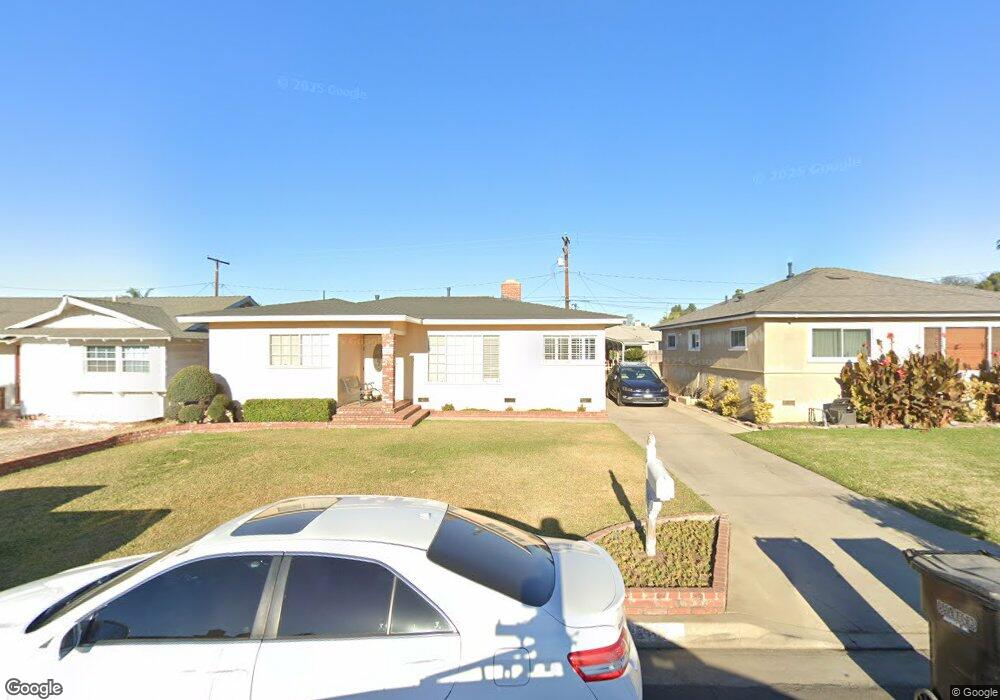
9249 Firebird Ave Whittier, CA 90605
South Whittier NeighborhoodEstimated Value: $737,000 - $745,000
3
Beds
1
Bath
1,144
Sq Ft
$647/Sq Ft
Est. Value
About This Home
This home is located at 9249 Firebird Ave, Whittier, CA 90605 and is currently estimated at $740,621, approximately $647 per square foot. 9249 Firebird Ave is a home located in Los Angeles County with nearby schools including Laurel Elementary School, Hillview Middle School, and Whittier High School.
Ownership History
Date
Name
Owned For
Owner Type
Purchase Details
Closed on
Jan 8, 1999
Sold by
Thompson Ralph E & Ione H Family Trust
Bought by
Martinez Francisco and Martinez Claudette
Current Estimated Value
Home Financials for this Owner
Home Financials are based on the most recent Mortgage that was taken out on this home.
Original Mortgage
$156,442
Interest Rate
6.78%
Mortgage Type
FHA
Purchase Details
Closed on
Aug 15, 1996
Sold by
Thompson Ralph E
Bought by
Thompson Ralph Edward and Thompson Ione H
Create a Home Valuation Report for This Property
The Home Valuation Report is an in-depth analysis detailing your home's value as well as a comparison with similar homes in the area
Home Values in the Area
Average Home Value in this Area
Purchase History
| Date | Buyer | Sale Price | Title Company |
|---|---|---|---|
| Martinez Francisco | $157,500 | Fidelity National Title Co | |
| Thompson Ralph Edward | -- | Gateway Title Company |
Source: Public Records
Mortgage History
| Date | Status | Borrower | Loan Amount |
|---|---|---|---|
| Previous Owner | Martinez Francisco | $156,442 |
Source: Public Records
Tax History Compared to Growth
Tax History
| Year | Tax Paid | Tax Assessment Tax Assessment Total Assessment is a certain percentage of the fair market value that is determined by local assessors to be the total taxable value of land and additions on the property. | Land | Improvement |
|---|---|---|---|---|
| 2025 | $3,277 | $246,888 | $153,466 | $93,422 |
| 2024 | $3,277 | $242,048 | $150,457 | $91,591 |
| 2023 | $3,223 | $237,303 | $147,507 | $89,796 |
| 2022 | $3,154 | $232,651 | $144,615 | $88,036 |
| 2021 | $3,092 | $228,090 | $141,780 | $86,310 |
| 2019 | $3,031 | $221,326 | $137,576 | $83,750 |
| 2018 | $2,901 | $216,987 | $134,879 | $82,108 |
| 2016 | $2,744 | $208,564 | $129,643 | $78,921 |
| 2015 | $2,726 | $205,432 | $127,696 | $77,736 |
| 2014 | $2,694 | $201,409 | $125,195 | $76,214 |
Source: Public Records
Map
Nearby Homes
- 13535 Dunton Dr
- 13762 Danbrook Dr
- 9551 Barkerville Ave
- 13856 Mulberry Dr
- 8723 Laurel Ave
- 13426 Anola St
- 9534 Painter Ave
- 9009 Bluford Ave
- 14033 Oval Dr
- 14042 Hawes St
- 8603 Laurel Ave
- 13649 Reis St
- 8807 Jacmar Ave
- 13328 Citicourt Ln
- 9127 Greenleaf Ave
- 13414 Reis St
- 10123 Lanett Ave
- 14064 Carnell St
- 14013 Chestnut St
- 10035 Ben Hur Ave
- 9303 Firebird Ave
- 9243 Firebird Ave
- 9307 Firebird Ave
- 9237 Firebird Ave
- 9230 Laurel Ave
- 9234 Laurel Ave
- 9226 Laurel Ave
- 9313 Firebird Ave
- 9233 Firebird Ave
- 9240 Laurel Ave
- 9220 Laurel Ave
- 9248 Firebird Ave
- 9302 Firebird Ave
- 9242 Firebird Ave
- 9246 Laurel Ave
- 9214 Laurel Ave
- 9306 Firebird Ave
- 9236 Firebird Ave
- 9319 Firebird Ave
- 9229 Firebird Ave