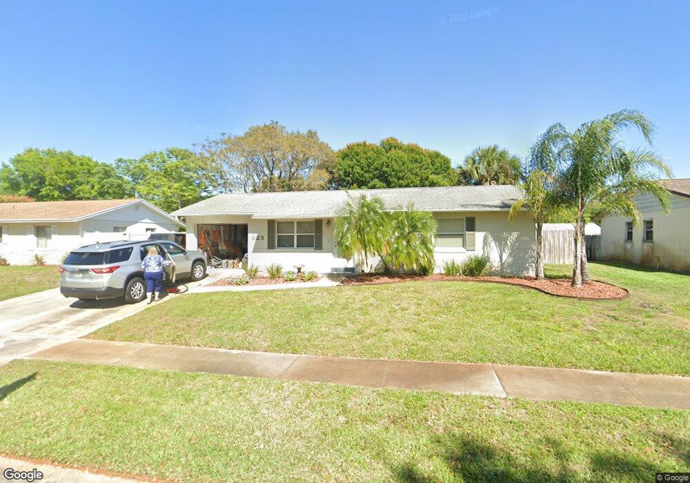
925 Alabama St Titusville, FL 32796
Estimated Value: $165,000 - $225,000
2
Beds
2
Baths
888
Sq Ft
$217/Sq Ft
Est. Value
About This Home
This home is located at 925 Alabama St, Titusville, FL 32796 and is currently estimated at $192,269, approximately $216 per square foot. 925 Alabama St is a home located in Brevard County with nearby schools including Oak Park Elementary School, James Madison Middle School, and Astronaut High School.
Ownership History
Date
Name
Owned For
Owner Type
Purchase Details
Closed on
Jun 14, 2002
Sold by
Enright Christopher N and Enright Julie A
Bought by
Lehmann Curtis E and Lehmann Charlene D
Current Estimated Value
Home Financials for this Owner
Home Financials are based on the most recent Mortgage that was taken out on this home.
Original Mortgage
$47,502
Outstanding Balance
$20,028
Interest Rate
6.77%
Estimated Equity
$172,241
Create a Home Valuation Report for This Property
The Home Valuation Report is an in-depth analysis detailing your home's value as well as a comparison with similar homes in the area
Home Values in the Area
Average Home Value in this Area
Purchase History
| Date | Buyer | Sale Price | Title Company |
|---|---|---|---|
| Lehmann Curtis E | $48,000 | -- |
Source: Public Records
Mortgage History
| Date | Status | Borrower | Loan Amount |
|---|---|---|---|
| Open | Lehmann Curtis E | $47,502 |
Source: Public Records
Tax History Compared to Growth
Tax History
| Year | Tax Paid | Tax Assessment Tax Assessment Total Assessment is a certain percentage of the fair market value that is determined by local assessors to be the total taxable value of land and additions on the property. | Land | Improvement |
|---|---|---|---|---|
| 2025 | $676 | $56,610 | -- | -- |
| 2024 | $654 | $55,020 | -- | -- |
| 2023 | $654 | $53,420 | $0 | $0 |
| 2022 | $616 | $51,870 | $0 | $0 |
| 2021 | $628 | $50,360 | $0 | $0 |
| 2020 | $627 | $49,670 | $0 | $0 |
| 2019 | $629 | $48,560 | $0 | $0 |
| 2018 | $624 | $47,660 | $0 | $0 |
| 2017 | $611 | $46,680 | $0 | $0 |
| 2016 | $514 | $45,720 | $15,500 | $30,220 |
| 2015 | $526 | $45,410 | $15,500 | $29,910 |
| 2014 | $520 | $45,050 | $15,500 | $29,550 |
Source: Public Records
Map
Nearby Homes
- 970 Carolina Cir
- 2135 Mayfair Way Unit Lot 71
- 2135 Mayfair Way Unit 84
- 2135 Mayfair Way Unit 98
- 671 N Dixie Ave Unit 18A
- 614 West Ct
- 610 East Ct
- 2015 Malinda Ln
- 2565 Shady Oaks Dr
- 870 Century Medical Dr
- 502 Vaughn St
- 0000 Buffalo Rd
- 1035 S Mars Ct
- 2765 Winstead Dr
- 424 Lenore Ave
- 7.26 Route 1
- 2870 Starlight Dr
- 965 N Singleton Ave
- 1636 Violet Ave
- 1481 U S Route 1 Unit 55
- 915 Alabama St
- 935 Alabama St
- 922 Tennessee St
- 932 Tennessee St
- 905 Alabama St
- 945 Alabama St
- 910 Alabama St
- 920 Alabama St
- 902 Tennessee St
- 942 Tennessee St
- 930 Alabama St
- 955 Alabama St
- 2255 Florida Ave
- 952 Tennessee St
- 892 Tennessee St
- 940 Alabama St
- 927 Tennessee St
- 890 Alabama St
- 937 Tennessee St
- 917 Tennessee St