Estimated Value: $329,000 - $359,279
--
Bed
1
Bath
1,311
Sq Ft
$262/Sq Ft
Est. Value
About This Home
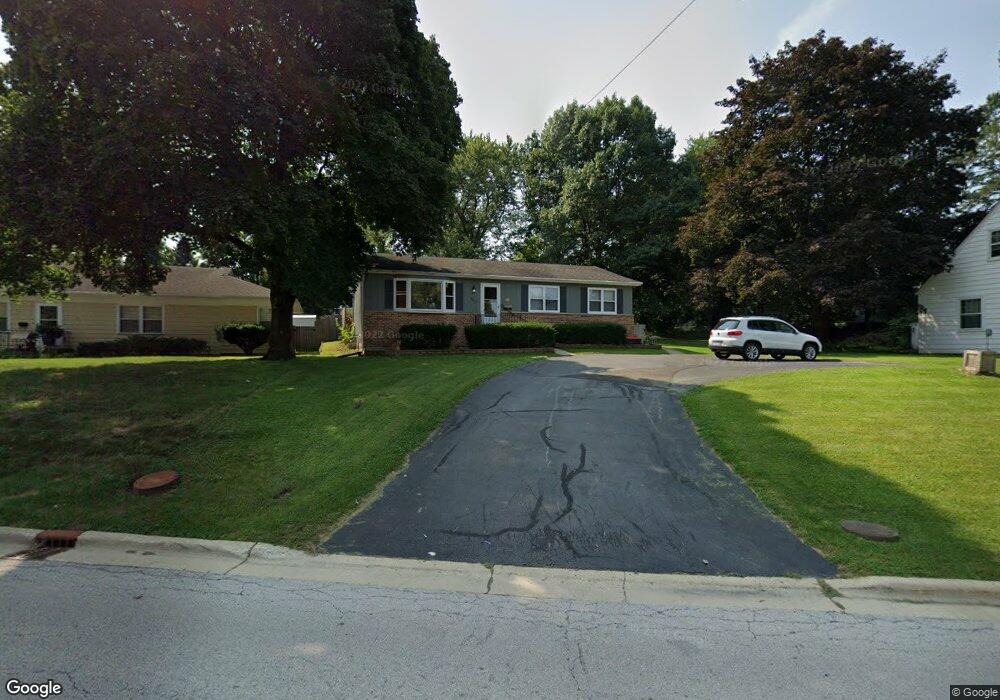
This home is located at 925 Dean St, Saint Charles, IL 60174 and is currently estimated at $343,320, approximately $261 per square foot. 925 Dean St is a home located in Kane County with nearby schools including Wild Rose Elementary School, Thompson Middle School, and St Charles East High School.
Ownership History
Date
Name
Owned For
Owner Type
Purchase Details
Closed on
Jul 26, 2000
Sold by
Lasalle Bank National Assn
Bought by
Schaefer Eugene J and Schaefer Sheri K
Current Estimated Value
Create a Home Valuation Report for This Property
The Home Valuation Report is an in-depth analysis detailing your home's value as well as a comparison with similar homes in the area
Home Values in the Area
Average Home Value in this Area
Purchase History
| Date | Buyer | Sale Price | Title Company |
|---|---|---|---|
| Schaefer Eugene J | -- | -- |
Source: Public Records
Tax History Compared to Growth
Tax History
| Year | Tax Paid | Tax Assessment Tax Assessment Total Assessment is a certain percentage of the fair market value that is determined by local assessors to be the total taxable value of land and additions on the property. | Land | Improvement |
|---|---|---|---|---|
| 2024 | $6,241 | $84,070 | $33,516 | $50,554 |
| 2023 | $6,022 | $75,244 | $29,997 | $45,247 |
| 2022 | $5,889 | $72,941 | $32,539 | $40,402 |
| 2021 | $5,670 | $69,527 | $31,016 | $38,511 |
| 2020 | $5,553 | $67,469 | $30,438 | $37,031 |
| 2019 | $5,458 | $66,133 | $29,835 | $36,298 |
| 2018 | $5,325 | $64,197 | $29,285 | $34,912 |
| 2017 | $5,195 | $62,002 | $28,284 | $33,718 |
| 2016 | $5,465 | $59,825 | $27,291 | $32,534 |
| 2015 | -- | $56,666 | $26,997 | $29,669 |
| 2014 | -- | $55,373 | $26,997 | $28,376 |
| 2013 | -- | $56,471 | $27,267 | $29,204 |
Source: Public Records
Map
Nearby Homes
- 231 Sedgewick Cir
- 205 Auburn Ct Unit 205
- 50 S 1st St Unit 5D
- 1108 S 12th St Unit 2
- 1017 S 6th St
- 1330-1332 S 14th St
- 1336-1338 S 14th St
- 1028 S 5th St
- 107 N 3rd Ave
- 311 Ohio Ave
- 3N866 Ferson Creek Rd
- 806 Fellows St
- 885 Geneva Rd
- 921 Oak Crest Ln Unit 1
- Lot 1 Keller Place
- 1008 Pine St
- Lot 2 Geneva Rd
- Lot 1 Geneva Rd
- 1034 N 5th Ave
- 82 Gray St