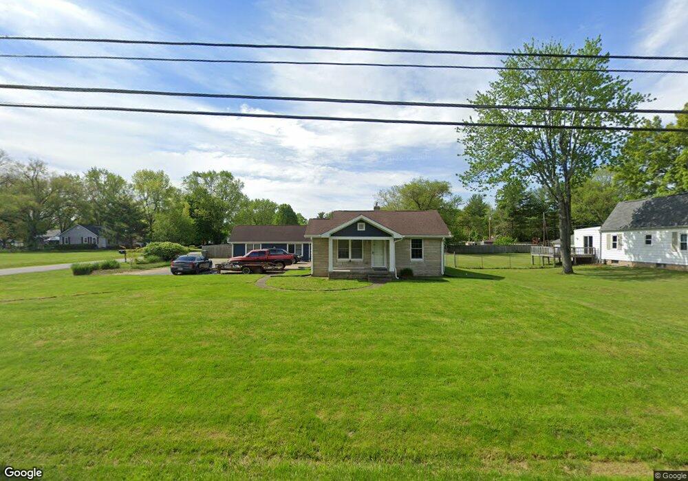
925 E Southport Rd Indianapolis, IN 46227
South Perry NeighborhoodEstimated Value: $222,000 - $333,000
3
Beds
2
Baths
2,238
Sq Ft
$132/Sq Ft
Est. Value
About This Home
This home is located at 925 E Southport Rd, Indianapolis, IN 46227 and is currently estimated at $295,644, approximately $132 per square foot. 925 E Southport Rd is a home located in Marion County with nearby schools including Southport Elementary School, Southport 6th Grade Academy, and Southport Middle School.
Ownership History
Date
Name
Owned For
Owner Type
Purchase Details
Closed on
Jul 22, 2015
Sold by
Gray Michael
Bought by
Boyd Christopher and Boyd Nicole
Current Estimated Value
Home Financials for this Owner
Home Financials are based on the most recent Mortgage that was taken out on this home.
Original Mortgage
$166,829
Outstanding Balance
$130,401
Interest Rate
4.01%
Mortgage Type
VA
Estimated Equity
$165,243
Purchase Details
Closed on
Feb 11, 2013
Sold by
Kevin Todd Farris Kelleher Ak Kevin T Farris, As Personal R
Bought by
Gray Michael
Create a Home Valuation Report for This Property
The Home Valuation Report is an in-depth analysis detailing your home's value as well as a comparison with similar homes in the area
Home Values in the Area
Average Home Value in this Area
Purchase History
| Date | Buyer | Sale Price | Title Company |
|---|---|---|---|
| Boyd Christopher | -- | Security Title Services | |
| Gray Michael | $144,000 | -- |
Source: Public Records
Mortgage History
| Date | Status | Borrower | Loan Amount |
|---|---|---|---|
| Open | Boyd Christopher | $166,829 |
Source: Public Records
Tax History Compared to Growth
Tax History
| Year | Tax Paid | Tax Assessment Tax Assessment Total Assessment is a certain percentage of the fair market value that is determined by local assessors to be the total taxable value of land and additions on the property. | Land | Improvement |
|---|---|---|---|---|
| 2024 | $3,405 | $247,200 | $28,800 | $218,400 |
| 2023 | $3,405 | $253,500 | $28,800 | $224,700 |
| 2022 | $3,176 | $232,000 | $28,800 | $203,200 |
| 2021 | $2,772 | $200,000 | $28,800 | $171,200 |
| 2020 | $2,536 | $182,400 | $28,800 | $153,600 |
| 2019 | $2,407 | $172,600 | $21,300 | $151,300 |
| 2018 | $2,216 | $160,800 | $21,300 | $139,500 |
| 2017 | $2,495 | $181,200 | $21,300 | $159,900 |
| 2016 | $2,439 | $177,300 | $21,300 | $156,000 |
| 2014 | $1,540 | $130,900 | $21,300 | $109,600 |
| 2013 | $1,607 | $130,900 | $21,300 | $109,600 |
Source: Public Records
Map
Nearby Homes
- 931 Maynard Dr
- 410 E Southport Rd
- 7525 Surrey Dr
- 1610 Southview Dr
- 1603 Maynard Dr
- 6643 S New Jersey St
- 618 Reda Rd
- 232 Bangor Dr
- 6560 Hi Vu Dr
- 6602 Madison Ave
- 1721 Southview Dr
- 7628 Briarstone Ln
- 7548 Briarstone Dr
- 234 E Hickory Ln
- 7528 S New Jersey St
- 7693 Briarstone Ln
- 7645 Lindenwood Dr
- 7725 S Oak Dr
- 246 Griffin Rd
- 418 E Beechwood Ln
- 913 E Southport Rd
- 7010 Barth Ave
- 909 E Southport Rd
- 1015 E Southport Rd
- 7015 Barth Ave
- 7020 Barth Ave
- 930 E Southport Rd
- 1002 E Southport Rd
- 7015 Manker St
- 901 E Southport Rd
- 7017 Barth Ave
- 1045 E Southport Rd
- 7030 Barth Ave
- 7019 Manker St
- 7025 Barth Ave
- 7002 Shelby St
- 7033 Manker St
- 1055 E Southport Rd
- 7038 Barth Ave
- 827 E Southport Rd