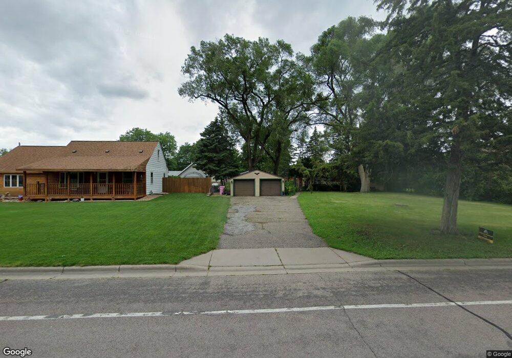
925 Lincoln Ave Saint Paul Park, MN 55071
Estimated Value: $295,413 - $302,000
3
Beds
1
Bath
1,237
Sq Ft
$242/Sq Ft
Est. Value
About This Home
This home is located at 925 Lincoln Ave, Saint Paul Park, MN 55071 and is currently estimated at $298,804, approximately $241 per square foot. 925 Lincoln Ave is a home located in Washington County with nearby schools including Pullman Elementary School, Oltman Middle School, and Park Senior High School.
Ownership History
Date
Name
Owned For
Owner Type
Purchase Details
Closed on
Nov 18, 2022
Sold by
Mnsf T2 Spe Llc
Bought by
Bridge Sfr Iv Seed Borrower Llc
Current Estimated Value
Purchase Details
Closed on
Feb 26, 2015
Sold by
Mnsf Minneapolis 2 Llc
Bought by
Mnsf T2 Spe Llc
Home Financials for this Owner
Home Financials are based on the most recent Mortgage that was taken out on this home.
Original Mortgage
$19,000,000
Interest Rate
3.64%
Mortgage Type
Purchase Money Mortgage
Purchase Details
Closed on
Jan 21, 2014
Purchase Details
Closed on
Feb 1, 2013
Sold by
Gmac Mortgage Llc
Bought by
Federal National Mortgage Association
Purchase Details
Closed on
Jan 8, 2013
Sold by
Dahlke Dean
Bought by
Gmac Mortgage Llc
Create a Home Valuation Report for This Property
The Home Valuation Report is an in-depth analysis detailing your home's value as well as a comparison with similar homes in the area
Home Values in the Area
Average Home Value in this Area
Purchase History
| Date | Buyer | Sale Price | Title Company |
|---|---|---|---|
| Bridge Sfr Iv Seed Borrower Llc | $515 | -- | |
| Mnsf T2 Spe Llc | -- | Avenue 365 Lender Services | |
| -- | $85,000 | -- | |
| Federal National Mortgage Association | -- | None Available | |
| Gmac Mortgage Llc | $133,876 | None Available |
Source: Public Records
Mortgage History
| Date | Status | Borrower | Loan Amount |
|---|---|---|---|
| Previous Owner | Mnsf T2 Spe Llc | $19,000,000 |
Source: Public Records
Tax History Compared to Growth
Tax History
| Year | Tax Paid | Tax Assessment Tax Assessment Total Assessment is a certain percentage of the fair market value that is determined by local assessors to be the total taxable value of land and additions on the property. | Land | Improvement |
|---|---|---|---|---|
| 2024 | $3,456 | $258,100 | $80,000 | $178,100 |
| 2023 | $3,456 | $267,100 | $91,000 | $176,100 |
| 2022 | $3,256 | $255,300 | $90,100 | $165,200 |
| 2021 | $3,270 | $212,600 | $75,000 | $137,600 |
| 2020 | $3,222 | $216,000 | $85,000 | $131,000 |
| 2019 | $2,822 | $208,500 | $76,000 | $132,500 |
| 2018 | $2,784 | $167,700 | $63,000 | $104,700 |
| 2017 | $2,626 | $164,200 | $63,000 | $101,200 |
| 2016 | $2,680 | $155,700 | $58,000 | $97,700 |
| 2015 | -- | $146,200 | $55,000 | $91,200 |
| 2013 | -- | $124,400 | $45,400 | $79,000 |
Source: Public Records
Map
Nearby Homes
- 1313 11th Ave
- 816 Holley Ave
- 1033 Portland Ave
- 1200 Laurel Ave
- 801 Summit Ave
- 1200 Summit Ave
- 730 Pleasant Ave
- 1121 5th St
- 1601 14th Ave
- 1227 5th St
- TBD Broadway Ave
- 928 1st St
- 11XX 1st St
- 1142 1st St
- 1020 Gary Dr
- 6745 Wildflower Dr S
- 6467 82nd St S
- 6444 Genevieve Trail
- 6564 Genevieve Trail
- 6538 Genevieve Trail
- 921 Lincoln Ave
- 929 Lincoln Ave
- 925 925 Lincoln Ave
- 930 Laurel Ave
- 924 Laurel Ave
- 936 936 Laurel Ave
- 936 Laurel Ave
- 909 909 Lincoln Ave
- 909 Lincoln Ave
- 945 Lincoln Ave
- 916 Laurel Ave
- 926 Lincoln Ave
- 932 Lincoln Ave
- 932 932 Lincoln Ave
- 920 Lincoln Ave
- 944 Laurel Ave
- 938 Lincoln Ave
- 908 Laurel Ave
- 914 Lincoln Ave
- 901 901 Lincoln Ave