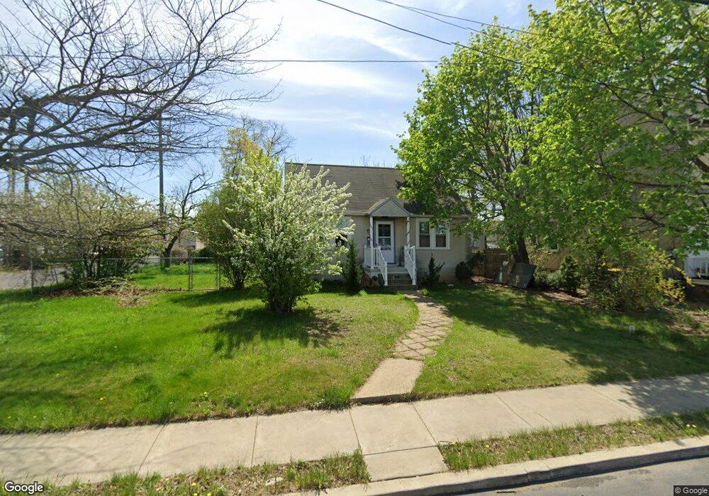
925 Walnut St Lansdale, PA 19446
Estimated Value: $249,000 - $348,419
3
Beds
1
Bath
1,056
Sq Ft
$292/Sq Ft
Est. Value
About This Home
This home is located at 925 Walnut St, Lansdale, PA 19446 and is currently estimated at $308,355, approximately $292 per square foot. 925 Walnut St is a home located in Montgomery County with nearby schools including Oak Park El School, Penndale Middle School, and North Penn Senior High School.
Ownership History
Date
Name
Owned For
Owner Type
Purchase Details
Closed on
Jul 30, 2009
Sold by
Shirley M Hartzel Irrevoc Living Tr
Bought by
Ciccarella Lauren M and Ciccarella Philip A
Current Estimated Value
Home Financials for this Owner
Home Financials are based on the most recent Mortgage that was taken out on this home.
Original Mortgage
$140,822
Interest Rate
5.36%
Create a Home Valuation Report for This Property
The Home Valuation Report is an in-depth analysis detailing your home's value as well as a comparison with similar homes in the area
Home Values in the Area
Average Home Value in this Area
Purchase History
| Date | Buyer | Sale Price | Title Company |
|---|---|---|---|
| Ciccarella Lauren M | $145,000 | None Available |
Source: Public Records
Mortgage History
| Date | Status | Borrower | Loan Amount |
|---|---|---|---|
| Previous Owner | Ciccarella Lauren M | $140,822 |
Source: Public Records
Tax History Compared to Growth
Tax History
| Year | Tax Paid | Tax Assessment Tax Assessment Total Assessment is a certain percentage of the fair market value that is determined by local assessors to be the total taxable value of land and additions on the property. | Land | Improvement |
|---|---|---|---|---|
| 2025 | $4,123 | $98,020 | $49,660 | $48,360 |
| 2024 | $4,123 | $98,020 | $49,660 | $48,360 |
| 2023 | $3,857 | $98,020 | $49,660 | $48,360 |
| 2022 | $3,735 | $98,020 | $49,660 | $48,360 |
| 2021 | $3,582 | $98,020 | $49,660 | $48,360 |
| 2020 | $3,474 | $98,020 | $49,660 | $48,360 |
| 2019 | $3,417 | $98,020 | $49,660 | $48,360 |
| 2018 | $916 | $98,020 | $49,660 | $48,360 |
| 2017 | $3,189 | $98,020 | $49,660 | $48,360 |
| 2016 | $3,151 | $98,020 | $49,660 | $48,360 |
| 2015 | $2,924 | $98,020 | $49,660 | $48,360 |
| 2014 | $2,924 | $98,020 | $49,660 | $48,360 |
Source: Public Records
Map
Nearby Homes
- 816 Kenilworth Ave
- 302 W 8th St Unit 21
- 129 W Fifth St
- 529 N Chestnut St
- 39 E 5th St
- 124 E 5th St
- 130 E 5th St
- 111 Country Ln
- 200 E 5th St
- Warwick Plan at Sterling Walk
- Stratford Plan at Sterling Walk
- 375 Sydney Ln
- 381 Sydney Ave
- 373 Sydney Ln
- 401 Sadie Ave
- 135 Third
- 235 E 2nd St
- 833 W 4th St
- 405 Derstine Ave
- 2 N Line St
- 923 Walnut St
- 921 Walnut St
- 915 Walnut St
- 202 Hatfield St Unit B
- 202 Hatfield St Unit A
- 911 Walnut St
- 1 Hatfield St
- 200 Hatfield St
- 200 Hatfield St Unit B
- 200 Hatfield St Unit A
- 907 Walnut St
- 905 Walnut St
- 903 Walnut St
- 27 W 9th St
- 23 W 9th St
- 920 N Broad St Unit SUITE 6
- 920 N Broad St Unit STE 8
- 920 N Broad St
- 901 Walnut St
- 830 Walnut St