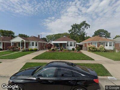
9252 Carter Ave Allen Park, MI 48101
Estimated Value: $183,769 - $253,000
--
Bed
1
Bath
984
Sq Ft
$221/Sq Ft
Est. Value
About This Home
This home is located at 9252 Carter Ave, Allen Park, MI 48101 and is currently estimated at $217,192, approximately $220 per square foot. 9252 Carter Ave is a home located in Wayne County with nearby schools including Lindemann Elementary School, Allen Park Middle School, and Allen Park High School.
Ownership History
Date
Name
Owned For
Owner Type
Purchase Details
Closed on
Jan 4, 2024
Sold by
Guobis Michael A and Guobis Katherine K
Bought by
Guobis Michael A and Guobis Michael A
Current Estimated Value
Purchase Details
Closed on
Jan 10, 2007
Sold by
Guobis Michael A and Guobis Katherine K
Bought by
The Guobis Living Trust
Purchase Details
Closed on
Nov 8, 1994
Sold by
Fields Michael L
Bought by
Guobis Michael A and Guobis Katherine
Create a Home Valuation Report for This Property
The Home Valuation Report is an in-depth analysis detailing your home's value as well as a comparison with similar homes in the area
Home Values in the Area
Average Home Value in this Area
Purchase History
| Date | Buyer | Sale Price | Title Company |
|---|---|---|---|
| Guobis Michael A | -- | None Listed On Document | |
| The Guobis Living Trust | -- | None Available | |
| Guobis Michael A | $92,000 | -- |
Source: Public Records
Mortgage History
| Date | Status | Borrower | Loan Amount |
|---|---|---|---|
| Previous Owner | Guobis Michael A | $80,761 | |
| Previous Owner | Guobis Michael A | $106,000 | |
| Previous Owner | Guobis Michael A | $53,648 |
Source: Public Records
Tax History Compared to Growth
Tax History
| Year | Tax Paid | Tax Assessment Tax Assessment Total Assessment is a certain percentage of the fair market value that is determined by local assessors to be the total taxable value of land and additions on the property. | Land | Improvement |
|---|---|---|---|---|
| 2024 | $2,570 | $93,700 | $0 | $0 |
| 2023 | $2,456 | $85,600 | $0 | $0 |
| 2022 | $2,942 | $76,500 | $0 | $0 |
| 2021 | $2,861 | $71,000 | $0 | $0 |
| 2020 | $2,826 | $64,600 | $0 | $0 |
| 2019 | $2,805 | $61,900 | $0 | $0 |
| 2018 | $2,205 | $53,800 | $0 | $0 |
| 2017 | $1,079 | $53,100 | $0 | $0 |
| 2016 | $2,741 | $51,100 | $0 | $0 |
| 2015 | $4,325 | $46,400 | $0 | $0 |
| 2013 | $4,190 | $44,800 | $0 | $0 |
| 2012 | $2,246 | $42,700 | $10,700 | $32,000 |
Source: Public Records
Map
Nearby Homes
- 9064 Becker Ave
- 8998 Quandt Ave
- 9644 Manor Ave
- 8911 Manor Ave
- 9260 Ruth Ave
- 9280 Ruth Ave
- 17405 Brody Ave
- 8607 Quandt Ave
- 17494 Herrick St
- 8464 Becker Ave
- 17489 Brody Ave
- 18755 Dale Ave
- 15769 Aster Ave
- 9648 Sterling Ave
- 9211 Laurence Ave
- 17440 Midway Ave
- 9222 Fox Ave
- 8050 Park Ave
- 18859 Moore Ave
- 15086 Aster Ave
- 9252 Carter Ave
- 9260 Carter Ave
- 9244 Carter Ave
- 9268 Carter Ave
- 9236 Carter Ave
- 9276 Carter Ave
- 9251 Manor Ave
- 9241 Manor Ave
- 9284 Carter Ave
- 9261 Manor Ave
- 9275 Manor Ave
- 15925 Wick Rd
- 9226 Carter Ave
- 15905 Wick Rd
- 9201 Carter Ave
- 9292 Carter Ave
- 9221 Manor Ave
- 9300 Carter Ave
- 9287 Manor Ave
- 15951 Wick Rd