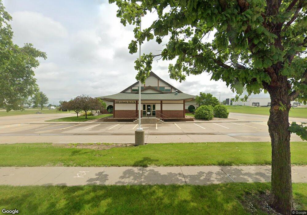
9255 Atlantic Dr SW Cedar Rapids, IA 52404
Estimated Value: $1,345,898
--
Bed
--
Bath
10,640
Sq Ft
$126/Sq Ft
Est. Value
About This Home
This home is located at 9255 Atlantic Dr SW, Cedar Rapids, IA 52404 and is currently priced at $1,345,898, approximately $126 per square foot. 9255 Atlantic Dr SW is a home located in Linn County with nearby schools including Prairie Crest Elementary School, Prairie Heights Elementary School, and Prairie View Elementary School.
Ownership History
Date
Name
Owned For
Owner Type
Purchase Details
Closed on
Jan 7, 2020
Sold by
St Luke S Methodist Hospital
Bought by
Prairie Bible Church Inc
Current Estimated Value
Home Financials for this Owner
Home Financials are based on the most recent Mortgage that was taken out on this home.
Original Mortgage
$960,000
Outstanding Balance
$848,198
Interest Rate
3.6%
Mortgage Type
Future Advance Clause Open End Mortgage
Purchase Details
Closed on
Sep 30, 2011
Sold by
Ahn Yang and Ahn Yong Hwa
Bought by
St Lukes Methodist Hospital
Create a Home Valuation Report for This Property
The Home Valuation Report is an in-depth analysis detailing your home's value as well as a comparison with similar homes in the area
Home Values in the Area
Average Home Value in this Area
Purchase History
| Date | Buyer | Sale Price | Title Company |
|---|---|---|---|
| Prairie Bible Church Inc | $1,200,000 | None Available | |
| St Lukes Methodist Hospital | $2,324,500 | None Available |
Source: Public Records
Mortgage History
| Date | Status | Borrower | Loan Amount |
|---|---|---|---|
| Open | Prairie Bible Church Inc | $960,000 |
Source: Public Records
Tax History Compared to Growth
Tax History
| Year | Tax Paid | Tax Assessment Tax Assessment Total Assessment is a certain percentage of the fair market value that is determined by local assessors to be the total taxable value of land and additions on the property. | Land | Improvement |
|---|---|---|---|---|
| 2025 | -- | $3,724,900 | $535,600 | $3,189,300 |
| 2024 | -- | $3,220,000 | $535,600 | $2,684,400 |
| 2023 | -- | $3,220,000 | $535,600 | $2,684,400 |
| 2022 | $0 | $2,774,200 | $535,600 | $2,238,600 |
| 2021 | $67,238 | $1,908,600 | $535,600 | $1,373,000 |
| 2020 | $67,238 | $1,941,300 | $580,000 | $1,361,300 |
| 2019 | $65,566 | $1,941,300 | $580,000 | $1,361,300 |
| 2018 | $65,266 | $1,941,300 | $580,000 | $1,361,300 |
| 2017 | $63,685 | $1,819,100 | $580,000 | $1,239,100 |
| 2016 | $63,685 | $1,819,100 | $580,000 | $1,239,100 |
| 2015 | $64,295 | $1,850,320 | $580,000 | $1,270,320 |
| 2014 | $61,862 | $1,850,320 | $580,000 | $1,270,320 |
| 2013 | $65,178 | $1,850,320 | $580,000 | $1,270,320 |
Source: Public Records
Map
Nearby Homes
- 8905 6th St SW Unit Land Lease
- 0 Lawrence Drive East SW Unit A 2502372
- 0 Lawrence Drive East SW Unit B 2502371
- 0 Lawrence Drive West SW Unit C
- 8515 Aldridge Dr SW
- 160 Bethany Loop SW Unit D
- 160 Bethany Loop SW Unit C
- 160 Bethany Loop SW Unit B
- 160 Bethany Loop SW Unit A
- Hamilton Plan at American Prairie
- Bellhaven Plan at American Prairie
- Roland Plan at American Prairie
- 69 Pompas SW
- 69 Pompas Dr
- 9305 Snowberry Dr SW
- 110 SW Audrey Way
- 110 SW Audrey Way Unit Lot 11
- 8921 SW Griswold Ln
- 8921 SW Griswold Ln Unit Lot 20
- 9309 Snowberry Dr SW
- 9255 Atlantic Dr SW
- 9255 Atlantic Dr SW
- 805 Wright Brothers Blvd SW Unit 4A
- 805 Wright Brothers Blvd SW Unit 2
- 805 Wright Brothers Blvd SW Unit 1
- 9310 Atlantic Dr SW Unit A
- 9310 Atlantic Dr SW Unit 5
- 9310 Atlantic Dr SW
- 9310 Atlantic Dr SW Unit 2-5
- 9310 Atlantic Dr SW Unit 1,2,5
- 9310 Atlantic Dr SW Unit 1-2
- 9310 Atlantic Dr SW Unit 2
- 9310 Atlantic Dr SW Unit 1
- LOT 9 Atlantic Dr SW
- LOT 8 Atlantic Dr SW
- LOT 11 Atlantic Dr SW
- LOT 10 Atlantic Dr SW
- Lot 7 Atlantic Dr SW
- 710 Wright Brothers Blvd SW
- 645 Wright Brothers Blvd SW