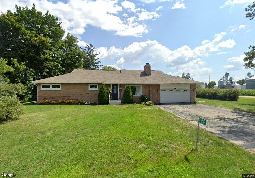
9257 391st Ave Genoa City, WI 53128
Estimated Value: $314,000 - $424,000
2
Beds
1
Bath
1,400
Sq Ft
$256/Sq Ft
Est. Value
About This Home
This home is located at 9257 391st Ave, Genoa City, WI 53128 and is currently estimated at $358,571, approximately $256 per square foot. 9257 391st Ave is a home located in Kenosha County with nearby schools including Randall Consolidated School and Wilmot High School.
Ownership History
Date
Name
Owned For
Owner Type
Purchase Details
Closed on
Feb 20, 2017
Sold by
Kaefer Julia K and Kaefer 27664
Bought by
Gribben Madison K
Current Estimated Value
Purchase Details
Closed on
Nov 29, 2012
Sold by
Callarman Lois
Bought by
Kaefer Julia K
Purchase Details
Closed on
Nov 5, 2010
Sold by
Collins Tom
Bought by
Callarman Lois
Purchase Details
Closed on
Aug 19, 2010
Sold by
Deutsche Bank National Trust Company As
Bought by
Collins Tom
Purchase Details
Closed on
Dec 16, 2009
Sold by
Richter Gerald T
Bought by
Deutsche Bank National Trust Company As
Create a Home Valuation Report for This Property
The Home Valuation Report is an in-depth analysis detailing your home's value as well as a comparison with similar homes in the area
Home Values in the Area
Average Home Value in this Area
Purchase History
| Date | Buyer | Sale Price | Title Company |
|---|---|---|---|
| Gribben Madison K | $173,600 | -- | |
| Kaefer Julia K | $179,300 | None Available | |
| Callarman Lois | $155,000 | -- | |
| Collins Tom | $85,000 | -- | |
| Deutsche Bank National Trust Company As | $105,000 | -- |
Source: Public Records
Tax History Compared to Growth
Tax History
| Year | Tax Paid | Tax Assessment Tax Assessment Total Assessment is a certain percentage of the fair market value that is determined by local assessors to be the total taxable value of land and additions on the property. | Land | Improvement |
|---|---|---|---|---|
| 2024 | $3,533 | $235,200 | $66,200 | $169,000 |
| 2023 | $3,440 | $235,200 | $66,200 | $169,000 |
| 2022 | $3,849 | $235,200 | $66,200 | $169,000 |
| 2021 | $3,408 | $235,200 | $66,200 | $169,000 |
| 2020 | $3,408 | $179,300 | $61,700 | $117,600 |
| 2019 | $3,279 | $179,300 | $61,700 | $117,600 |
| 2018 | $3,799 | $179,300 | $61,700 | $117,600 |
| 2017 | $3,235 | $179,300 | $61,700 | $117,600 |
| 2016 | $3,605 | $179,300 | $61,700 | $117,600 |
| 2015 | $3,266 | $179,300 | $61,700 | $117,600 |
| 2014 | -- | $179,300 | $61,700 | $117,600 |
Source: Public Records
Map
Nearby Homes
- 9244 391st Ave
- 9020 388th Ave
- 39918 93rd St
- Lt9 95th St
- Lt10 95th St
- 9631 400th Ave
- 8627 392nd Ave
- 9499 402nd Ave
- 478 Tomahawk Dr
- 207 Tomahawk Dr
- 1061 Highland Dr
- 40724 93rd St
- 39740 Bloomfield Rd
- Lt2 Marion Ave
- 8823 406th Ave
- 10536 401st Ave
- 201 Lance Dr
- 1400 Richmond Rd
- 1111 Rosebud Ave
- 10244 406th Ave