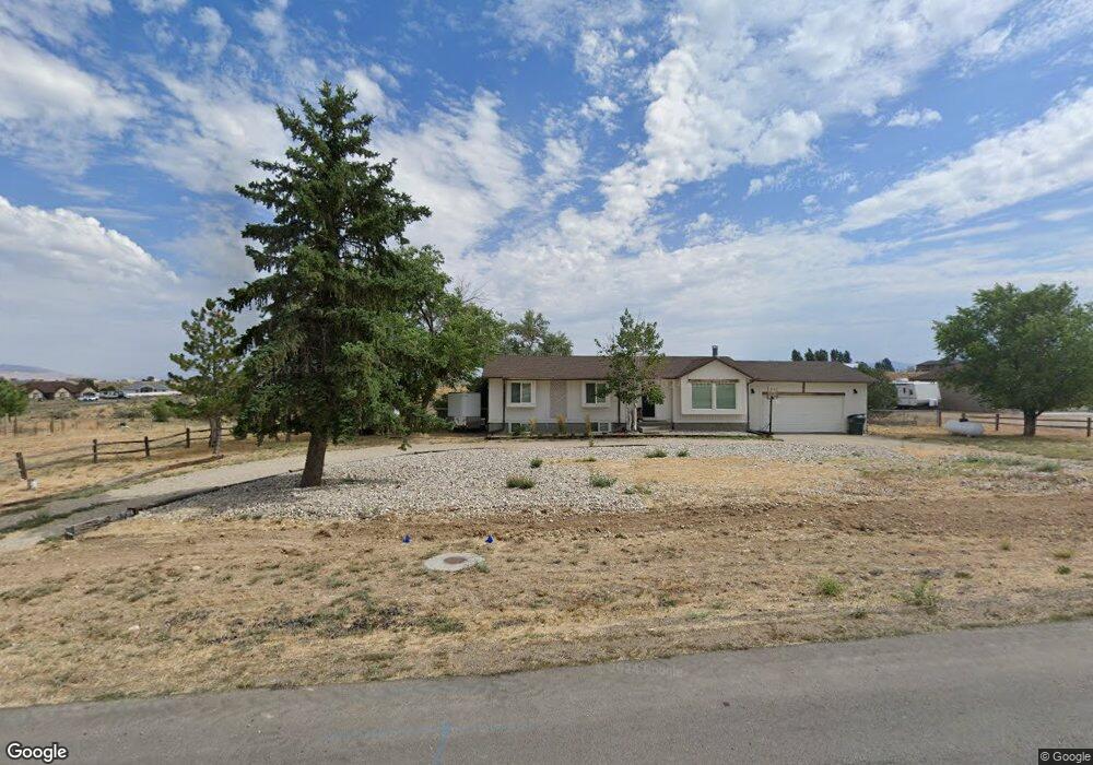
926 Bronco Dr Spring Creek, NV 89815
Estimated Value: $317,000 - $368,000
3
Beds
3
Baths
1,254
Sq Ft
$268/Sq Ft
Est. Value
About This Home
This home is located at 926 Bronco Dr, Spring Creek, NV 89815 and is currently estimated at $335,571, approximately $267 per square foot. 926 Bronco Dr is a home located in Elko County with nearby schools including Spring Creek Elementary School, Spring Creek Middle School, and Spring Creek High School.
Ownership History
Date
Name
Owned For
Owner Type
Purchase Details
Closed on
May 21, 2015
Sold by
Wittner Glenn E and Wittner Annette V
Bought by
Bradley Samuel P and Bradley Ashley A
Current Estimated Value
Home Financials for this Owner
Home Financials are based on the most recent Mortgage that was taken out on this home.
Original Mortgage
$188,673
Outstanding Balance
$145,136
Interest Rate
3.64%
Mortgage Type
New Conventional
Estimated Equity
$190,435
Create a Home Valuation Report for This Property
The Home Valuation Report is an in-depth analysis detailing your home's value as well as a comparison with similar homes in the area
Home Values in the Area
Average Home Value in this Area
Purchase History
| Date | Buyer | Sale Price | Title Company |
|---|---|---|---|
| Bradley Samuel P | $185,000 | First American Title Elko |
Source: Public Records
Mortgage History
| Date | Status | Borrower | Loan Amount |
|---|---|---|---|
| Open | Bradley Samuel P | $188,673 |
Source: Public Records
Tax History Compared to Growth
Tax History
| Year | Tax Paid | Tax Assessment Tax Assessment Total Assessment is a certain percentage of the fair market value that is determined by local assessors to be the total taxable value of land and additions on the property. | Land | Improvement |
|---|---|---|---|---|
| 2025 | $1,757 | $73,650 | $21,000 | $52,651 |
| 2024 | $1,757 | $75,478 | $21,000 | $54,478 |
| 2023 | $1,627 | $62,842 | $11,200 | $51,642 |
| 2022 | $1,507 | $56,197 | $11,200 | $44,997 |
| 2021 | $1,586 | $55,469 | $11,200 | $44,269 |
| 2020 | $1,525 | $56,423 | $11,200 | $45,223 |
| 2019 | $1,472 | $52,103 | $8,750 | $43,353 |
| 2018 | $1,483 | $52,694 | $8,750 | $43,944 |
| 2017 | $1,307 | $50,890 | $8,750 | $42,140 |
| 2016 | $1,321 | $50,934 | $8,750 | $42,184 |
| 2015 | $1,305 | $50,645 | $8,750 | $41,895 |
| 2014 | -- | $49,017 | $8,750 | $40,267 |
Source: Public Records
Map
Nearby Homes
- 936 Buckskin Place
- 782 Bronco Dr
- 726 Bronco Dr
- 522 Parkridge Pkwy
- 850 1 Eye Dr
- 661 Burro Bay
- 599 Wolf Creek Dr
- 899 Eastlake Dr
- 991 Wolf Creek Ln
- 768 Alpine Dr
- 855 Willington Dr
- 860 Willington Dr
- 951 Bluejay Dr
- 595 Abarr Dr
- 697 Clover Dr
- 603 Palace Pkwy
- 675 Willington Dr
- 609 Westcott Dr
- 611 Westcott Dr
- 489 Parkridge Pkwy
- 930 Bronco Dr
- 931 Bronco Dr
- 934 Bronco Dr
- 927 Bronco Dr
- 935 Bronco Dr
- 786 Buckskin Ln
- 938 Bronco Dr
- 939 Bronco Dr
- 914 Bronco Dr
- 942 Bronco Dr
- 824 Parkridge Pkwy
- 928 Buckskin Place
- 919 Bronco Dr
- 943 Bronco Dr
- 830 Parkridge Pkwy
- 910 Bronco Dr
- 937 Buckskin Place
- 911 Bronco Dr
- 946 Bronco Dr
- ONE Buckskin Cir