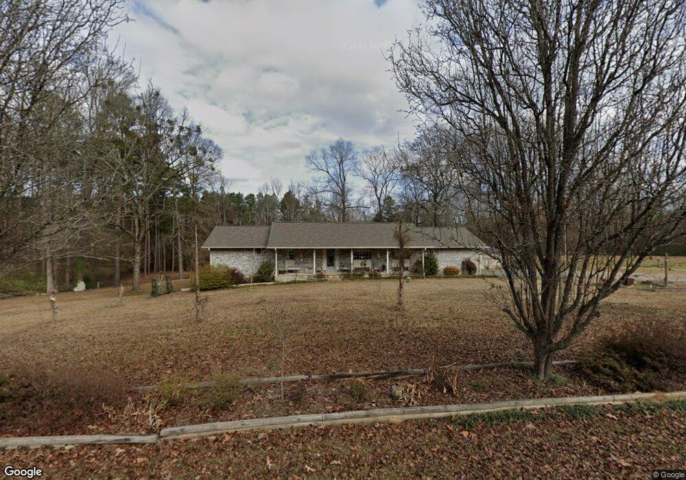
926 Grant 67 Sheridan, AR 72150
Estimated Value: $182,326 - $230,000
--
Bed
2
Baths
1,791
Sq Ft
$117/Sq Ft
Est. Value
About This Home
This home is located at 926 Grant 67, Sheridan, AR 72150 and is currently estimated at $209,582, approximately $117 per square foot. 926 Grant 67 is a home located in Grant County with nearby schools including Sheridan High School.
Ownership History
Date
Name
Owned For
Owner Type
Purchase Details
Closed on
Jun 2, 2022
Sold by
Blake Randy and Mclarnon Melinda
Bought by
Lott Randy J
Current Estimated Value
Purchase Details
Closed on
Jan 5, 2008
Sold by
Wilson Marion D and Wilson Mae Dean
Bought by
Lott Randy J and Lott Brenda K
Purchase Details
Closed on
Oct 19, 2004
Sold by
Lott Brenda K and Lott Randy J
Bought by
Lott Brenda K and Lott Randy J
Home Financials for this Owner
Home Financials are based on the most recent Mortgage that was taken out on this home.
Original Mortgage
$84,497
Interest Rate
5.66%
Mortgage Type
FHA
Purchase Details
Closed on
May 3, 2003
Bought by
Lotts and Lotts Wilson
Purchase Details
Closed on
Apr 13, 2000
Bought by
Wilson and Wilson Lott
Purchase Details
Closed on
Mar 20, 1996
Bought by
Johnson
Create a Home Valuation Report for This Property
The Home Valuation Report is an in-depth analysis detailing your home's value as well as a comparison with similar homes in the area
Home Values in the Area
Average Home Value in this Area
Purchase History
| Date | Buyer | Sale Price | Title Company |
|---|---|---|---|
| Lott Randy J | $25,000 | First National Title | |
| Lott Randy J | -- | Stewart Title Of Arkansas | |
| Lott Brenda K | -- | Transcontinental Title Co | |
| Lotts | -- | -- | |
| Wilson | -- | -- | |
| Herman Johnson For Lila | $87,000 | -- | |
| Johnson | -- | -- | |
| Johnson | $83,000 | -- |
Source: Public Records
Mortgage History
| Date | Status | Borrower | Loan Amount |
|---|---|---|---|
| Previous Owner | Lott Brenda K | $84,497 |
Source: Public Records
Tax History Compared to Growth
Tax History
| Year | Tax Paid | Tax Assessment Tax Assessment Total Assessment is a certain percentage of the fair market value that is determined by local assessors to be the total taxable value of land and additions on the property. | Land | Improvement |
|---|---|---|---|---|
| 2025 | $1,497 | $42,000 | $4,500 | $37,500 |
| 2024 | $1,426 | $31,680 | $2,320 | $29,360 |
| 2023 | $1,001 | $31,680 | $2,320 | $29,360 |
| 2022 | $1,051 | $31,680 | $2,320 | $29,360 |
| 2021 | $993 | $31,680 | $2,320 | $29,360 |
| 2020 | $928 | $28,960 | $2,200 | $26,760 |
| 2019 | $1,303 | $28,960 | $2,200 | $26,760 |
| 2018 | $1,303 | $28,960 | $2,200 | $26,760 |
| 2017 | $1,303 | $28,960 | $2,200 | $26,760 |
| 2015 | -- | $28,040 | $2,200 | $25,840 |
| 2014 | -- | $28,040 | $2,200 | $25,840 |
| 2012 | -- | $26,040 | $2,200 | $23,840 |
Source: Public Records
Map
Nearby Homes
- 303 Fiser Dr
- 27 Carolyn Rd
- 610 S Rock St
- 00 Grant County 9
- 0 Grant 9 Unit 25044833
- 407 E Holly St
- 39 Valley Ct
- 38 Valley Ct
- 0 E Center St
- 708 E 2nd St
- 534 Shackleford Rd
- 0 Gary
- 1363 U S 270
- 904 Grant 9
- 507 Gary Ln
- 205 N Main St
- 700 Shannon Ln
- 0 Freda Lane (North Lot)
- 0 Freda Lane (South Lot)
- 0 W Bell St
- 915 Grant 67
- 879 Grant 67
- 955 Grant 67
- 853 Grant 67
- 850 Grant 67
- 811 Grant 67
- 813 Grant 67
- 0 Blake Rd St
- 1092 Grant 67
- 1001 Blake Rd
- 0 Grant 67
- 841 Abby Ln
- 0 Hwy 270 Unit 18029761
- 0 Hwy 270 Unit 18029760
- 0 Hwy 270 Unit 18029759
- 40 Acres Sheridan
- 0 Shoemaker and Grant 43 Unit 18024827
- 0 0 Unit 18011002
- 83 Grant 3535
- 000 Leola