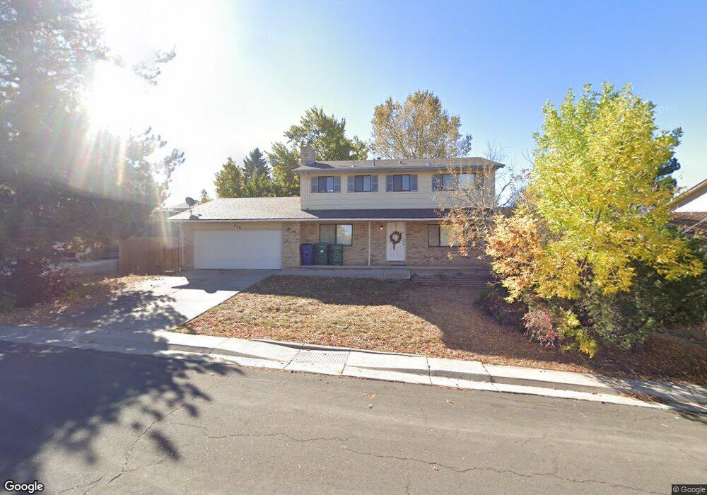
926 Hamal Dr Lone Tree, CO 80124
Estimated Value: $576,573 - $657,000
4
Beds
3
Baths
1,984
Sq Ft
$311/Sq Ft
Est. Value
About This Home
This home is located at 926 Hamal Dr, Lone Tree, CO 80124 and is currently estimated at $616,787, approximately $310 per square foot. 926 Hamal Dr is a home located in Douglas County with nearby schools including Acres Green Elementary School, Cresthill Middle School, and Highlands Ranch High School.
Ownership History
Date
Name
Owned For
Owner Type
Purchase Details
Closed on
Oct 24, 2018
Sold by
Cah 2015 1 Broower Llc
Bought by
2018 4 Ih Borrower Lp
Current Estimated Value
Home Financials for this Owner
Home Financials are based on the most recent Mortgage that was taken out on this home.
Original Mortgage
$960,304,000
Outstanding Balance
$840,987,909
Interest Rate
4.7%
Mortgage Type
Commercial
Estimated Equity
-$840,371,122
Purchase Details
Closed on
Jun 7, 2016
Sold by
Colfin Ai Co 1 Llc
Bought by
Csh 2016 & 1 Borrower Llc
Purchase Details
Closed on
Apr 16, 2013
Sold by
Koper Joe M
Bought by
Colfin Ai & Co 1 Llc
Purchase Details
Closed on
Jun 8, 2004
Sold by
Kopper Joe M and Kopper Fe M
Bought by
Kopper Joe M
Purchase Details
Closed on
Aug 31, 1995
Sold by
Strayer Dena and Ranney Sandra
Bought by
Kopper Joe M and Kopper Fe M
Home Financials for this Owner
Home Financials are based on the most recent Mortgage that was taken out on this home.
Original Mortgage
$129,500
Interest Rate
7.76%
Purchase Details
Closed on
Oct 19, 1993
Sold by
Lampman Sandra
Bought by
Ranney Sandra
Purchase Details
Closed on
Apr 7, 1992
Sold by
Strayer Dena and Lampman Sandra
Bought by
Strayer Dena and Ranney Sandra
Purchase Details
Closed on
May 20, 1991
Sold by
Veterans Affairs Admin
Bought by
Strayer Dena and Lampman Sandra
Purchase Details
Closed on
Aug 27, 1990
Sold by
Public Trustee
Bought by
First Interstate Mtg Co
Purchase Details
Closed on
Jun 26, 1990
Sold by
First Interstate Mtg Co
Bought by
Veterans Affairs Admin
Purchase Details
Closed on
Jan 25, 1984
Sold by
Zasadil Russell M and Zasadil Margaret Sue
Bought by
Jandura Michael J and Jandura Yvonne M
Create a Home Valuation Report for This Property
The Home Valuation Report is an in-depth analysis detailing your home's value as well as a comparison with similar homes in the area
Home Values in the Area
Average Home Value in this Area
Purchase History
| Date | Buyer | Sale Price | Title Company |
|---|---|---|---|
| 2018 4 Ih Borrower Lp | -- | Os National Llc | |
| Csh 2016 & 1 Borrower Llc | -- | None Available | |
| Colfin Ai & Co 1 Llc | -- | None Available | |
| Kopper Joe M | -- | -- | |
| Kopper Joe M | $143,900 | -- | |
| Ranney Sandra | -- | -- | |
| Strayer Dena | -- | -- | |
| Strayer Dena | -- | -- | |
| First Interstate Mtg Co | -- | -- | |
| Veterans Affairs Admin | -- | -- | |
| Jandura Michael J | $99,900 | -- |
Source: Public Records
Mortgage History
| Date | Status | Borrower | Loan Amount |
|---|---|---|---|
| Open | 2018 4 Ih Borrower Lp | $960,304,000 | |
| Previous Owner | Kopper Joe M | $129,500 |
Source: Public Records
Tax History Compared to Growth
Tax History
| Year | Tax Paid | Tax Assessment Tax Assessment Total Assessment is a certain percentage of the fair market value that is determined by local assessors to be the total taxable value of land and additions on the property. | Land | Improvement |
|---|---|---|---|---|
| 2024 | $3,588 | $42,790 | $7,980 | $34,810 |
| 2023 | $3,625 | $42,790 | $7,980 | $34,810 |
| 2022 | $2,737 | $30,740 | $6,770 | $23,970 |
| 2021 | $2,846 | $30,740 | $6,770 | $23,970 |
| 2020 | $2,717 | $30,060 | $6,390 | $23,670 |
| 2019 | $2,726 | $30,060 | $6,390 | $23,670 |
| 2018 | $2,191 | $25,870 | $5,570 | $20,300 |
| 2017 | $2,226 | $25,870 | $5,570 | $20,300 |
| 2016 | $1,989 | $22,630 | $3,930 | $18,700 |
| 2015 | $1,017 | $22,630 | $3,930 | $18,700 |
| 2014 | $998 | $19,410 | $3,980 | $15,430 |
Source: Public Records
Map
Nearby Homes
- 789 Hamal Dr
- 9275 Erminedale Dr
- 802 Altair Dr
- 7057 Chestnut Hill St
- 13117 Deneb Dr
- 13134 Deneb Dr
- 6887 Chestnut Hill St
- 7041 Chestnut Hill Trail
- 9412 La Quinta Way
- 8159 Lodgepole Trail
- 9308 Miles Dr Unit 5
- 9390 Yale Ln
- 6426 Nassau Ct
- 7469 La Quinta Place
- 9368 Harvard Dr
- 6482 Silver Mesa Dr Unit B
- 6723 Amherst Ct
- 6266 Nassau Ct
- 13483 Achilles Dr
- 181 Dianna Dr