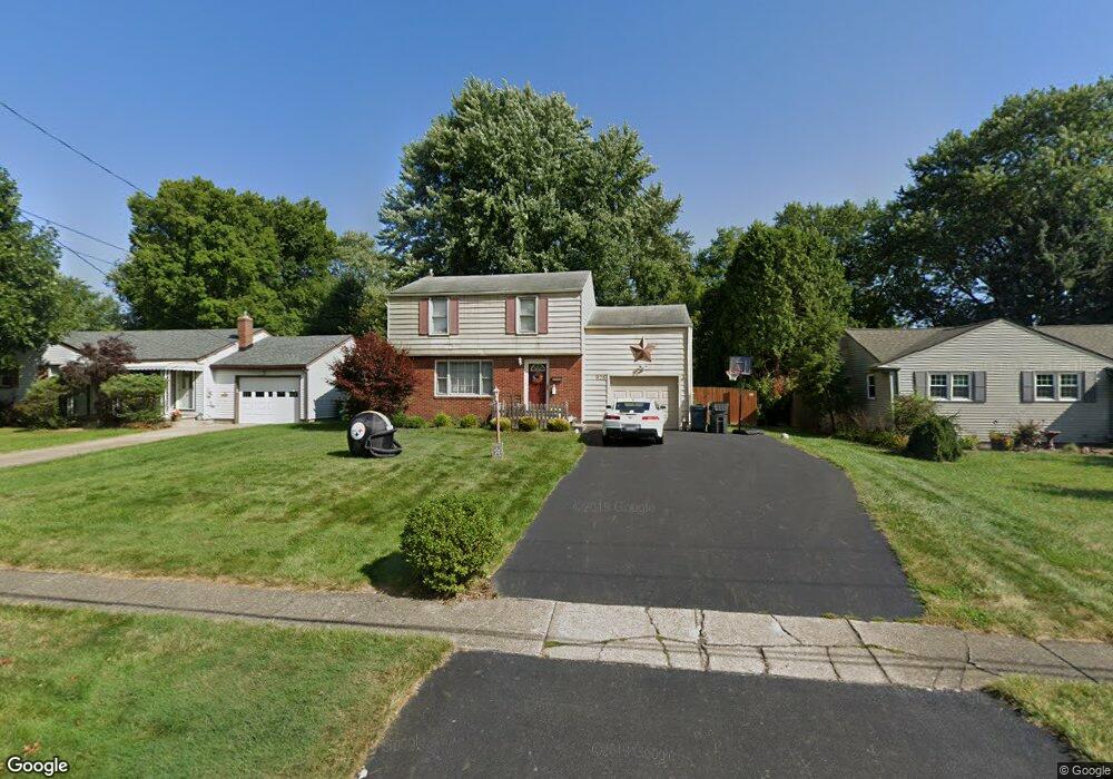
926 Larkridge Ave Youngstown, OH 44512
Estimated Value: $197,000 - $229,000
4
Beds
2
Baths
1,474
Sq Ft
$140/Sq Ft
Est. Value
About This Home
This home is located at 926 Larkridge Ave, Youngstown, OH 44512 and is currently estimated at $206,414, approximately $140 per square foot. 926 Larkridge Ave is a home located in Mahoning County with nearby schools including Robinwood Lane Elementary School, Boardman Glenwood Junior High School, and Boardman High School.
Ownership History
Date
Name
Owned For
Owner Type
Purchase Details
Closed on
May 21, 2002
Sold by
Florence L Tr Billman James I Trustee & Billm
Bought by
Geraci Salvatore J
Current Estimated Value
Home Financials for this Owner
Home Financials are based on the most recent Mortgage that was taken out on this home.
Original Mortgage
$91,600
Outstanding Balance
$38,870
Interest Rate
7%
Estimated Equity
$167,544
Purchase Details
Closed on
Dec 13, 1971
Bought by
Billman James I and F L
Create a Home Valuation Report for This Property
The Home Valuation Report is an in-depth analysis detailing your home's value as well as a comparison with similar homes in the area
Home Values in the Area
Average Home Value in this Area
Purchase History
| Date | Buyer | Sale Price | Title Company |
|---|---|---|---|
| Geraci Salvatore J | $92,000 | -- | |
| Billman James I | -- | -- |
Source: Public Records
Mortgage History
| Date | Status | Borrower | Loan Amount |
|---|---|---|---|
| Open | Geraci Salvatore J | $91,600 |
Source: Public Records
Tax History Compared to Growth
Tax History
| Year | Tax Paid | Tax Assessment Tax Assessment Total Assessment is a certain percentage of the fair market value that is determined by local assessors to be the total taxable value of land and additions on the property. | Land | Improvement |
|---|---|---|---|---|
| 2024 | $2,719 | $53,590 | $8,460 | $45,130 |
| 2023 | $2,682 | $53,590 | $8,460 | $45,130 |
| 2022 | $2,186 | $33,310 | $6,870 | $26,440 |
| 2021 | $2,187 | $33,310 | $6,870 | $26,440 |
| 2020 | $2,199 | $33,310 | $6,870 | $26,440 |
| 2019 | $2,133 | $28,720 | $5,920 | $22,800 |
| 2018 | $1,859 | $28,720 | $5,920 | $22,800 |
| 2017 | $1,837 | $28,720 | $5,920 | $22,800 |
| 2016 | $2,018 | $31,270 | $5,920 | $25,350 |
| 2015 | $1,978 | $31,270 | $5,920 | $25,350 |
| 2014 | $1,984 | $31,270 | $5,920 | $25,350 |
| 2013 | $1,959 | $31,270 | $5,920 | $25,350 |
Source: Public Records
Map
Nearby Homes
- 928 Edenridge Dr
- 0 Moyer Ave
- 796 Edenridge Dr
- 857 Maple Ridge Dr
- 792 Forest Ridge Dr
- 6229 Appleridge Dr
- 424 Mathews Rd
- 732 Forest Ridge Dr
- 6278 Appleridge Dr
- 0 Mathews Rd Unit 5149232
- 0 Mathews Rd Unit 5143059
- 772 Teakwood Dr
- 0 Mulberry Ln Unit 5119623
- 707 Oakridge Dr
- 0 Cranberry Ln Unit 5119702
- 1738 Island Dr
- 642 Oakridge Dr
- 6785 Tanglewood Dr
- 0 Mathews Rd Unit 5038026
- 4715 Euclid Blvd
- 930 Larkridge Ave
- 920 Larkridge Ave
- 914 Larkridge Ave
- 934 Larkridge Ave
- 908 Larkridge Ave
- 940 Larkridge Ave
- 929 Larkridge Ave
- 923 Larkridge Ave
- 893 Mathews Rd
- 925 Mathews Rd
- 891 Mathews Rd
- 935 Larkridge Ave
- 917 Larkridge Ave
- 902 Larkridge Ave
- 931 Mathews Rd
- 887 Mathews Rd
- 939 Larkridge Ave
- 944 Larkridge Ave
- 937 Mathews Rd
- 896 Larkridge Ave