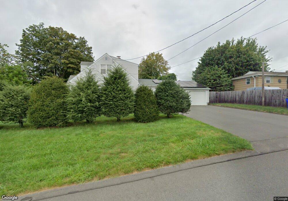
926 Old Rte 22-Smithfield Rd Unknown Ny City, CT 12546
North East NeighborhoodEstimated Value: $292,000 - $434,822
5
Beds
6
Baths
2,996
Sq Ft
$114/Sq Ft
Est. Value
About This Home
This home is located at 926 Old Rte 22-Smithfield Rd, Unknown Ny City, CT 12546 and is currently estimated at $341,706, approximately $114 per square foot. 926 Old Rte 22-Smithfield Rd is a home located in Dutchess County with nearby schools including Eugene Brooks Intermediate School, Olivet Academy, and Maplebrook School.
Ownership History
Date
Name
Owned For
Owner Type
Purchase Details
Closed on
May 8, 2025
Sold by
Northern Dutchess Pro Llc
Bought by
Colonial House & Barn Llc
Current Estimated Value
Purchase Details
Closed on
Apr 5, 2006
Sold by
Perotti James
Bought by
Perotti James E John J,Robert F
Purchase Details
Closed on
Jan 11, 2002
Sold by
Perotti Frank and Perotti Doris
Bought by
Perotti Frank & D
Create a Home Valuation Report for This Property
The Home Valuation Report is an in-depth analysis detailing your home's value as well as a comparison with similar homes in the area
Home Values in the Area
Average Home Value in this Area
Purchase History
| Date | Buyer | Sale Price | Title Company |
|---|---|---|---|
| Colonial House & Barn Llc | $300,000 | None Available | |
| Perotti James E John J,Robert F | -- | Robert Trotta | |
| Perotti James E John J Robert F | -- | Robert Trotta | |
| Perotti Frank & D | -- | -- | |
| Perotti Frank & D | -- | -- |
Source: Public Records
Tax History Compared to Growth
Tax History
| Year | Tax Paid | Tax Assessment Tax Assessment Total Assessment is a certain percentage of the fair market value that is determined by local assessors to be the total taxable value of land and additions on the property. | Land | Improvement |
|---|---|---|---|---|
| 2024 | $6,733 | $418,500 | $123,100 | $295,400 |
| 2023 | $6,566 | $406,300 | $123,200 | $283,100 |
| 2022 | $6,526 | $376,200 | $114,100 | $262,100 |
| 2021 | $6,344 | $335,900 | $106,600 | $229,300 |
| 2020 | $6,388 | $335,900 | $133,100 | $202,800 |
| 2019 | $6,268 | $335,900 | $133,100 | $202,800 |
| 2018 | $6,686 | $335,900 | $133,100 | $202,800 |
| 2017 | $6,635 | $335,900 | $133,100 | $202,800 |
| 2016 | $6,685 | $335,900 | $133,100 | $202,800 |
| 2015 | -- | $335,900 | $133,100 | $202,800 |
| 2014 | -- | $347,300 | $133,100 | $214,200 |
Source: Public Records
Map
Nearby Homes
- 124 Cooper Rd
- 710 Smithfield Rd
- 5 - 15 Homestead Farm Ln
- 5 Homestead Farm Ln
- Lot # 5 Smithfield Rd
- 0 Silver Mountain Rd Unit KEY860241
- 0 Mill Rd Unit KEY932153
- 5 Red Cedar Ln
- 12-19 Goose Pond Ln
- 26 Mountain Farm Rd
- 151 Lake Ln
- 174 Perrys Corners Rd
- A Skunks Misery Rd
- 1388 Route 83
- 490 Mill St
- 5842 S Elm Ave
- 5846 S Elm Ave
- 17 Forest Ln
- 1533-1539 Route 83
- 0 Cascade Mountain Rd Unit 419986
- 926 Old Rte 22 Smithfield Rd
- 926 Old Rte22 Smithfield Rd
- 238 Cooper Rd
- 993 Smithfield Rd
- 230 Cooper Rd
- 0 Old Route 22 Unit 100373
- 0 Old Route 22 Unit 126627
- 244 Cooper Rd
- 208 Cooper Rd
- 00 Old Route 22
- 260 Cooper Rd
- 261 Cooper Rd Unit 265
- 829 Smithfield Rd
- 926 Route 22 Rd
- 243 Cooper Rd
- 942 Smithfield Rd
- 265 Cooper Rd
- 993 Old Route 22
- 5527 Route 22
- 942 P4-Smithfield Rd