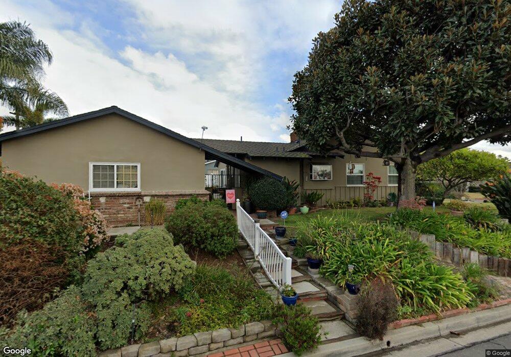
9261 Randall Ave La Habra, CA 90631
Estimated Value: $900,000 - $1,020,000
2
Beds
2
Baths
1,523
Sq Ft
$626/Sq Ft
Est. Value
About This Home
This home is located at 9261 Randall Ave, La Habra, CA 90631 and is currently estimated at $953,930, approximately $626 per square foot. 9261 Randall Ave is a home located in Orange County with nearby schools including Macy Elementary School, Rancho-Starbuck Intermediate School, and La Habra High School.
Ownership History
Date
Name
Owned For
Owner Type
Purchase Details
Closed on
Feb 8, 1995
Sold by
Pedrosa Andrew J and Pedrosa Anna Lilia
Bought by
Pedrosa Lawrence Daniel and Pedrosa Jo A
Current Estimated Value
Home Financials for this Owner
Home Financials are based on the most recent Mortgage that was taken out on this home.
Original Mortgage
$187,680
Interest Rate
9.03%
Mortgage Type
Assumption
Create a Home Valuation Report for This Property
The Home Valuation Report is an in-depth analysis detailing your home's value as well as a comparison with similar homes in the area
Home Values in the Area
Average Home Value in this Area
Purchase History
| Date | Buyer | Sale Price | Title Company |
|---|---|---|---|
| Pedrosa Lawrence Daniel | $184,000 | Fidelity National Title |
Source: Public Records
Mortgage History
| Date | Status | Borrower | Loan Amount |
|---|---|---|---|
| Closed | Pedrosa Lawrence Daniel | $187,680 |
Source: Public Records
Tax History Compared to Growth
Tax History
| Year | Tax Paid | Tax Assessment Tax Assessment Total Assessment is a certain percentage of the fair market value that is determined by local assessors to be the total taxable value of land and additions on the property. | Land | Improvement |
|---|---|---|---|---|
| 2025 | $3,593 | $346,735 | $198,476 | $148,259 |
| 2024 | $3,593 | $339,937 | $194,585 | $145,352 |
| 2023 | $3,509 | $333,272 | $190,770 | $142,502 |
| 2022 | $3,477 | $326,738 | $187,030 | $139,708 |
| 2021 | $3,406 | $320,332 | $183,363 | $136,969 |
| 2020 | $3,400 | $317,048 | $181,483 | $135,565 |
| 2019 | $3,314 | $310,832 | $177,925 | $132,907 |
| 2018 | $3,178 | $304,738 | $174,437 | $130,301 |
| 2017 | $3,119 | $298,763 | $171,016 | $127,747 |
| 2016 | $3,051 | $292,905 | $167,662 | $125,243 |
| 2015 | $2,963 | $288,506 | $165,144 | $123,362 |
| 2014 | $2,869 | $282,855 | $161,909 | $120,946 |
Source: Public Records
Map
Nearby Homes
- 9331 Mikinda Ave
- 1000 Dolores St
- 2311 Canfield Dr
- 9422 Canfield Dr
- 2401 Canfield Dr
- 16540 Whittier Blvd
- 2100 Gregory Ln
- 9915 Corella Ave
- 2611 Gregory Ln
- 16875 Sausalito Dr
- 10303 Pounds Ave
- 16635 Monte Oro Dr
- 188 Madelena Dr
- 1620 W El Portal Dr
- 10418 Bogardus Ave
- 401 Granada Dr
- 1230 Sunbird Ave
- 16621 Crape Myrtle Ln
- 1436 La Riata Dr
- 240 Oakland Dr
- 9281 Randall Ave
- 9262 Wallace Ave
- 9282 Wallace Ave
- 9241 Randall Ave
- 1271 Baldwin St
- 9291 Randall Ave
- 9262 Randall Ave
- 9282 Randall Ave
- 1251 Baldwin St
- 9292 Wallace Ave
- 9242 Randall Ave
- 9292 Randall Ave
- 9311 Randall Ave
- 9221 Randall Ave
- 1241 Baldwin St
- 1321 Baldwin St
- 9312 Wallace Ave
- 1332 Baldwin St
- 9261 Wallace Ave
- 9312 Randall Ave