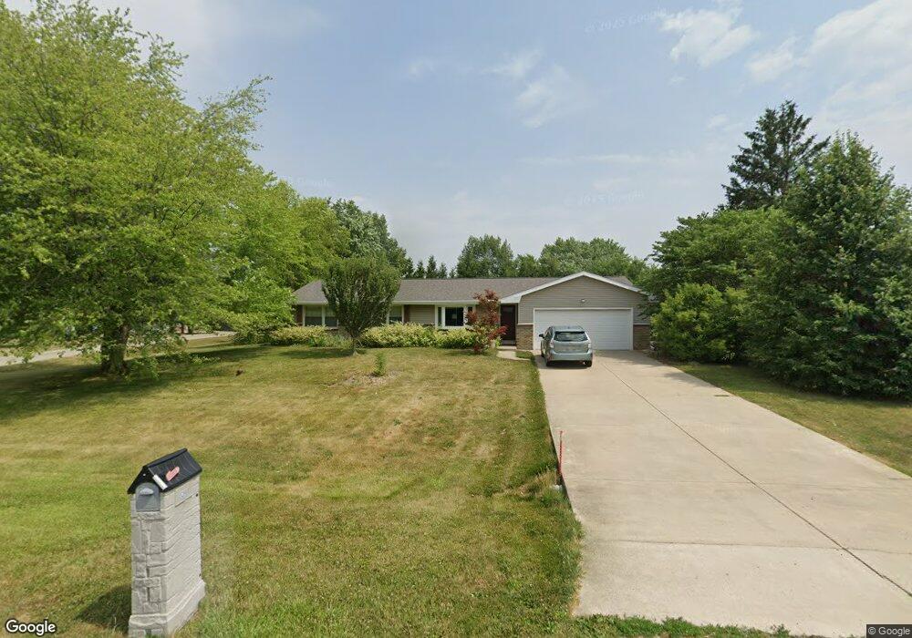
9268 Apollo Rd Bloomington, IL 61705
Twin Grove NeighborhoodEstimated Value: $255,000 - $291,000
Studio
--
Bath
1,479
Sq Ft
$182/Sq Ft
Est. Value
About This Home
This home is located at 9268 Apollo Rd, Bloomington, IL 61705 and is currently estimated at $269,059, approximately $181 per square foot. 9268 Apollo Rd is a home located in McLean County with nearby schools including Carlock Elementary School, Parkside Junior High School, and Normal Community West High School.
Ownership History
Date
Name
Owned For
Owner Type
Purchase Details
Closed on
Feb 7, 2014
Sold by
Winings Terice S
Bought by
Winings Terice S and Morton Lorey D
Current Estimated Value
Purchase Details
Closed on
Aug 12, 2005
Sold by
Kaiser Ronald L and Kaiser Arlene R
Bought by
Winnigs Terice S
Home Financials for this Owner
Home Financials are based on the most recent Mortgage that was taken out on this home.
Original Mortgage
$53,000
Interest Rate
5.38%
Mortgage Type
New Conventional
Create a Home Valuation Report for This Property
The Home Valuation Report is an in-depth analysis detailing your home's value as well as a comparison with similar homes in the area
Home Values in the Area
Average Home Value in this Area
Purchase History
| Date | Buyer | Sale Price | Title Company |
|---|---|---|---|
| Winings Terice S | -- | None Available | |
| Winnigs Terice S | $135,000 | First American Title |
Source: Public Records
Mortgage History
| Date | Status | Borrower | Loan Amount |
|---|---|---|---|
| Previous Owner | Winnigs Terice S | $53,000 |
Source: Public Records
Tax History
| Year | Tax Paid | Tax Assessment Tax Assessment Total Assessment is a certain percentage of the fair market value that is determined by local assessors to be the total taxable value of land and additions on the property. | Land | Improvement |
|---|---|---|---|---|
| 2024 | $3,781 | $71,748 | $13,863 | $57,885 |
| 2022 | $3,781 | $58,332 | $11,271 | $47,061 |
| 2021 | $3,512 | $54,302 | $10,492 | $43,810 |
| 2020 | $3,426 | $52,812 | $10,204 | $42,608 |
| 2019 | $3,394 | $53,961 | $10,426 | $43,535 |
| 2018 | $3,803 | $53,961 | $10,426 | $43,535 |
| 2017 | $3,598 | $53,608 | $10,358 | $43,250 |
| 2016 | $3,494 | $52,219 | $10,090 | $42,129 |
| 2015 | $3,412 | $51,185 | $9,890 | $41,295 |
| 2014 | $3,251 | $49,584 | $9,581 | $40,003 |
| 2013 | -- | $49,584 | $9,581 | $40,003 |
Source: Public Records
Map
Nearby Homes
- 9491 Crossbow Dr
- 9667 Crossbow Dr
- 13591 Fawn Dr
- 14111 Twin Grove Rd
- Lots 2, 3 and 4 Burr Oak Rd
- Lot 26 Oak Hill Rd
- 1044 Wylie Dr
- 7 Fedor Cir
- 231 Eugene Dr
- 259 Cassidy Rd
- 103 Cheltenham Dr
- 303 Jo Ann Ct
- 1715 Bryan St
- 3 Pebblebrook Ct
- 67 Oak Park Rd
- 7 Lake Ridge Ct
- 203 Edwards Dr
- 205 Edwards Dr
- 2112 Parker Ave
- 9 Linda Ln
- 9387 Polaris Dr
- 14693 Aquarius Dr
- 9228 Apollo Rd
- 9357 Polaris Dr
- 9265 Apollo Rd
- 9291 Apollo Rd Unit 83
- 14704 Aquarius Dr
- 9231 Apollo Rd
- 14715 Aquarius Dr
- 9374 Polaris Dr
- 9198 Apollo Rd
- 9402 Polaris Dr
- 9313 Apollo Rd
- 14520 Redstone Cir
- 9335 Polaris Dr
- 9346 Polaris Dr
- 14732 Aquarius Dr
- 9205 Apollo Rd
- 14529 Saturn Cir
- 9269 Polaris Dr
Your Personal Tour Guide
Ask me questions while you tour the home.