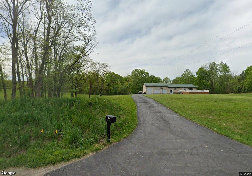
9269 State Route 45 Orwell, OH 44076
Estimated Value: $230,000 - $290,000
4
Beds
2
Baths
1,200
Sq Ft
$223/Sq Ft
Est. Value
About This Home
This home is located at 9269 State Route 45, Orwell, OH 44076 and is currently estimated at $268,107, approximately $223 per square foot. 9269 State Route 45 is a home with nearby schools including Mesopotamia Elementary School and Bloomfield High School.
Ownership History
Date
Name
Owned For
Owner Type
Purchase Details
Closed on
Oct 25, 2024
Sold by
Gay Michael S
Bought by
Gay Michael S and Gay Melissa
Current Estimated Value
Purchase Details
Closed on
Mar 31, 2004
Sold by
Bates Taylor Arthur G and Bates Taylor Linda R
Bought by
Gay Michael S
Home Financials for this Owner
Home Financials are based on the most recent Mortgage that was taken out on this home.
Original Mortgage
$128,000
Interest Rate
5.65%
Mortgage Type
New Conventional
Purchase Details
Closed on
Jan 1, 1990
Bought by
Arthur Arthur G and Arthur S
Create a Home Valuation Report for This Property
The Home Valuation Report is an in-depth analysis detailing your home's value as well as a comparison with similar homes in the area
Home Values in the Area
Average Home Value in this Area
Purchase History
| Date | Buyer | Sale Price | Title Company |
|---|---|---|---|
| Gay Michael S | -- | None Listed On Document | |
| Gay Michael S | $160,000 | -- | |
| Arthur Arthur G | -- | -- |
Source: Public Records
Mortgage History
| Date | Status | Borrower | Loan Amount |
|---|---|---|---|
| Previous Owner | Gay Michael S | $128,000 |
Source: Public Records
Tax History Compared to Growth
Tax History
| Year | Tax Paid | Tax Assessment Tax Assessment Total Assessment is a certain percentage of the fair market value that is determined by local assessors to be the total taxable value of land and additions on the property. | Land | Improvement |
|---|---|---|---|---|
| 2024 | $2,603 | $68,600 | $9,100 | $59,500 |
| 2023 | $2,603 | $68,600 | $9,100 | $59,500 |
| 2022 | $2,306 | $54,920 | $8,300 | $46,620 |
| 2021 | $2,309 | $54,920 | $8,300 | $46,620 |
| 2020 | $2,264 | $54,920 | $8,300 | $46,620 |
| 2019 | $2,174 | $50,060 | $7,670 | $42,390 |
| 2018 | $2,148 | $50,060 | $7,670 | $42,390 |
| 2017 | $2,145 | $50,060 | $7,670 | $42,390 |
| 2016 | $2,108 | $49,350 | $6,930 | $42,420 |
| 2015 | $2,114 | $49,350 | $6,930 | $42,420 |
| 2014 | $2,113 | $49,350 | $6,930 | $42,420 |
| 2013 | $2,142 | $49,350 | $6,930 | $42,420 |
Source: Public Records
Map
Nearby Homes
- 9575 State Route 45
- 2271 Peck Leach Rd
- 2750 Moore Rd
- 0 Vl Sunset St
- 75 Leffingwell Dr
- V/L Eddy Ct
- 63 Janet Ave
- 2605 Us Route 322
- 26 Grand Valley
- 2601 Hague Rd
- 6582 Thompson Clark Rd
- 2494 Mahan Denman Rd NW
- V/L Noble Rd
- 0 New Hudson Rd
- 7126 State Route 534
- 6990 Morrell Ray Rd
- 2693 Mahan Denman Rd NW
- 6102 Corey Hunt Rd
- 5834 U S 322
- 8441 State Route 46
- 9190 Warren Painsville
- 9118 State Route 45
- 9347 State Route 45
- 9118 State Route 45
- 9115 State Route 45
- 9350 State Route 45
- 9112 Warren Painsville
- 9095 State Route 45
- 9367 State Route 45
- 9035 State Route 45
- 9380 State Route 45
- 8970 Painesville Warren
- 9050 State Route 45
- 8988 State Route 45
- 8981 State Route 45
- 9200 Creaser Rd
- 9000 Warren Painsville
- 1845 Haines Rd
- 8967 Warren Painsville
- 9150 Creaser Rd