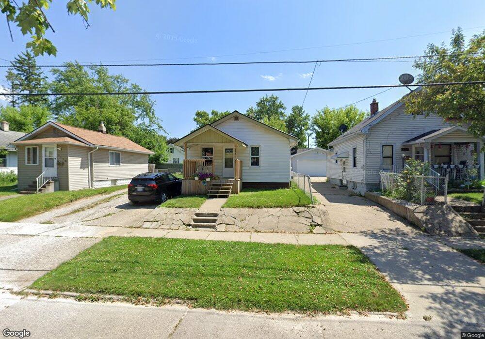
927 Major St Flint, MI 48507
South Side NeighborhoodEstimated Value: $44,000 - $53,000
2
Beds
1
Bath
748
Sq Ft
$64/Sq Ft
Est. Value
About This Home
This home is located at 927 Major St, Flint, MI 48507 and is currently estimated at $47,787, approximately $63 per square foot. 927 Major St is a home located in Genesee County with nearby schools including Neithercut Elementary School, Flint Southwestern Classical Academy, and International Academy of Flint (K-12).
Ownership History
Date
Name
Owned For
Owner Type
Purchase Details
Closed on
Mar 9, 2021
Sold by
Hubbard Scott D
Bought by
Sh Property Holdings Llc
Current Estimated Value
Purchase Details
Closed on
Feb 10, 2017
Sold by
Stair Philip G and Genesee County Land Bank Of Au
Bought by
Hubbard Scott Darnon
Purchase Details
Closed on
May 20, 2013
Sold by
The Genesee County Land Bank Authority
Bought by
Logan Richard Lamont
Home Financials for this Owner
Home Financials are based on the most recent Mortgage that was taken out on this home.
Original Mortgage
$184
Interest Rate
7%
Mortgage Type
Seller Take Back
Purchase Details
Closed on
Dec 21, 2011
Sold by
Genesee County Treasurer
Bought by
Genesee County Land Bank
Create a Home Valuation Report for This Property
The Home Valuation Report is an in-depth analysis detailing your home's value as well as a comparison with similar homes in the area
Home Values in the Area
Average Home Value in this Area
Purchase History
| Date | Buyer | Sale Price | Title Company |
|---|---|---|---|
| Sh Property Holdings Llc | -- | None Available | |
| Hubbard Scott Darnon | -- | None Available | |
| Logan Richard Lamont | $7,500 | None Available | |
| Genesee County Land Bank | -- | None Available |
Source: Public Records
Mortgage History
| Date | Status | Borrower | Loan Amount |
|---|---|---|---|
| Previous Owner | Logan Richard Lamont | $184 |
Source: Public Records
Tax History
| Year | Tax Paid | Tax Assessment Tax Assessment Total Assessment is a certain percentage of the fair market value that is determined by local assessors to be the total taxable value of land and additions on the property. | Land | Improvement |
|---|---|---|---|---|
| 2025 | $1,139 | $16,800 | $0 | $0 |
| 2024 | $1,056 | $17,300 | $0 | $0 |
| 2023 | $1,032 | $14,100 | $0 | $0 |
| 2022 | $0 | $11,100 | $0 | $0 |
| 2021 | $942 | $10,000 | $0 | $0 |
| 2020 | $869 | $10,000 | $0 | $0 |
| 2019 | $852 | $10,400 | $0 | $0 |
| 2018 | $836 | $8,800 | $0 | $0 |
| 2017 | $221 | $0 | $0 | $0 |
| 2016 | $790 | $0 | $0 | $0 |
| 2015 | -- | $0 | $0 | $0 |
| 2014 | -- | $0 | $0 | $0 |
| 2012 | -- | $0 | $0 | $0 |
Source: Public Records
Map
Nearby Homes
- 846 W Hemphill Rd
- 912 Huron St
- 1122 Markham St
- 829 Clinton St
- 1015 Alvord Ave
- 845 Alvord Ave
- 1210 Pinehurst Ave
- 805 Alvord Ave
- 806 Alvord Ave
- 1234 Huron St
- 1216 E Hemphill Rd
- 1318 Ingleside Ave
- 1310 Huron St
- 3902 Brunswick Ave
- 1219 Norton St
- 1028 Campbell St
- 822 Campbell St
- 652 Crawford St
- 612 Clinton St
- 1130 W Atherton Rd
Your Personal Tour Guide
Ask me questions while you tour the home.