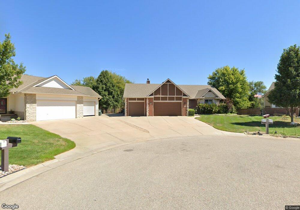
927 S Melvin Ct Haysville, KS 67060
Estimated Value: $364,606 - $401,000
5
Beds
3
Baths
1,702
Sq Ft
$225/Sq Ft
Est. Value
About This Home
This home is located at 927 S Melvin Ct, Haysville, KS 67060 and is currently estimated at $382,803, approximately $224 per square foot. 927 S Melvin Ct is a home located in Sedgwick County with nearby schools including Freeman Elementary School, Haysville Middle School, and Campus High School.
Ownership History
Date
Name
Owned For
Owner Type
Purchase Details
Closed on
Oct 2, 2019
Sold by
Kahmann David and Herndon Hollis
Bought by
Martines Ildo and Coleman Martins Shelly
Current Estimated Value
Home Financials for this Owner
Home Financials are based on the most recent Mortgage that was taken out on this home.
Original Mortgage
$240,000
Outstanding Balance
$210,252
Interest Rate
3.5%
Mortgage Type
New Conventional
Estimated Equity
$172,551
Purchase Details
Closed on
Jul 2, 2009
Sold by
Kahmann Stacy
Bought by
Kahmann David
Create a Home Valuation Report for This Property
The Home Valuation Report is an in-depth analysis detailing your home's value as well as a comparison with similar homes in the area
Home Values in the Area
Average Home Value in this Area
Purchase History
| Date | Buyer | Sale Price | Title Company |
|---|---|---|---|
| Martines Ildo | -- | None Available | |
| Kahmann David | -- | None Available |
Source: Public Records
Mortgage History
| Date | Status | Borrower | Loan Amount |
|---|---|---|---|
| Open | Martines Ildo | $240,000 |
Source: Public Records
Tax History Compared to Growth
Tax History
| Year | Tax Paid | Tax Assessment Tax Assessment Total Assessment is a certain percentage of the fair market value that is determined by local assessors to be the total taxable value of land and additions on the property. | Land | Improvement |
|---|---|---|---|---|
| 2025 | $5,261 | $38,686 | $7,774 | $30,912 |
| 2023 | $5,261 | $37,559 | $7,682 | $29,877 |
| 2022 | $5,597 | $37,559 | $7,245 | $30,314 |
| 2021 | $5,599 | $37,272 | $3,105 | $34,167 |
| 2020 | $5,302 | $34,719 | $3,105 | $31,614 |
| 2019 | $4,460 | $29,107 | $3,105 | $26,002 |
| 2018 | $5,508 | $27,991 | $3,312 | $24,679 |
| 2017 | $5,519 | $0 | $0 | $0 |
| 2016 | $5,398 | $0 | $0 | $0 |
| 2015 | $5,399 | $0 | $0 | $0 |
| 2014 | $5,532 | $0 | $0 | $0 |
Source: Public Records
Map
Nearby Homes
- 1204 W Leonard St
- 504 S Shira Cir
- 812 S Saddle Brooke Ct
- 238 Western Ave
- 449 W 4th St
- 2103 W Schoolhouse St
- 200 Sunset Ave
- 214 Stearns Ave
- 415 Spring Dr
- 242 Wire Ave
- 181 Sunset Ave
- 150 Sunset Ave
- 115 Hungerford Ave
- 221 River Birch St
- 213 Timberlane Ct
- 1038 W 81st St S
- 2200-2202 E Plaza Ct
- 2114-2116 E Plaza Ct
- 2120-2122 E Plaza Ct
- 2108-2110 E Plaza Ct
- 925 S Melvin Ct
- 930 S Melvin Ct
- 921 S Melvin Ct
- 922 S Melvin Ct
- 916 S Melvin Ct
- 915 S Melvin Ct
- 825 S Erin Ct
- 910 S Melvin Ct
- 1012 S Shira St
- 821 S Erin Ct
- 827 S Erin Ct
- 904 S Melvin Ct
- 1000 S Shira St
- 815 S Erin Ct
- 903 S Melvin Ct
- 830 S Erin Ct
- 900 S Melvin Ct
- 809 S Erin Ct
- 1006 S Shira St
- 803 S Erin Ct