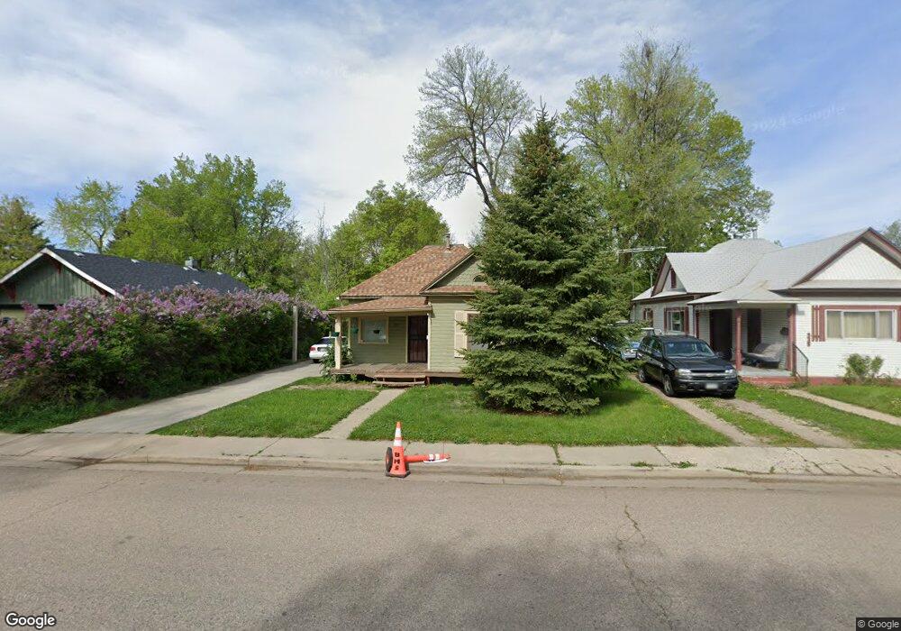
927 Washington Ave Loveland, CO 80537
Estimated Value: $360,000 - $415,000
2
Beds
1
Bath
1,370
Sq Ft
$290/Sq Ft
Est. Value
About This Home
This home is located at 927 Washington Ave, Loveland, CO 80537 and is currently estimated at $397,428, approximately $290 per square foot. 927 Washington Ave is a home located in Larimer County with nearby schools including Truscott Elementary School, Bill Reed Middle School, and Loveland High School.
Ownership History
Date
Name
Owned For
Owner Type
Purchase Details
Closed on
Mar 24, 2020
Sold by
Mccurdy Patrick R
Bought by
Mccurdy Patrick R and Zeng Yinghong
Current Estimated Value
Purchase Details
Closed on
Sep 1, 2009
Sold by
Wells Fargo Bank Minnesota National Asso
Bought by
Mccurdy Patrick R
Home Financials for this Owner
Home Financials are based on the most recent Mortgage that was taken out on this home.
Original Mortgage
$75,000
Outstanding Balance
$49,472
Interest Rate
5.36%
Mortgage Type
New Conventional
Estimated Equity
$347,956
Purchase Details
Closed on
Jul 24, 2009
Sold by
Delich Michael
Bought by
Wells Fargo Bank Minnesota National Asso
Home Financials for this Owner
Home Financials are based on the most recent Mortgage that was taken out on this home.
Original Mortgage
$75,000
Outstanding Balance
$49,472
Interest Rate
5.36%
Mortgage Type
New Conventional
Estimated Equity
$347,956
Purchase Details
Closed on
Dec 5, 2002
Sold by
Punessen John
Bought by
Delich Michael
Home Financials for this Owner
Home Financials are based on the most recent Mortgage that was taken out on this home.
Original Mortgage
$138,400
Interest Rate
5.37%
Purchase Details
Closed on
Nov 30, 2000
Sold by
Quain Tamra R
Bought by
Punessen John
Home Financials for this Owner
Home Financials are based on the most recent Mortgage that was taken out on this home.
Original Mortgage
$100,800
Interest Rate
10.12%
Purchase Details
Closed on
Jan 30, 1998
Sold by
Parmley Louise M
Bought by
Quain Tamra R
Home Financials for this Owner
Home Financials are based on the most recent Mortgage that was taken out on this home.
Original Mortgage
$83,845
Interest Rate
6.98%
Mortgage Type
FHA
Purchase Details
Closed on
Jan 2, 1998
Sold by
H L Johnson Dorothy A Parmley, Louise M Forrest L
Bought by
Parmley Louise M
Home Financials for this Owner
Home Financials are based on the most recent Mortgage that was taken out on this home.
Original Mortgage
$83,845
Interest Rate
6.98%
Mortgage Type
FHA
Purchase Details
Closed on
Aug 14, 1997
Sold by
H L Johnson Dorothy A Parmley, Louise M Forrest L
Bought by
Parmley Louise M and Parmley Forrest L
Create a Home Valuation Report for This Property
The Home Valuation Report is an in-depth analysis detailing your home's value as well as a comparison with similar homes in the area
Home Values in the Area
Average Home Value in this Area
Purchase History
| Date | Buyer | Sale Price | Title Company |
|---|---|---|---|
| Mccurdy Patrick R | -- | None Available | |
| Mccurdy Patrick R | $115,000 | Ata | |
| Wells Fargo Bank Minnesota National Asso | -- | None Available | |
| Delich Michael | $173,000 | Chicago Title Co | |
| Punessen John | $126,000 | -- | |
| Quain Tamra R | $85,000 | -- | |
| Parmley Louise M | -- | -- | |
| Parmley Louise M | -- | -- |
Source: Public Records
Mortgage History
| Date | Status | Borrower | Loan Amount |
|---|---|---|---|
| Open | Mccurdy Patrick R | $75,000 | |
| Previous Owner | Delich Michael | $138,400 | |
| Previous Owner | Punessen John | $100,800 | |
| Previous Owner | Quain Tamra R | $83,845 |
Source: Public Records
Tax History Compared to Growth
Tax History
| Year | Tax Paid | Tax Assessment Tax Assessment Total Assessment is a certain percentage of the fair market value that is determined by local assessors to be the total taxable value of land and additions on the property. | Land | Improvement |
|---|---|---|---|---|
| 2025 | $1,875 | $27,182 | $3,015 | $24,167 |
| 2024 | $1,809 | $27,182 | $3,015 | $24,167 |
| 2022 | $1,504 | $18,905 | $3,128 | $15,777 |
| 2021 | $1,546 | $19,449 | $3,218 | $16,231 |
| 2020 | $1,358 | $17,075 | $3,218 | $13,857 |
| 2019 | $1,335 | $17,075 | $3,218 | $13,857 |
| 2018 | $1,183 | $14,371 | $3,240 | $11,131 |
| 2017 | $1,018 | $14,371 | $3,240 | $11,131 |
| 2016 | $898 | $12,242 | $3,582 | $8,660 |
| 2015 | $891 | $12,240 | $3,580 | $8,660 |
| 2014 | $705 | $9,370 | $3,580 | $5,790 |
Source: Public Records
Map
Nearby Homes
- 770 N Lincoln Ave
- 411 E 10th St
- 707 E 8th St
- 717 E 8th St
- 1031 N Lincoln Ave
- 1034 N Cleveland Ave
- 205 E 6th St Unit 400
- 205 E 6th St Unit 302
- 205 E 6th St Unit 200
- 205 E 6th St Unit 205
- 205 E 6th St Unit 301
- 205 E 6th St Unit 305
- 205 E 6th St Unit 300
- 205 E 6th St Unit 204
- 205 E 6th St Unit 303
- 205 E 6th St Unit 202
- 205 E 6th St Unit 304
- 535 N Adams Ave
- 1117 Cleveland Ave
- 1204 N Lincoln Ave
- 927 N Washington Ave
- 917 Washington Ave
- 935 Washington Ave
- 943 Washington Ave
- 905 Washington Ave
- 920 N Jefferson Ave
- 912 N Jefferson Ave
- 503 E 9th St
- 948 N Jefferson Ave
- 845 Washington Ave
- 429 E 10th St
- 900 N Jefferson Ave
- 511 E 9th St
- 419 E 10th St
- 435 E 10th St
- 443 E 10th St
- 833 Washington Ave
- 844 N Jefferson Ave
- 522 E 10th St
- 527 E 9th St