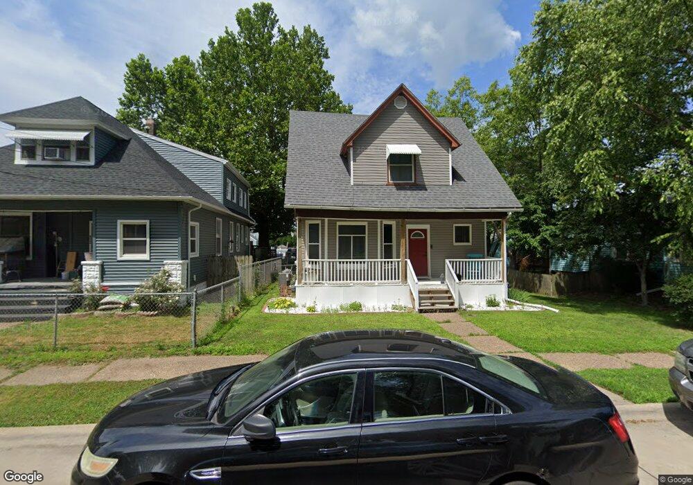
928 Minnie Ave Davenport, IA 52802
West End NeighborhoodEstimated Value: $118,000 - $144,000
4
Beds
1
Bath
1,352
Sq Ft
$98/Sq Ft
Est. Value
About This Home
This home is located at 928 Minnie Ave, Davenport, IA 52802 and is currently estimated at $132,538, approximately $98 per square foot. 928 Minnie Ave is a home located in Scott County with nearby schools including Walnut Hill Elementary School, South Christian Elementary School, and Caverna Middle School.
Ownership History
Date
Name
Owned For
Owner Type
Purchase Details
Closed on
Apr 16, 2015
Sold by
Kepford Ryan R and Kepford Britani
Bought by
Dormier Jennifer L
Current Estimated Value
Home Financials for this Owner
Home Financials are based on the most recent Mortgage that was taken out on this home.
Original Mortgage
$6,000
Interest Rate
0.78%
Mortgage Type
New Conventional
Purchase Details
Closed on
Dec 19, 2009
Sold by
Alva Emilio and Maria A Medrano C
Bought by
Kepford Ryan R
Home Financials for this Owner
Home Financials are based on the most recent Mortgage that was taken out on this home.
Original Mortgage
$67,241
Interest Rate
4.9%
Mortgage Type
FHA
Purchase Details
Closed on
Mar 17, 2005
Sold by
Alva Leona
Bought by
Alva Emilio
Create a Home Valuation Report for This Property
The Home Valuation Report is an in-depth analysis detailing your home's value as well as a comparison with similar homes in the area
Home Values in the Area
Average Home Value in this Area
Purchase History
| Date | Buyer | Sale Price | Title Company |
|---|---|---|---|
| Dormier Jennifer L | $85,000 | Attorney | |
| Kepford Ryan R | $68,500 | Gomez Title | |
| Alva Emilio | -- | None Available |
Source: Public Records
Mortgage History
| Date | Status | Borrower | Loan Amount |
|---|---|---|---|
| Previous Owner | Dormier Jennifer L | $6,000 | |
| Previous Owner | Kepford Ryan R | $67,241 |
Source: Public Records
Tax History Compared to Growth
Tax History
| Year | Tax Paid | Tax Assessment Tax Assessment Total Assessment is a certain percentage of the fair market value that is determined by local assessors to be the total taxable value of land and additions on the property. | Land | Improvement |
|---|---|---|---|---|
| 2025 | $2,166 | $115,200 | $15,600 | $99,600 |
| 2024 | $1,884 | $108,080 | $15,600 | $92,480 |
| 2023 | $1,720 | $108,080 | $15,600 | $92,480 |
| 2022 | $1,728 | $80,490 | $13,440 | $67,050 |
| 2021 | $1,728 | $80,490 | $13,440 | $67,050 |
| 2020 | $1,672 | $76,960 | $13,440 | $63,520 |
| 2019 | $1,726 | $76,960 | $13,440 | $63,520 |
| 2018 | $1,612 | $76,960 | $13,440 | $63,520 |
| 2017 | $408 | $73,440 | $13,440 | $60,000 |
| 2016 | $1,608 | $73,440 | $0 | $0 |
| 2015 | $1,608 | $75,380 | $0 | $0 |
| 2014 | $1,480 | $75,380 | $0 | $0 |
| 2013 | $1,450 | $0 | $0 | $0 |
| 2012 | -- | $79,140 | $15,860 | $63,280 |
Source: Public Records
Map
Nearby Homes
- 1109 S Michigan Ave
- 3207 Homestead Ave
- 3228 Sunnyside Ave
- 815 S Dittmer St
- 3412 Michigan
- 3154 Diehn Ave
- 2736 Rockingham Rd
- 520 S Clark St
- 2707 Jackson Ave
- 2614 Mckinley Ave
- 2537 Boies Ave
- 3011 Telegraph Rd
- 2502 Rockingham Rd
- 2639 Whitewood Ave
- 125 S Birchwood Ave
- 223 S Lincoln Ave
- 124 N Elmwood Ave
- 131 S Lincoln Ave
- 2312 W 1st St
- 2312 1/2 W 1st St
- 922 Minnie Ave
- 916 Minnie Ave
- 1004 Minnie Ave
- 929 S Ohio Ave
- 1008 Minnie Ave
- 925 S Ohio Ave
- 935 S Ohio Ave
- 923 Minnie Ave
- 931 Minnie Ave
- 917 S Ohio Ave
- 1003 S Ohio Ave
- 917 Minnie Ave
- 1014 Minnie Ave
- 1005 Minnie Ave
- 1007 S Ohio Ave
- 3303 Rockingham Rd
- 3301 Rockingham Rd
- 3307 Rockingham Rd
- 3311 Rockingham Rd
- 1013 S Ohio Ave