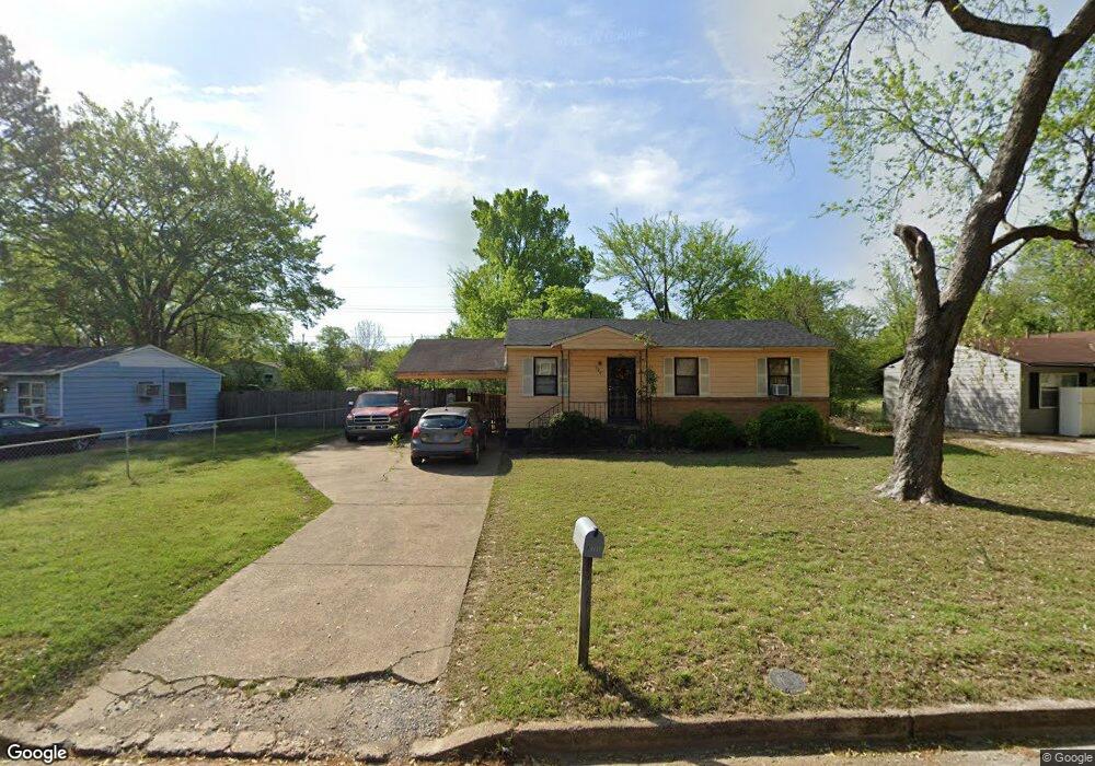
929 Leacrest Ave Memphis, TN 38109
Westwood NeighborhoodEstimated Value: $68,695 - $87,000
3
Beds
1
Bath
864
Sq Ft
$87/Sq Ft
Est. Value
About This Home
This home is located at 929 Leacrest Ave, Memphis, TN 38109 and is currently estimated at $75,424, approximately $87 per square foot. 929 Leacrest Ave is a home located in Shelby County with nearby schools including Levi Elementary School, Chickasaw Middle School, and Westwood High School.
Ownership History
Date
Name
Owned For
Owner Type
Purchase Details
Closed on
Dec 23, 1996
Sold by
Monger Ronald K and Monger Cynthia
Bought by
Alexander Everett L
Current Estimated Value
Home Financials for this Owner
Home Financials are based on the most recent Mortgage that was taken out on this home.
Original Mortgage
$39,378
Outstanding Balance
$3,683
Interest Rate
7.51%
Mortgage Type
FHA
Estimated Equity
$71,741
Create a Home Valuation Report for This Property
The Home Valuation Report is an in-depth analysis detailing your home's value as well as a comparison with similar homes in the area
Home Values in the Area
Average Home Value in this Area
Purchase History
| Date | Buyer | Sale Price | Title Company |
|---|---|---|---|
| Alexander Everett L | $39,000 | -- | |
| Alexander Everett L | $39,000 | -- |
Source: Public Records
Mortgage History
| Date | Status | Borrower | Loan Amount |
|---|---|---|---|
| Open | Alexander Everett L | $39,378 | |
| Closed | Alexander Everett L | $39,378 | |
| Closed | Alexander Everett L | $2,429 |
Source: Public Records
Tax History
| Year | Tax Paid | Tax Assessment Tax Assessment Total Assessment is a certain percentage of the fair market value that is determined by local assessors to be the total taxable value of land and additions on the property. | Land | Improvement |
|---|---|---|---|---|
| 2025 | $399 | $17,625 | $2,650 | $14,975 |
| 2024 | $399 | $11,775 | $2,175 | $9,600 |
| 2023 | $717 | $11,775 | $2,175 | $9,600 |
| 2022 | $717 | $11,775 | $2,175 | $9,600 |
| 2021 | $726 | $11,775 | $2,175 | $9,600 |
| 2020 | $781 | $10,775 | $2,175 | $8,600 |
| 2019 | $781 | $10,775 | $2,175 | $8,600 |
| 2018 | $781 | $10,775 | $2,175 | $8,600 |
| 2017 | $443 | $10,775 | $2,175 | $8,600 |
| 2016 | $437 | $10,000 | $0 | $0 |
| 2014 | $437 | $10,000 | $0 | $0 |
Source: Public Records
Map
Nearby Homes
- 963 Leacrest Ave
- 896 Leacrest Ave
- 896 Pawnee Ave
- 931 W Raines Rd
- 1233 W Raines Rd
- 1307 W Raines Rd
- 1097 W Raines Rd
- 812 Leacrest Ave
- 4282 Westmont Rd
- 808 Mohawk Ave
- 785 Pawnee Ave
- 436 Western Park Dr
- 803 Ledbetter Ave
- 4360 Bluebell St
- 4087 Weaver Rd
- 1088 Western Park Dr
- 0 Weaver Rd
- 748 Western Park Dr
- 4413 Bluebell St
- 655 W Raines Rd
- 919 Leacrest Ave
- 4209 Glenbrook St
- 939 Leacrest Ave
- 4213 Glenbrook St
- 4201 Glenbrook St
- 4217 Glenbrook St
- 4190 Leacrest Cove
- 907 Leacrest Ave
- 928 Leacrest Ave
- 943 Leacrest Ave
- 4221 Glenbrook St
- 922 Leacrest Ave
- 916 Leacrest Ave
- 949 Leacrest Ave
- 4182 Leacrest Cove
- 940 Leacrest Ave
- 908 Leacrest Ave
- 4225 Glenbrook St
- 4210 Glenbrook St
- 4206 Glenbrook St
Your Personal Tour Guide
Ask me questions while you tour the home.